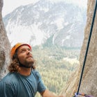
Summit Price & Agassiz from Desolation Wilderness
Twin Bridges, California
Description
Added by Jake Young
Summiting Mt. Price at 9,975ft. Summiting Mt. Agassiz at 9,967ft. Duration: Multi Day Backpacking trip from Desolation Wilderness.
Mount Price (9,975') is the second highest summit in the Desolation Wilderness, standing just eight feet lower than Pyramid Peak to the south. In between these two peaks stands Mount Agassiz (9,967'), whose overhanging summit resembles a granite wave poised to crash down into the Desolation Valley nearly 2,000 feet below. Both Agassiz and Price offer fun scrambling and airy summits, and can be easily reached from the west side Desolation trailheads. For those looking for more challenge, these peaks can also be climbed from the Lake Aloha area, or combined with Pyramid Peak for a high traverse of the southern half of the Crystal Range. We present three options here, each of which is also presented on this topo map. topo map
Below are details of the backpacking approach from Lake Aloha:
Mileage:1.5 miles from Mosquito Pass to Mt. Price2.0 miles to Mt. Agassiz
Elevation:Trailhead (Mosquito Pass): 8,422'Mt. Price Summit: 9,975'
Hiking time: Multi-day backpackTrailhead/Wilderness Permits: This route assumes you are already in Desolation Valley, having gotten there through one of the many approaches. Although this hike could be done by a very strong hiker as a day-hike from the Echo Lakes or Pyramid Creek trailheads, I don't recommend it. It is much better to do this as a day hike from a camp in the Desolation Valley area. If you do this, you will need a wilderness permit for camping -- click here for details. Note that this route involves some steep and semi-exposed class 3 scrambling, as well as some tricky routefinding. If you are not comfortable doing this, try one of the easier routes.
The Route: From either the north (Rockbound Valley) or the south (Desolation Valley), follow the Pacific Crest Trail to Mosquito Pass, just north of Lake Aloha. Head cross-country SW from the pass, climbing up the granite dome that separates Clyde Lake and Lake Aloha. Drop down slightly from the top of the dome and then continue SW up granite slabs ("the slabs of insanity") that lead to the east face of Mt. Price. Ascend these slabs, aiming for a notch on the ridge just to the north of Mt. Price's summit. Note that this notch is not the obvious low point to the north of Mt. Price, but rather a smaller notch just above and to the left of the low point. This photo, taken from the summit of Jacks Peak, shows the entire route from Mosquito Pass.
The route to the top of the notch is steep and slippery, but really no harder than class 2. However, climbing to the notch gets you atop a knife-edge ridge that drops off steeply to the east down to Island and Twin Lakes. The route directly up the ridge to the summit is very steep and exposed and is not recommended without climbing gear. The easiest route to the summit is to descend slightly to the left, and then contour left over class 3 rock to a point just before the summit. From here, climb up to the summit. Some routefinding will be required in this section in order to stay on class 3 terrain. If you find the going too difficult, retrace your steps and try a different route. If you want to traverse to Mt. Agassiz, see the description above under Option #1. Source
Download the Outbound mobile app
Find adventures and camping on the go, share photos, use GPX tracks, and download maps for offline use.
Get the appFeatures
Summit Price & Agassiz from Desolation Wilderness Reviews
I just completed this hike from the Twin Lakes trailhead in mid-August and it made for an epic overnight backpacking trip. There are some great campsites around Twin Lake and Island Lake, which you need an overnight permit for. The valley which the lakes are in is surrounded by incredible peaks, including Mt. Price. I made the summit up Mt. Price first thing in the morning and it was definitely a tough climb. There was still a good amount of snow at the top, and the loose rock made for some tricky navigating. There was no trail to be found past Twin Lake going up to the summit so I have no clue if I took the easiest route, but I was definitely huffing and puffing my way up to the top. The top of Mt. Price has incredible views of the Crystal Mountain Range and Desolation Wilderness.
5.0
you'll catch some of the best views of desolation from the peaks and the entire hike is beautiful along the way.
5.0
Leave No Trace
Always practice Leave No Trace ethics on your adventures and follow local regulations. Please explore responsibly!
Nearby
Grouse, Hemlock, and Smith Lake
Twin and Island Lakes
Smith Lake
Hike to Half Moon Lake in Desolation Wilderness
Susie Lake, Desolation Wilderness
Glen Alpine Falls and Grass Lake
Community
© 2024 The Outbound Collective - Terms of Use - Privacy Policy


