Signal Hill, California
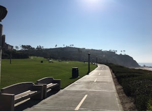
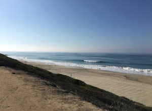
Signal Hill, California is a top destination for those seeking outdoor adventures. The Hilltop Park Trail is a must-visit, offering panoramic views of the city and the Pacific Ocean. This easy, paved trail is perfect for a casual stroll or a quick jog. Another scenic hiking trail is the Discovery Well Park Trail, known for its historical oil wells and beautiful city views. For those who prefer water activities, the nearby Long Beach offers kayaking and paddleboarding. For a unique outdoor attraction, visit the Signal Hill Petroleum Viewing Structure - a fascinating insight into the city's oil history. Indeed, Signal Hill offers some of the best trails and outdoor activities in California.
Top Spots in and near Signal Hill
-
Trabuco Canyon, California
The Luge: Santiago Truck Trail Loop
5.07.46 mi / 1371 ft gainThe Luge: Santiago Truck Trail Loop is a loop trail that takes you through a nice forest located near Lake Forest, California.Read more -
Corona, California
Skyline Drive Trail
3.09.07 mi / 1946 ft gainThis trail is shared by hikers, mountain bikers and trail runners. Rock climbers can find areas to boulder off the trail. Bring lots of extra water as this trail is rather dusty and can get very hot. This is a good training hike for those looking to do some backpacking. The trail is open year-r...Read more -
Los Angeles County, California
Big Tujunga Canyon Lookouts
1.22 mi / 453 ft gainPark at the Condor Peak Trailhead, please note that this trail head is unmarked so keep your eyes peeled on the right side of the turnout for a small single track trail. The trail gradually climbs along the side of the canyon until reaching a 4 way intersection. To your left and to your right wil...Read more -
Malibu, California
Surf Malibu Point
3.0Malibu point is an iconic surf spot located in Malibu, California. It's a very popular summer time spot due to the exposure to south swells. The majority of people longboard this surf spot. It's a very iconic wave with lots of history! The wave itself is a long right-hand point break that is r...Read more -
Malibu, California
Photograph the Iconic Malibu Pier
3.2Less than a mile South from the small town center, Malibu Pier stretches out into the Pacific. The Pier has been in Malibu since 1905 and though much of Malibu has been built up around it, it has remained quite similar to when it was first constructed. You can either pay for parking right at the ...Read more -
Avalon, California
Camp at Hermit Gulch on Catalina Island
3.9 mi / 1206 ft gainThe Avalon port in Catalina is most easily accessed through the Catalina Express leaving from Dana Point, Newport Beach or Long Beach. The Hermit Gulch campsite is only a 20 min walk from the boat and is well run with restrooms, showers... etc. They also sell anything you might have forgotten for...Read more -
Calabasas, California
Hike and Rock Climb at Saddle Peak
5.0This is one of my favorite hikes in the Los Angeles area. Super easy, yet beautiful and a perfect place to get away from the city.Parking for the trailhead is where the three roads intersect. The parking area is a long strip of dirt, there will most likely be cars there when you arrive already th...Read more -
Avalon, California
Trans-Catalina Trail
5.037.67 mi / 8189 ft gainThis adventure is a great way to see the entire island of Santa Catalina. Catalina Island is situated less than 30 miles off the coast of Southern California, and can be reached by ferry from Dana Point, San Pedro, or Long Beach. Catalina Express in the company that operates the ferry. This adve...Read more -
Malibu, California
The Malibu Lagoon State Beach
5.02.11 mi / 98 ft gainThe Malibu Lagoon State Beach is a loop trail that takes you past scenic surroundings located near Malibu, California.Read more -
Los Angeles, California
Reseda Pond Path
1.00.3 mi / 0 ft gainReseda Pond Path is a loop trail that takes you by a lake located near Reseda, CaliforniaRead more -
Silverado, California
Bedford Peak Trail
5.06.78 mi / 1972 ft gainThe Bedford Peak Trail in Silverado, California is a challenging hike that offers a variety of natural features. The trail spans 6.78 miles round trip and has an elevation gain of 1,972 feet. It is rated as difficult due to its steep inclines and rocky terrain. The trail begins in a dense oak w...Read more -
Topanga, California
Top of Topanga Overlook
1 mi / 1613 ft gainThe Top of Topanga Overlook is where you can simply park your car, and sit in one of the benches to view the San Fernando Valley. But there is one hiking trail in that area which lets you get better vantage points, as well as a quick workout. Once you get to the overlook, park your car and safel...Read more -
Topanga, California
Red Rock Canyon to Calabasas Peak
4.04.53 mi / 1004 ft gainWhen you get to the parking lot be sure to pay the $5 parking fee. You will need to place this in the provided envelope and drop it in the iron ranger. Start the hike by following the fire road behind the gate. About a couple of yards in, you will see a trail on your left which leads to a ghoul...Read more -
Dana Point, California
Hike the Salt Creek Trail
5.03 mi / 20 ft gainStarting from the Salt Creek Beach parking lot (a paid lot that takes cash, debit, and credit cards and charges by the hour. There are pay stations at a few points in the parking lots), you head west towards the ocean...through a tunnel and down the hill towards the beach. Once you get to the bas...Read more -
Dana Point, California
Surf Salt Creek
5.0There are two HUGE parking lots off of PCH, so parking isn't an issue (unless it's on a weekend in the summer, then it does get full). This is a paid lot with a few pay stations located around the parking lot, and they take cash and credit/ debit card...you can pay by the hour. Once you find your...Read more -
Laguna Niguel, California
Colinas Ridge Trail
2.01 mi / 131 ft gainFirst, you'll be parking in the parking lot for the dog park. It's free parking and there are roughly 40 spaces, so there is plenty of parking. I've never seen more than 20 cars here at any one time. Once parked you'll find the trail head/ start on the northwest side of the lot (opposite the dog ...Read more

