Signal Hill, California
Looking for the best running in Signal Hill? We've got you covered with the top trails, trips, hiking, backpacking, camping and more around Signal Hill. The detailed guides, photos, and reviews are all submitted by the Outbound community.
Top Running Spots in and near Signal Hill
-
La Verne, California
Marshall Canyon Trail
4.05.99 mi / 722 ft gainFor this adventure you can choose to start in a multiple of places; for the easiest parking use Oak Mesa Park located next to Oak Mesa Elementary School. From the parking lot cross the soccer field towards the bridge on the north east end of the school. Once across the bridge follow Los Robles ea...Read more -
Altadena, California
Gabrieleno Trail: Switzer Falls to Hahamonga Watershed
5.010.14 mi / 814 ft gainGabrieleno Trail: Switzer Falls to Hahamonga Watershed is a point-to-point trail that takes you by a waterfall located near La Canada Flintridge, California.Read more -
Laguna Beach, California
Aliso Peak via the Valido Trail
5.01.14 mi / 325 ft gainThe Valido Trail trailhead can be found just off West street off the Pacific Coast Highway, just south of Aliso Beach. Park on West Street past the trailhead. The trail proceeds approximate .5 miles till it intersects with the Aliso Peak Trail. Go left .4 miles to the obvious summit and wooden p...Read more -
Los Angeles, California
Sepulveda Basin: Upstream Of Balboa
4.03.7 mi / 75 ft gainSepulveda Basin: Upstream Of Balboa is a loop trail that takes you by a river located near Encino, California.Read more -
Corona, California
Skyline Drive Trail
3.09.07 mi / 1946 ft gainThis trail is shared by hikers, mountain bikers and trail runners. Rock climbers can find areas to boulder off the trail. Bring lots of extra water as this trail is rather dusty and can get very hot. This is a good training hike for those looking to do some backpacking. The trail is open year-r...Read more -
Avalon, California
Camp at Hermit Gulch on Catalina Island
3.9 mi / 1206 ft gainThe Avalon port in Catalina is most easily accessed through the Catalina Express leaving from Dana Point, Newport Beach or Long Beach. The Hermit Gulch campsite is only a 20 min walk from the boat and is well run with restrooms, showers... etc. They also sell anything you might have forgotten for...Read more -
Silverado, California
Bedford Peak Trail
5.06.78 mi / 1972 ft gainThe Bedford Peak Trail in Silverado, California is a challenging hike that offers a variety of natural features. The trail spans 6.78 miles round trip and has an elevation gain of 1,972 feet. It is rated as difficult due to its steep inclines and rocky terrain. The trail begins in a dense oak w...Read more -
Topanga, California
Calabasas Peak Motorway
7.23 mi / 1565 ft gainGetting There You can, from Los Angeles, go one of three ways: take I-405 to US-101 and head west, or from downtown, take US-101 the whole way, OR, get on I-10 from the Westside or east of there and take that until it becomes PCH, then take that to Topanga Canyon (turn left onto Old Topanga Cany...Read more -
Claremont, California
Claremont Wilderness Loop
4.85.03 mi / 1020 ft gainDrive to the top of Mills Ave in Claremont. There is a main parking area to the left and overflow parking a block south on the right. It costs $3 to park for 4hrs. As the name implies, the Wilderness Loop is a loop that connects to other trails in the Claremont Hills Wilderness. You can choose t...Read more -
Dana Point, California
Walk the Dana Point Preserve Trail
5.00.5 miOcean views the whole time, plenty of wildlife and different species of native plants make this short hike beautiful. With the hike being short enough to complete in the afternoon after a day at the beach you can see a beautiful view of the coastline north and south. There is plenty of parking in...Read more -
Agoura Hills, California
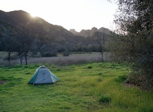
Camp at Malibu Creek State Park
5.0Malibu Creek State Park boasts over 8,000 acres of oak woodlands, grassy hills, dramatic peaks and serene meadows. It's an outdoor lover's paradise and only a short drive north from most of Los Angeles. Before it was a park, the land was owned by 20th Century Fox Studios and used in productions...Read more -
Trabuco Canyon, California
Bell Canyon Trail
3.86 mi / 102 ft gainBell Canyon Trail is an out-and-back trail where you may see wildflowers located near San Juan Capistrano, California.Read more -
Pearblossom, California
Cooper Canyon Trail Camp
5.37 mi / 1214 ft gainThere's a small parking lot just below Cloudburst Summit on the way to Mount Waterman. Start your adventure there. I'd be hard-pressed to say it's more than 15 yards from the sign for the summit (7018' AMSL). There's a fire road, if you're newer to altitude and don't know how to read a map (or e...Read more -
Malibu, California
Hike the Backbone East from Latigo Canyon
3.8 mi / 780 ft gainStarting in a dusty, generally empty parking lot, at about 2,000' ASL, you'll go immediately due north, up a few more feet before you drop down into another canyon covered in live oaks (and poison oak), thistles, ferns, and wildflowers. There's only one trail. It's windy, it's not hilly, it just ...Read more -
San Clemente, California
San Clemente State Beach
4.54.58 mi / 26 ft gainSan Clemente State Beach is an out-and-back trail that takes past scenic surroundings located near San Clemente, California.Read more -
Stevenson Ranch, California
Hike the Towsley Canyon Loop
4.75.1 mi / 1340 ft gainThe Towsley Canyon Loop can be done in either a clockwise or counter-clockwise loop. The clockwise path starts with a gradual ascent through Wiley Canyon and steep descent into the Towsley Gorge while a counter-clockwise route starts with a steep climb out of Towsley Canyon and a gradual descent ...Read more


