Sierra Nevada, California
Looking for the best backpacking in Sierra Nevada? We've got you covered with the top trails, trips, hiking, backpacking, camping and more around Sierra Nevada. The detailed guides, photos, and reviews are all submitted by the Outbound community.
Top Backpacking Spots in and near Sierra Nevada
-
Mariposa County, California
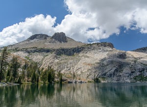
May Lake Trail
4.02.34 mi / 489 ft gainMay Lake is a stunning, serene subalpine lake that rests at the base of Mt. Hoffmann. The May Lake turnoff is located four miles past Tenaya Lake. From the turnoff, it's 1.8 miles to the trailhead parking lot. During summer time, I will recommend getting to the parking area early to get a spot ...Read more -
Mariposa County, California
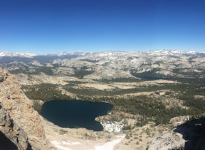
Mt. Hoffman via May Lake Trailhead
5.55 mi / 2140 ft gainThe May Lake trailhead is at the end of a 2-mile unpaved road leading north from Tioga Road. The trailhead has pit toilets and bear lockers. (Please be sure to store any food, garbage, scented items, and empty coolers in these lockers while hiking!) After hiking an easy 1.3 miles, you'll arrive ...Read more -
Mariposa County, California
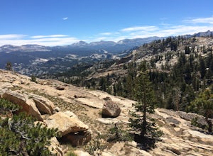
Hike to Tuolumne Peak Plateau
11.7 mi / 1800 ft gainThe most direct route begins at Murphy Creek trailhead, on the north side of Tioga Road near Tenaya Lake. Walk north on Murphy Creek trail for 2.5 miles with minimal elevation gain. Polly Dome Lakes are a great side trip via the social trail on the right side of the trail before the first junctio...Read more -
Mariposa County, California
Sunrise Lakes to Clouds Rest
4.718.93 mi / 1775 ft gainStart out at the Tenaya Lake Trailhead, where you can head directly onto the trail for Clouds Rest or you can branch off after 2.7 miles to Sunrise Lakes. This allows you to break up the hike, spend a night relaxing and help you have an early start back on the trail. Once re-connected to the Clo...Read more -
Tuolumne County, California
Lyell Loop
35.88 mi / 5541 ft gainStart the hike at the Mono pass trail. You'll eventually take the fork towards Parker Pass a couple miles in. We tackled the trail in late spring, and it quickly became clear that there was still enough snow to make our lives difficult. As we climbed out of the Parker drainage, the trail essenti...Read more -
Tuolumne County, California
Mono Pass to Silver Lake Trailhead via Koip Peak Pass
20.25 mi / 3606 ft gainThis trip begins in Yosemite National Park and can be completed as an out-and-back or by hiking one-way to the Ansel Adams Wilderness and exiting at Silver Lake on the east side of the mountains. Start at the Mono/Parker Pass trailhead, a few miles past Tuolumne Meadows. Don't forget to make a pe...Read more -
Markleeville, California
Backpack to Grouse Lake
4.711.43 mi / 2283 ft gainIt is a 6 mile hike to Grouse Lake. You begin at the trailhead which is right by Damsite Campground at Upper Blue Lake. Park in the dirt parking area and then cross the metal footbridge, and you will see the trailhead marker on your left. The trail takes you into the Mokelumne Wilderness. Follow...Read more -
Mariposa County, California
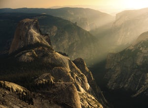
Backpack to North Dome in Yosemite
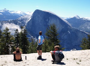
5.08.8 miTo stay overnight in Yosemite without a reserved campsite requires a "Wilderness Permit" to camp, but you can camp anywhere. However, any fires need to be in pre-made fire pits (so rangers can know where to check for fires) Day 1 - Hike in from the Porcupine Trailhead off of Tioga Road in to vie...Read more -
Mariposa County, California
Porcupine Creek Trail to Indian Ridge Natural Arch to North Dome
10.04 mi / 2089 ft gainPorcupine Creek Trail to Indian Ridge Natural Arch to North Dome is an out-and-back trail where you may see beautiful wildflowers located near Yosemite Valley, California.Read more -
Lee Vining, California
Hike to Upper Sardine Lake
Directions (from south of June Lake): 395 northTurn right onto the 158Keep right at fork onto Parker Lake Rd and go about 0.5 milesTurn right at first right and head all the way to the top until you hit a parking lot/camping ground/trail head From North of June Lake: 395 southTurn left at 158Keep...Read more -
Yosemite Valley, California
El Capitan Trail
5.014.68 mi / 5052 ft gainStart on the Yosemite Falls trailhead and work your way up. Yosemite Falls can be anywhere from a huge flow to a slow trickle depending on the time of year. Hiking boots are absolutely necessary and hiking poles are a huge benefit. Say hello to rock climbers at the top as they finish their El Cap...Read more -
Mariposa County, California
Backpack to Yosemite's Eagle Peak via Yosemite Falls
12.6 mi / 3779 ft gainGet a permit. Any overnight backpacking in Yosemite requires a permit from the Wilderness Center. Before you leave make sure to get one! Get a bear canister! Bears are active in Yosemite and all backpackers must take the required measures to keep food away from them! Start at Camp 4. Eagle Pe...Read more -
37.739698,-119.564018
Snow Creek Trail
5.020.43 mi / 2700 ft gainThis is truly a beautiful hike. Although it’s not the easiest, you are rewarded by the views. From the Mirror Lake trailhead (shuttle stop #17), it is 0.9 miles to the Snow Creek trailhead and 1.7 miles to the Snow Creek overlook where you can camp in close proximity. Once you reach the top, you...Read more -
Yosemite Valley, California
Hike to Basket Dome
9.45 miGetting There Starting in Yosemite Valley, head to the Snow Creek trailhead just past Muir Meadows. Start the hike early in the morning, since it gets pretty hot in the summer and the last part of the hike is in the sun. The Trail You'll hike more than 140 switchbacks to reach the top of Ba...Read more -
Yosemite Valley, California
Thru-Hike the John Muir Trail
5.0203.17 mi / 44944 ft gainTo thru hike the JMT is probably one of the sickest trips to do! It's not a heavy commitment like the PCT or AT but it's also no week long vacation from work, backpacking the woods of your local forests either. There's a sweet spot in thru hiking and I believe this trail gives the full taste. You...Read more -
Mariposa County, California
Camp at Glacier Point
4.79.17 mi / 3491 ft gainEveryone that knows Yosemite, knows Glacier Point. An overlook that attracts thousands of people per day that drive up via Glacier Point Road is rarely vacant of the hustle and bustle of people. However, there is a loop hole here, and when the stars align you can have Glacier Point ALL to yoursel...Read more

