Santa Barbara, California
Looking for the best photography in Santa Barbara? We've got you covered with the top trails, trips, hiking, backpacking, camping and more around Santa Barbara. The detailed guides, photos, and reviews are all submitted by the Outbound community.
Top Photography Spots in and near Santa Barbara
-
Ventura, California
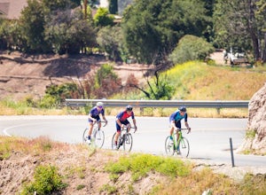
Bike the Ventura, Santa Paula, and Ojai Loop
48.8 mi / 2081 ft gainThe Ventura - Ojai - Santa Paul loop is a classic half-century loop throughs some of the most beautiful cycling roads on the Central Coast. Beginning in Ventura and heading on the off-road (but paved) Ventura / Ojai trails, this loop then heads into downtown Ojai before following Ojai Valley Road...Read more -
Los Olivos, California
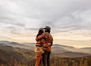
Dispersed Camp in Los Padres National Forest (near Davy Brown Campground)
7 mi / 2000 ft gainI was looking for a last minute adventure out of LA and found this epic view. Easy backpacking trip for one night, no permits needed, less than 3.5 hours from LA, and secluded. Go to REI and pick up your adventure pass for your car. Plug into your GPS "Davy Brown Campground" in Los Olivos / Los...Read more -
Ventura, California
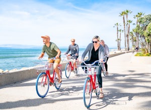
Bike the Ventura Promenade
0.5 mi / 0 ft gainThe Ventura Promenade is a .5 mile long biking and walking trail that runs from the Ventura Pier to Sufer's Point, eventually connecting to the Ventura River & Ojai Bike Trail. It is also part of the the larger "Omer Rains Trail" which runs some 3.5 miles to the south through Buenaventura Sta...Read more -
Maricopa, California
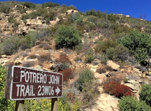
Potrero John Trail
5.03.51 mi / 627 ft gainThe Potrero John Trail is only 1.75 miles one-way, and is mostly used for hiking. It is right off Highway 33- driving north on the 33, the trailhead is on the right side of the street, right after the Potrero John Bridge (parking is fairly limited so the earlier you get there the better). There ...Read more -
Ojai, California
Couch Rock
3.51.3 mi / 627 ft gainDriving up Gridley Road away from Ojai you’ll come upon a small parking lot on your left and a gate barring the way to a dirt road. Park here, as close to the mountainside as possible and head onto the trail. Follow the trail until you see pass a bench, and start heading downhill. Keep your eye...Read more -
Ventura, California
Scorpion Ranch Campground
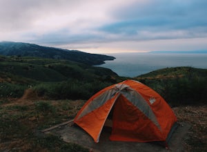
4.00.72 mi / 43 ft gainAccessible only by Ferry, this little-known national park is a backpacker's dream. You can catch the ferry out of Ventura or Santa Barbara, only a short distance from LA. The ride to the island is around 1 hour. We chose to take Island Packers Ferry out of Ventura to Santa Cruz Island. The ferry...Read more -
Ventura, California
Potato Harbor Trail
5.04.34 mi / 404 ft gainAs California’s largest island, Santa Cruz Island of the Channel Islands is the perfect little getaway from Los Angeles. Getting to the island is possible only by a one hour boat ride through Island Packers, click here to find out more about them. Be sure to pack light since you’ll be carrying ev...Read more -
Ventura, California
Smuggler's Cove
3.57.72 mi / 1342 ft gainSave one stretch of elevation close to the cove itself, this 8-mile, round-trip hike is a leisuring trek across one of the countries most beautiful, though less famous National Parks - the Channel Islands. Smuggler's Cove is located on the Santa Cruz Island, which also happens to be the largest i...Read more -
Maricopa, California
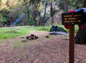
Bear Trap Campground via Gene Marshall/Piedra Blanca Trail
9.59 mi / 2211 ft gainThere's no better feeling then camping out and having a whole site to you and your friends...wouldn't you agree?!?! ...Deep in the Sespe Wilderness in Ojai, California sits a tucked away, well-managed campsite called "Bear Trap Campground". This campsite can be reached at any point of the year a...Read more -
Ventura, California
Prisoner's Cove to Scorpion Anchorage
5.013.19 mi / 2474 ft gainTo get to Santa Cruz Island you will need to book a ferry with Island Packers. On their website, you can only book roundtrip tickets in and out of the same location so for this trip you will need to call and book a ferry into Prisoner's Harbor and out of Scorpion Anchorage. You can call them at (...Read more -
Gaviota, California
Camp at Gaviota State Park
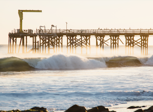
3.5About 30 miles north of Santa Barbara on the 101 is a small state beach in the 90 person town of Gaviota. Most people pass right on through to San Luis Obispo or don't even make it past Goleta, but this gem is worth checking out either for a day trip or to camp for the weekend.Since it is a state...Read more -
Gaviota, California
Gaviota Wind Caves
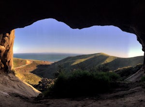
5.02.37 mi / 577 ft gainCaves and epic views...need I say more?! That's what you'll encounter on this short 2.5 mile out and back hike to the Gaviota Wind Caves in the San Ynez Mountains, West of Santa Barbara. The Gaviota Wind Caves are a sandstone formation located 1 mile from the Pacific Ocean. One good thing about t...Read more -
Ojai, California
Camp at Dennison Park in Ojai Valley
Great little campsite very close to the town of Ojai. My discovery of this gem was totally coincidental. I was trying to book a hotel room in Ojai; however, that particular weekend all the rooms that were within my budget were sold out. Instead of giving up, I looked for alternative options and ...Read more -
Ventura, California
Hike Arroyo Verde Park
3.5 mi / 800 ft gainArroyo Verde Park is a small parked tucked in the hills above Ventura, California, and has a network of trails running up and down the hills surrounding the valley in the center of the park. The entrance to the park is at the intersection of Foothill Road Day Road, east of downtown Ventura. There...Read more -
Ojai, California
Rose Valley Falls
5.00.68 mi / 256 ft gain...It's not often that you come across 100 ft waterfalls. This moderate to easy hike to Rose Valley Falls leads you to one of the tallest waterfalls in the Los Padres National Forest. The hike begins at Rose Valley Campground. If you're not staying at a campsite, park outside the entrance of the ...Read more -
Ojai, California
Piedra Blanca Formations
5.05.41 mi / 860 ft gainThese white sandstone formations, splitting out of the forest, are a worthwhile sight as you climb up to gain a great vantage point of the valley. Spend some time exploring the rocks - the nooks & crannies are full of surprises. You can turn this into an overnighter by staying at the campgrou...Read more

