Los Olivos, California
Los Olivos, California, is a top spot for outdoor adventures, offering some of the best trails and outdoor activities. The Figueroa Mountain Recreation Area is a must-visit for hiking enthusiasts. This trail offers scenic views of wildflowers, oak trees, and a variety of bird species. It's a moderate difficulty trail, making it suitable for most hikers. Another scenic trail is the Grass Mountain Trail that takes you to a stunning summit with panoramic views. For those interested in water activities, the Santa Ynez River offers opportunities for fishing and bird-watching. Los Olivos is also home to the Ballard Nature Reserve, a protected area with unique rock formations and native plants. All these attractions make Los Olivos a great destination for outdoor activities.
Top Spots in and near Los Olivos
-
Solvang, California
Roam Ostrichland USA
Enjoy meeting ostriches and emus alike! Located just outside of Solvang, near Santa Barbara, you get the chance to stroll through a farm and feed the ostriches and emus. Entrance is free, but there is a fee to feed them. There are scenic hills and flowers all around the farm. This is a great ...Read more -
Los Olivos, California
Dispersed Camp in Los Padres National Forest (near Davy Brown Campground)
7 mi / 2000 ft gainI was looking for a last minute adventure out of LA and found this epic view. Easy backpacking trip for one night, no permits needed, less than 3.5 hours from LA, and secluded. Go to REI and pick up your adventure pass for your car. Plug into your GPS "Davy Brown Campground" in Los Olivos / Los...Read more -
Gaviota, California
Nojoqui Falls
4.50.84 mi / 328 ft gainUnfortunately, the falls have been inaccessible for a while due to dangerous conditions from a mudslide. Contact the County of Santa Barbara Parks Division for more information. The falls are a great daytime getaway. Granted it's a quick, short hike, so you won't get the same workout or sweat go...Read more -
Santa Barbara, California
Camp at Lake Cachuma
The campground here is extremely well developed and tightly run (for better or worse). The sites afford very little privacy: I recommend looking for the "Prime" campsites along the bluff, or choosing a weekday. If you can afford to spend a little extra, the park offers yurt rentals, which have th...Read more -
Los Olivos, California
Backpack Zaca Ridge
5.07.32 mi / 2077 ft gainFrom Santa Ynez, CA take Armour Rd until it hits Happy Canyon Rd, and make a left. Follow this scenic drive through vineyards and oak shaded pastures into the Angeles National Forest. A half-mile section of asphalt is rough from winter storms, so drive slow. The road becomes Sunset Valley Rd and ...Read more -
Santa Maria, California
Bike Foxen Canyon Road
29 mi / 2400 ft gainFoxen Canyon Road from Santa Maria to Los Olivos runs through some of the most beautiful wine country in Santa Barbara county so much so that it was centerpiece of the film Sideways. The road itself begins at the intersection of Betteravia and Philbric roads just east of Santa Maria and proceeds ...Read more -
Goleta, California
Camp at El Capitan Canyon
5.0El Capitan Canyon is a gorgeous collection of permanent tents, yurts and cabins located across the highway from El Capitan State Beach and its campground. It's also the perfect place to ease your friends or loved ones into the world of camping. We all have that special person in our life who we'...Read more -
Gaviota, California
Camp at Gaviota State Park
3.5About 30 miles north of Santa Barbara on the 101 is a small state beach in the 90 person town of Gaviota. Most people pass right on through to San Luis Obispo or don't even make it past Goleta, but this gem is worth checking out either for a day trip or to camp for the weekend.Since it is a state...Read more -
Gaviota, California
Gaviota Wind Caves
5.02.37 mi / 577 ft gainCaves and epic views...need I say more?! That's what you'll encounter on this short 2.5 mile out and back hike to the Gaviota Wind Caves in the San Ynez Mountains, West of Santa Barbara. The Gaviota Wind Caves are a sandstone formation located 1 mile from the Pacific Ocean. One good thing about t...Read more -
Santa Maria, California
Trail Run, Hike, or Mountain Bike Los Flores Ranch Park
5 mi / 700 ft gainI'm a sucker for a good ridgeline trail, and Los Flores Ranch Park has lots of them. For a solid 5ish mile loop with about 600 ft of elevation gain, take the Manzanita Trail to the Ridge Top Trail for sweeping views of the valley, vineyards, and out to the ocean on a clear day. The Solomon Trail ...Read more -
Santa Maria, California
Cycle the Palmer and Cat Canyon Roads in Santa Maria Valley
30 miYou can't go wrong with cycling around the Santa Maria Valley area. There is an abundance of interesting roads to ride along with scenic hills meandering through wineries. I started my ride at the Los Flores Ranch Park parking lot and headed east along Dominion. Take a right on Palmer and follow...Read more -
Santa Barbara, California
Hike to Knapp's Castle
4.20.8 miOne of the many hidden gems near Santa Barbara, Knapp's Castle is an abandoned home built in 1916 by George Knapp. Finding the trailhead can be difficult because it's not clearly marked and the road it's starts from is long, winding and narrow. Coming from the 154, turn right on East Camino Cielo...Read more -
Orcutt, California
Hike or Trail Run the Rice Ranch Trail
4.03.2 mi / 400 ft gainHike, mountain bike, or trail run the Rice Ranch Trail in Orcutt, CA. This park is relatively small, but a great place for a hike or run. I did a 3 mile loop and could easily have added on a couple more miles. Hike up to water towers at the top and enjoy views overlooking Santa Maria Valley and o...Read more -
Lompoc, California
Beach Hike to Point Conception Lighthouse
4.09.3 mi / 171 ft gainIt must be approaching low tide to complete this hike! This hike begins at the Jalama Beach Campground. Head out on the beach a couple of hours before low tide and follow it until you reach the lighthouse. It is important to note that the land above the high-tide line, the top of the cliffs, and...Read more -
Lompoc, California
Camp and Surf Jalama Beach
4.3Take the 101 North out of LA and follow it till it meets back up with the 1 just south of Lompoc where you make a left turn onto Jalama Rd. If you forgot supplies, continue to Lompoc where you can buy whatever you need.Follow the winding road all the way to the beach, where your only option is th...Read more -
Santa Barbara, California
Red Rock Pools
0.89 mi / 10 ft gainRed Rock Pools is a relatively popular swimming hole located along the Santa Ynez River about an hour outside of Santa Barbara, California. The trail to the swimming hole is relatively short, but more pools can be found if you follow the Gibraltar Trail down to the Gibraltar Dam (an additional ...Read more
Top Activities
Camping and Lodging in Los Olivos
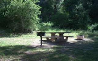
Fremont Campground
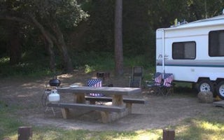
Paradise Campground
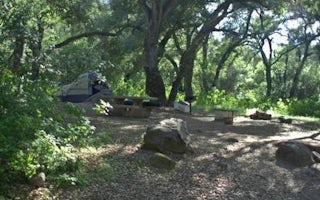
Los Prietos
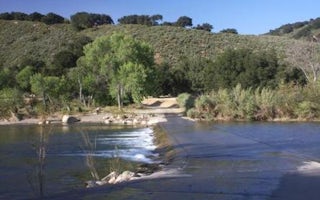
Sage Hill
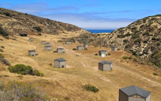
Santa Rosa Island
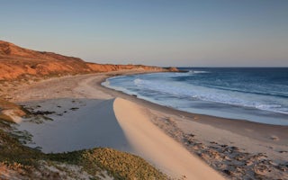
Santa Rosa Island Backcountry Beach Camping


