San Mateo County, California
San Mateo County, California, is home to some of the best trails and outdoor activities. A must-visit is the Sawyer Camp Trail, a scenic 6-mile path that winds along the Crystal Springs Reservoir. It's a top spot for walking, jogging, and cycling, with views of the sparkling water and unique rock formations. Another notable trail is the Devil's Slide Trail, a 1.3-mile path with panoramic views of the Pacific Ocean. For those who enjoy bird-watching, the Pescadero Marsh Natural Preserve is a must-visit. Here, you'll find a variety of bird species and a network of trails that meander through the marsh. These outdoor adventures in San Mateo County offer a unique and scenic way to enjoy the great outdoors.
Top Spots in and near San Mateo County
-
Orinda, California
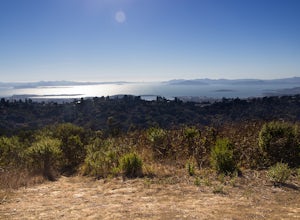
Wildcat Peak Loop
4.05.89 mi / 1050 ft gainFrom Inspiration Point, head toward Nimitz gate. Once you pass through the gate, keep an eye out for Curran Trailhead; this is the trail you'll be starting on. After about 1/8 of a mile, you'll reach a junction with the Meadows Canyon Trail. Turn right onto this trail to continue the loop. This p...Read more -
Muir Beach, California
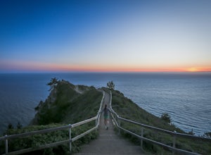
Muir Beach Overlook
4.9The Muir Beach Overlook is one of the most convenient spots to take in an amazing view of the entire coastline, and one of the best places to catch a dramatic sunset. It’s conveniently located one mile north of Muir Beach and parking is easy. It’s a 5 minute walk down the trail to the Overlook. O...Read more -
Muir Beach, California
Owl Trail
5.01.2 mi / 300 ft gainThe Owl Trail runs between Slide Ranch and the Muir Beach Overlook and is a great way to take in the breathtaking views, flora and fauna of the Northern California coast. The easiest way to access the trail is to park at the Muir Beach Overlook and to take the trail down to Slide Ranch and then...Read more -
Kensington, California
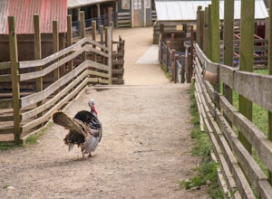
Tilden Little Farm
4.0First make sure to stop at the store and stock up on fresh lettuce and celery for the animals. Your kids (or just the kid in you) will love to feed them! Note that they're only allowed to eat lettuce and celery, so don't try to feed them your own snacks or get creative. ;) If you want to make it...Read more -
Walnut Creek, California
Sugarloaf Open Space Loop
1.91 mi / 243 ft gainSugarloaf Open Space Loop is an almost 2-mile loop for hiking, running and walking. This trail is relatively easy and takes under one hour to hike. This loop is dog friendly.Read more -
Danville, California
Summit Mount Diablo via Rock City Trail
5.07.8 mi / 2299 ft gainAlthough steep in sections, this trail is a wonderful workout and hikers are more than rewarded for their efforts. The Rock City Trail is a direct route to the summit of Mount Diablo, and the park is an ecological treasure dear to the hearts of Bay Area residents. The best views are on clear days...Read more -
Danville, California
Hike in Mount Diablo's Madrone Canyon
2.8 mi / 550 ft gainThis hike starts at the Rock City area of Mount Diablo State Park. Begin at the Madrone Canyon Trail, hiking southeast towards the Devils Slide trail. Along this section of the hike, the trail dips into a wooded canyon and follows the path of a small creek. To best experience the beauty of the cr...Read more -
Lafayette, California
Briones Park's Lafayette Ridge
4.35.31 mi / 981 ft gainThis is a nice and casual hike through the meadows and rolling hills, dotted with cows and hawks and sometimes goats or foxes. As you head up Lafayette Ridge, you'll be rewarded with the beautiful vista spanning from the Oakland Hills to sparkling Lafayette Reservoir. The hike is mostly through ...Read more -
Tiburon, California
Bouldering at Ring Mountain
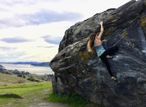
0.5 mi / 400 ft gainItching to climb outdoors near San Francisco? With only a quick drive from the city, Ring Mountain is a beautiful nature preserve overlooking the city of San Francisco offering two main rock formations, Turtle Rock (Pictured) and Split Rock. Split Rock is the slabby rock south of the parking ar...Read more -
Mill Valley, California
Canopy, Panoramic, Redwood Trail, Sun, Dipsea Trail Loop
4.74.31 mi / 1145 ft gainWhile there are other, less crowded redwood groves in the Bay Area, Muir Woods National Monument is easily one of the best. It is a beautifully maintained site, with wooden footpaths meandering between towering redwoods that are between 600 – 800 years old. It’s home to some true giants, with its...Read more -
Morgan Hill, California
Backpack to Coit Lake
5.026 miThis trail can be started from Coe Headquarters or Hunting Hollow Trailhead. The trail from Coe HQ is 2 miles longer, almost all elevation but provides beautiful views of the surrounding mountains. These directions will be starting from Coe HQ.Follow the loop around the parking area to the backpa...Read more -
Morgan Hill, California
Backpack to Mississippi Lake
5.026.4 mi / 3600 ft gainIf you're tired of trying and failing to get reservations for backcountry camping around the bay area, then Henry Coe State Park is the perfect place to visit. No reservations need to be made prior to the trip. All you need to do is get to the HQ on the morning of your trip, get your permits and ...Read more -
Mill Valley, California
Dipsea Trail
4.613.03 mi / 3701 ft gainThe Dipsea Race is the 2nd oldest foot race in the US. The race is named after the Dipsea Inn at the end of the trail at Stinson Beach. The good news is that you can enjoy this scenic trail and its sweeping ocean views at your leisure. The bad news is that the race is only one-way. If you choose,...Read more -
Stinson Beach, California
Steep Ravine Cabins
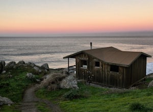
5.0Although these cabins are bare bones, lacking both water and electricity, they couldn't put you in a better spot for views of the Pacific Ocean. From your cabin, you can enjoy amazing sunsets, possibly whale watching, and access to trails like the cabin's namesake, Steep Ravine Trail. The cabins...Read more -
Stinson Beach, California
Steep Ravine Environmental Campground
5.0Gain access through a private locked gate, and descend about 1 mile down to the bluff's edge. There is only parking for 1 car per site and also several cabins that can be rented. A camp host is on site and there are bathrooms and water spigots throughout the campground. Each site has a fire ring...Read more -
Corte Madera, California
Ring Mountain Loop
4.02.65 mi / 597 ft gainRing Mountain Open Space is an easy but uphill trail that take you to the top where you can explore more trails. Take the 101 exit for Paradise Dr in Corte Madera, follow the road, and park on the side of the road once you pass Westward Dr. Even though there are many places to start the trail fo...Read more

