San Marcos, California
Looking for the best running in San Marcos? We've got you covered with the top trails, trips, hiking, backpacking, camping and more around San Marcos. The detailed guides, photos, and reviews are all submitted by the Outbound community.
Top Running Spots in and near San Marcos
-
San Diego, California
Run the Convention Center Stairs
4.8This is a great spot to get in a workout and to get some fresh air. The stairs are around 100 steps to the top, so if you're feeling good, you can get a few rounds in. In terms of safety, there are usually people around the convention center, so you most likely won't be alone. With that said, be ...Read more -
San Clemente, California
San Clemente State Beach
4.54.58 mi / 26 ft gainSan Clemente State Beach is an out-and-back trail that takes past scenic surroundings located near San Clemente, California.Read more -
Warner Springs, California
Eagle Rock via the Pacific Crest Trail
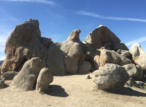
5.06.2 mi / 807 ft gainWith doing more hikes in the SoCal area, I've realized half the battle is just trying to find the damn trailhead.Technically you have 2 ways to enter this trail ... Start from 79 and add a very enjoyable extra 3ish miles, or start from the Warner Springs Fire Station, for a total 7 mile hike.We c...Read more -
Coronado, California
Coronado Beach
4.6Photograph the iconic and historic Hotel Del and Coronado Beach on Coronado Island. The Del is a beautiful Victorian resort, which is the second-largest wooden structure in the United States. The Del offers amazing photo opportunities during sunset and during sunrise when it is beautifully backli...Read more -
San Diego, California
Explore Cabrillo National Monument
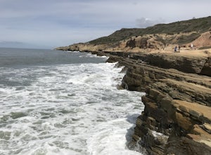
4.5Cabrillo National Monument is named after Juan Rodriguez Cabrillo, the first European explorer to reach America's Wet Coast. There are many knowledgable rangers in the park who are eager to share interesting historical facts. Activities in the park include hiking: the Bayside Trail offers 2 mile...Read more -
Julian, California
Volcan Mountain Trail
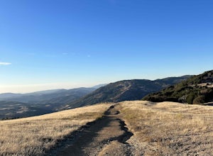
4.82 mi / 1270 ft gainVolcan Mountain Trail located near Julian, California is a moderate day hike. This well-maintained trail offers beautiful views, but keep in mind there isn't too much sun protection, so be sure to pack plenty of water and coverage on sunnier days. Dogs are permitted on the trail on a leash.Read more -
San Diego, California
Bayside Trail
4.01.99 mi / 397 ft gainThe Bayside Trail features beautiful spring wild flowers and is accessible year-round. The trail is wide with a few rest stops and benches along the way. The trail is breezy, much cooler than many trails inland, featuring ocean views throughout the duration. This monument commemorates the landi...Read more -
Chula Vista, California
Hike Mother Miguel Mountain
5.04.5 mi / 977 ft gainAt the summit, your work will be rewarded with stunning views from downtown San Diego all the way to Mexico. You can also see the surrounding mountain peaks and the Sweetwater Reservoir. This is a great hike to do at sunset - but bring a headlamp / flashlight for the hike back down. This trail i...Read more -
Lake Elsinore, California
Hike Bear Canyon Trail to Sitton Peak
6.4 mi / 2200 ft gainA MUST hike for any orange country resident! The hike starts of off Ortega HWY 74 at the Bear Canyon Trail head on the same side of the road as the Ortega oaks candy store. Its recommended you park in the lot across the street from the trail head (tip:there is a working water spicket in the parki...Read more -
Trabuco Canyon, California
Bell Canyon Trail
3.86 mi / 102 ft gainBell Canyon Trail is an out-and-back trail where you may see wildflowers located near San Juan Capistrano, California.Read more -
Jamul, California
Hike the Hollenbeck Canyon Trail
4.6 mi / 626 ft gainThe trail is wide and well maintained. The first mile of the trail is well shaded by oak trees. You'll see stunning rocky peaks and rolling green hills as the trail continues. There are three creek crossings to be aware of. Cleveland National Forest is dog friendly, but bring a leash! Hunting is ...Read more -
Dana Point, California
Walk the Dana Point Preserve Trail
5.00.5 miOcean views the whole time, plenty of wildlife and different species of native plants make this short hike beautiful. With the hike being short enough to complete in the afternoon after a day at the beach you can see a beautiful view of the coastline north and south. There is plenty of parking in...Read more -
Imperial Beach, California
Catch a Sunset at the Imperial Beach Pier
5.0From San Diego, head South on Hwy 5 for 12 miles. Take a right on exit 5A for Palm Ave/CA-75. Take CA-75 west for 1.6 miles. Stay on Palm Ave as it splits from CA-75. Take Palm Ave for 1 mile until it reaches the coast. Turn left on Seacoast Dr and take it for 1 mile until you reach the Imperial ...Read more -
Canyon Lake, California
Kabian Memorial Park Loop
5.03.48 mi / 335 ft gainKabian Memorial Park Loop is a loop trail that takes you by a lake located near Quail Valley, California.Read more -
San Diego, California
Hike to the beach at Border Field State Park
2 mi / 26 ft gainThe beach at Border Field State Park is southernmost beach in California. This beach begins (on US Maps) at the Mexican border and continues north to the mouth of the Tijuana River. The State Park shares its land with the Tijuana River National Estuarine Research Reserve which are both operated b...Read more -
Laguna Beach, California
Aliso Peak via the Valido Trail
5.01.14 mi / 325 ft gainThe Valido Trail trailhead can be found just off West street off the Pacific Coast Highway, just south of Aliso Beach. Park on West Street past the trailhead. The trail proceeds approximate .5 miles till it intersects with the Aliso Peak Trail. Go left .4 miles to the obvious summit and wooden p...Read more


