Sacramento, California
Looking for the best hiking in Sacramento? We've got you covered with the top trails, trips, hiking, backpacking, camping and more around Sacramento. The detailed guides, photos, and reviews are all submitted by the Outbound community.
Top Hiking Spots in and near Sacramento
-
Napa, California
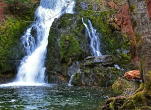
Hike To Zim Zim Falls
5.08 mi / 500 ft gainThis 8 mile (out and back) hike begins at the trail head off of Knoxville Road, just before mile marker 24. The first 3 miles are relatively flat, though you will cross the creek about 9 times. Right before you reach the waterfall, you will come to a fork in the trail marked by a pink boulder. St...Read more -
Colfax, California
Hike The Historical Stevens Trail
5.08 mi / 3376 ft gainBest known as one of the most popular hiking and biking trails to the North Fork American River, in part because of the easy access from Colfax. However, this is a remote trail, and hikers are advised to bring plenty of fluids as well as carry a whistle. The entire trail is primarily shaded, pa...Read more -
Napa, California
Lake Marie Road, Marie Creek, Buckeye Trail Loop
3.55.8 mi / 961 ft gainEnter the parking lot just off of Hwy 221. Plan to pay a $5 entrance fee at the kiosk. The trail head begins at the edge of the parking lot where you'll soon be passing by the Martha Walker Native Habitat Garden on your right. Veer left to continue along Lake Marie Road where you'll enter the blu...Read more -
Antioch, California
Hike the Old Homestead Loop
5.06.5 miThis is a fun day hike that takes you through the beautiful hills of the Black Diamond Mines Regional Preserve and a bit of the Contra Loma Recreational Area as well. You can hike here year round, but I suggest going in the spring time when the hills are covered in soft, green grass and the wild ...Read more -
Saint Helena, California
Lake Hennessey Loop
5.06.53 mi / 764 ft gainThe "lollipop" hike starts at the "Ranch House" parking lot off of Chiles Pope Valley Road - alternatively, you can access from Conn Valley Road for a shortened 5.6-mile loop. You turn off Chiles Pope Valley Road onto Moore Creek Trail, drive past a private house (you can see it on the map) and t...Read more -
Pollock Pines, United States
Hiking the Jenkinson Lake Loop Trail at Sly Park
4.0The Jenkinson Lake Loop Trail runs along Jenkinson Lake, making for an easy, shaded, and well-marked hike that the entire family can enjoy. The full loop is over eight miles, but can be easily modified into a shorter trip, as well.Along the way, you will see a variety of activities along the lake...Read more -
Napa, California
Westwood Hills Park Loop
4.02.12 mi / 476 ft gainThis park can get a little crowded on weekends, so best to go early if possible. In terms of parking, there's a lot at the trailhead, but also plenty of available street parking. The loop can be broken up in a various ways as there are several offshoots from the main trailhead/trail leaving fro...Read more -
Napa, California
Alston Park Loop Trail
2.76 mi / 184 ft gainAlston Park Loop Trail, located in Napa, California, is a 2.76-mile loop trail that offers a moderate level of difficulty for hikers. The trail is primarily used for hiking, walking, and running and is accessible year-round. The trail is well-maintained and clearly marked, making it suitable for ...Read more

