Running Springs, California
Looking for the best hiking in Running Springs? We've got you covered with the top trails, trips, hiking, backpacking, camping and more around Running Springs. The detailed guides, photos, and reviews are all submitted by the Outbound community.
Top Hiking Spots in and near Running Springs
-
Dawson Saddle, California
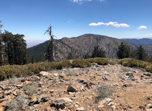
Hike to Throop Peak, Mt. Hawkins, and Mt. Burnham
8 mi / 2000 ft gainThe trailhead, or pair of trailheads actually, is at a location on the Angeles Crest Highway (CA-2) called Dawson's Saddle. There are a couple of parking areas along the side of the highway, and each of the pair of trailheads begins at either end of this parking area. The trailheads aren't mark...Read more -
Palm Springs, California
Skyline Trail to Aerial Tramway Top Station
5.09.41 mi / 8238 ft gainSkyline Trail to Aerial Tramway Top Station is a point-to-point trail where you may see beautiful wildflowers located near Palm Springs, California.Read more -
Palm Springs, California
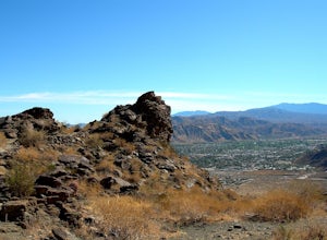
Museum Trail
1.52 mi / 860 ft gainThe Museum Trail is a very steep climb with a 1,000 feet elevation gain in just one mile but has some great views of downtown Palm Springs. The hike starts behind the Palm Springs Art Museum. This trail can also access the Cactus to Clouds Trail that goes all the way to the top of Mt. San Jacinto...Read more -
Silverado, California
Bedford Peak Trail
5.06.78 mi / 1972 ft gainThe Bedford Peak Trail in Silverado, California is a challenging hike that offers a variety of natural features. The trail spans 6.78 miles round trip and has an elevation gain of 1,972 feet. It is rated as difficult due to its steep inclines and rocky terrain. The trail begins in a dense oak w...Read more -
Azusa, California
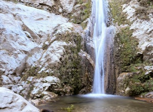
Lewis Falls
1 mi / 732 ft gainLocated deep in the Angeles National Forest above Azusa, this short but at times challenging hike rewards you with a beautiful fifty-foot waterfall. The base of the waterfall is only a foot at its deepest, so I wouldn't rush to bring a bathing suit with you. Protected by the heavy forestry around...Read more -
Yucca Valley, California
Backpack the California Riding and Hiking Trail in Joshua Tree
36.97 mi / 2792 ft gainThe starting point for this hike is at the Black Rock campground, 5 miles from the town of Yucca Valley. You'll need to self register for a free backcountry permit before starting. The first section of the trail follows a wash then the trail narrows and, after only a mile or two, you'll begin cl...Read more -
Palm Springs, California
South Lykken Trail to Simonetta Kennett Viewpoint
3.66.45 mi / 1654 ft gainThe South Lykken Trail is the south half of the 9.5-mile Carl Lykken Trail, which weaves along a series of mountain ridges above downtown Palm Springs. Dogs are not permitted on this trail. This section of the trail runs 3.2 miles one-way. You will gain just over 1600ft of elevation at the high...Read more -
Azusa, California
Smith Mountain Trail
6.69 mi / 3189 ft gainSmith Mountain Trail is an awesome day hike located near Glendora, California. This out-and-back trail offers great views of the Los Angeles National Forest and the potential for continuation to Bear Creek for even more variety of scenery. Smith Mountain is a moderately strenuous hike with an el...Read more -
Palm Springs, California
South Carl Lykken Trail - North Section
3.42 mi / 1076 ft gainSouth Carl Lykken Trail - North Section is an out-and-back trail that takes you by a waterfall located near Palm Springs, California.Read more -
Azusa, California
Little Jimmy Trail Camp
4.33.36 mi / 607 ft gainTake Hwy 2 out of La Canada north along Angeles Crest Highway. Follow this for quite some time enjoying the fine views in all directions. After traveling through two consecutive tunnels continue to the Islip Saddle parking lot (on left). There will be a vault toilet & a picnic table. Display ...Read more -
Corona, California
Hike to Santiago Peak via Holy Jim
5.015 mi / 4500 ft gainWhen you think of Orange County, you think of beaches, boardwalks, but what you may not know is that there are some great hikes in our very own backyard! My favorite is a fairly strenuous day hiking adventure that only the strong survive. Not to dissuade any interested parties, since this is a ...Read more -
Corona, California
Hike to Holy Jim Falls
3.02.9 mi / 570 ft gainTo start, directions on how to get to the trail there are two different ways, the most common , which I will explain, being through Rancho Santa Margarita you will head east on Santa Margarita Parkway, turn left at the dead end (into a parking lot for a shopping center) on Plano Trabuco Road, thi...Read more -
Los Angeles County, California
Mt. Williamson via Islip Saddle
4.16 mi / 1519 ft gainThe trailhead is immediately off of Angeles Crest Highway CA-2 at Islip Saddle. It's just a touch over 2 miles to reach the summit, through which you'll be hiking among the pine tree forest practically the entire way up (part of this trail doubles as the Pacific Crest Trail). The summit is larg...Read more -
Mountain Center, California
Apache Peak Trail
9.4 mi / 2966 ft gainApache Peak Trail is an out-and-back trail where you may see wildflowers located near Mountain Center, California.Read more -
Palm Springs, California
Earl Henderson and Shannon Trail Loop
4.31 mi / 1257 ft gainThis is a short but sweet trail close to the Araby and Garstin Trails. Great views of Palm Springs and the San Jacinto Mountains. Parking area is off of Lansdale Street. From here, head down the Earl Henderson Trail and you will see where in connects with the Shannon Trail. You can choose to swit...Read more -
Palm Springs, California
Araby and Berns Trail Loop
4.76 mi / 1293 ft gainAraby and Berns Trail Loop is a loop trail that takes you past scenic surroundings located near Palm Springs, California.Read more

