Rock Climbing, California
Top Spots in and near Rock Climbing
-
Half Moon Bay, California
This is a great way to destress and have fun! Goat yoga is like normal yoga, but with goats. Goats tend to like higher ground and flat surfaces. So, when you are in table top position, they are highly likely to jump onto your back! These goats are still young, and so do not weigh as much as f...
Read more
-
San Mateo County, California
The Sawyer Camp Trail is a popular paved trail that stretches alongside the Crystal Springs Reservoir all the way to Hillcrest Blvd. The sixth mile crosses over the San Andreas Dam with nice views of San Andreas Lake.There are markers every half mile which makes timing and tracking your run easy....
Read more
-
Half Moon Bay, California
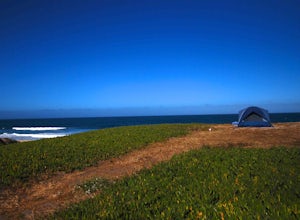
If you love to log as much water time as possible, this little gem is the campsite for you. Half Moon Bay State Beach is actually four smaller beaches, with a total of two miles of sandy shore, but you'll be camping right at Kelly Ave., one of Half Moon Bay's most consistent surf spots. Keep in m...
Read more
-
Half Moon Bay, California
Start at the visitor center along Kelly Avenue. Take note that the day parking fee is $10 in 2016 for each vehicle. You will then be able to enjoy both the Coastside Trail and Francis Beach (plus other beaches) with access to the amenities such as coin-operated showers and a semi-private beach.Th...
Read more
-
Mount Hamilton, California
Hop on Road 130 heading out of San Jose and follow the winding two lane road up, up, up to to the top of Mt. Hamilton and the Lick Observatory. There are lots of deer, wild turkey, and pigs in the area. If you are lucky you will get to see a herd of deer grazing in a meadow. But be careful that y...
Read more
-
Sunol, California
4.3
6.4 mi
/ 1443 ft gain
Pleasanton Ridge Trail is a 6.4 mile loop. The loop is shared by dog walkers, trail runners, hikers, mountain bikers and horseback riders. From the ridge your viewpoints will include Mount Diablo and the San Francisco Bay.
This hike from the Foothills Staging Area is an excellent introduction ...
Read more
-
Half Moon Bay, California
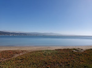
The Half Moon Bay Jetty is a calm place to paddle as it is covered on all sides. There is an opening into the ocean on the far side, but is mostly calm with plenty of beach area to launch. Keep in mind, there are boats in the harbor so keep an eye out. There is also a scenic hike nearby the West ...
Read more
-
Burlingame, California
This hike can be done at any time of year. Hiking in winter and spring means that many varieties of wildflowers will be present, and the creek will have much more water. Summer and fall mean higher temperatures and drier conditions, but the hike is still a pleasant experience.
Begin the hike at t...
Read more
-
Half Moon Bay, California
Maverick's beach is most well-known for the Maverick surf competition and the gnarly waves which surface here in the winter months. For the rest of the year, the beach is still a site to see. With huge waves crashing ¼ mile off shore and bluffs towering 100 feet above you, it’s a picturesque plac...
Read more
-
Moss Beach, California
4.7
1.84 mi
/ 154 ft gain
Sitting on a 140 acre bluff top, the Pillar Point Bluffs are a simple, easy hike with breathtaking views throughout. The bluffs are 22 miles from San Francisco – a 30 minute drive depending on the traffic. There is a small 10 car or so parking lot off of Airport Blvd, but there are two additional...
Read more
-
Pleasanton, California
This is a 5+ mile out and back trail through the hills in the South Bay. The beginning of the hike has a steeper incline and then becomes more gradual later on. There is a beautiful views of the South Bay that are enjoyable in the day, but are fantastic in the evening. Some areas of the trail hav...
Read more
-
Moss Beach, California
4.5
0.79 mi
/ 105 ft gain
The Cypress Tree Tunnels are a quick jaunt from San Francisco (22 miles) and make for a great half-day trip. Getting here depends on traffic, but 30 minutes from the center of the city is doable. Parking is relatively easy. You can either park at the south end of the area at the Cypress Cove entr...
Read more
-
Moss Beach, California
Located beside a residential neighborhood, Fitzgerald Marine Reserve offers a rare glimpse of life in the northern California intertidal zones. There are parking spaces and restrooms available, as well as ranger-led guided tours.
Be sure to check the tide charts and go during low tide (preferab...
Read more
-
Livermore, California
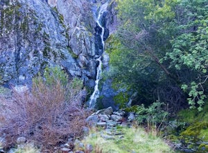
Get ready for one of the toughest, lung busting hikes in the east bay with over 6-miles and 4,000ft of climbing in one direction. When you make it to the hike, it's also important to realize that without recent rain, there many not actually be a waterfall. With that said, you're still getting in ...
Read more
-
Livermore, California
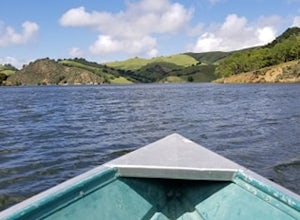
Lake Del Valle is a reservoir located in Livermore, California. The lake has boat motor boats, pedal boats, patio boats, canoes, and row boats available for rent. There is a dock and rental house in the marina.The lake is also a popular destination for picnics, barbecues, and camping.
Parking fi...
Read more
-
Morgan Hill, California
This trail can be started from Coe Headquarters or Hunting Hollow Trailhead. The trail from Coe HQ is 2 miles longer, almost all elevation but provides beautiful views of the surrounding mountains. These directions will be starting from Coe HQ.Follow the loop around the parking area to the backpa...
Read more

