Riverside, California
Mount Rubidoux Trail in Riverside, California is a must-visit for outdoor adventures. It's a top choice for hikers, offering scenic views of the city and the Santa Ana River. The trail is 3 miles long and moderately difficult, making it suitable for most fitness levels. Along the way, you'll find unique landmarks like the Serra Cross and the Peace Bridge. Another best trail is the Santa Ana River Trail, a 50 mile long path perfect for biking, walking, and horseback riding. For a different kind of outdoor activity, head to the California Citrus State Historic Park. Here, you can explore the vast citrus groves, learn about the state's citrus industry, and even sample some of the fruits. The best Trails and Outdoor Activities await you in Riverside, California.
Top Spots in and near Riverside
-
Altadena, California
Eaton Canyon to Idlehour Trail Camp
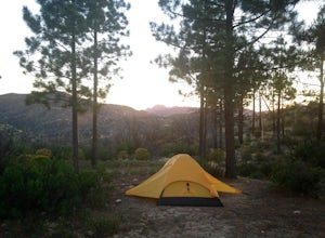
4.510.99 mi / 3291 ft gainIdlehour is nestled deep in the Angeles National Forest, so it feels like you're in the heart of some untapped wilderness instead of six miles away from a bustling metropolis. The trail camp is accessible by foot through a variety of locations, but the most popular route is through Eaton Canyon, ...Read more -
Pasadena, California
Eaton Canyon Falls via Eaton Canyon Trailhead
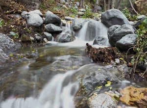
4.23.54 mi / 528 ft gainThe hidden forty-foot-tall Eaton Canyon Falls fills an amphitheater at the top of Eaton Canyon Trail, tumbling into a wide pool that you can rest alongside or wade in. Normally the water is waist deep, but during this recent trip, we found the water only to stop at our ankles as it tends to fluct...Read more -
Palmdale, California
Camp at Chilao Campground
4.3While not as popular as shady Buckhorn Campground up the road, Chilao offers the better views and greater chances of scoring a peaceful and private campsite. There are two campsites located here (and two group camps down in the valley). Sites are first come, first serve, and cost $12 (bring exact...Read more -
Palmdale, California
Camp at Manzanita Loop in Chilao Campground
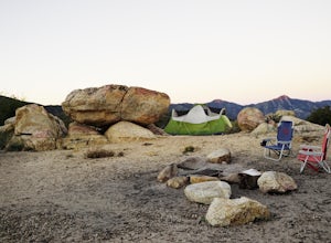
5.0Chilao Camp is located at an elevation of 5,300 feet, in the San Gabriel Mountains, and is divided into two different loops called the Manzanita and Pine.This specific adventure is for the Manzanita Loop, which is pretty much known as the more scenic loop, mainly because the area overlooks the Bi...Read more -
Long Beach, California
Colorado Lagoon
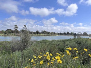
5.00.95 mi / 30 ft gainThe Colorado Lagoon is a wetland that is being restored. To make this 1 mile walk into a loop, you have to walk along sidewalks near the park. This is a very kid-friendly destination. This trail crosses over the lagoon on a boardwalk. It also accesses a sandy swimming beach with restrooms, picnic...Read more -
Long Beach, California
Red Car Greenbelt
5.00.63 mi / 0 ft gainThe Greenbelt used to be the right-of-way for the long lost Pacific Electric Red Car, an amazing system of public transportation that connected Long Beach, LA, Orange Coutny, and even San Bernardino. The pathways are landscaped with plants typical of the area and plenty of native flowers for the...Read more -
Palm Springs, California
Palm Springs Tram to Idyllwild
5.010.09 mi / 1404 ft gainPalm Springs Tram to Idyllwild is a point-to-point trail where you may see wildflowers located near Palm Springs, California.Read more -
Palm Springs, California
Hidden Lake via Willow Creek Trail
3.35 mi / 518 ft gainHidden Lake via Willow Creek Trail is a loop trail that takes you by a lake located near Palm Springs, California.Read more -
Palm Springs, California
Caramba Overlook
12.97 mi / 2779 ft gainCaramba Overlook is an out-and-back trail that provides a good opportunity to see wildlife located near Palm Springs, California.Read more -
Pearblossom, California
Camp at Horse Flats Campground
3.0The Horse Flats Campground is located 29 miles up Highway 2 from Interstate 210. You will turn left at the Santa Clara Divide Road(this intersection is also known as 3 Points). 3 miles down the road you will turn left to enter the campground. I have camped here a few times and its always been pre...Read more -
Los Angeles County, California
San Gabriel Peak
4.02.79 mi / 1040 ft gainAt 6,000 feet, San Gabriel Peak gives you one of the best views of the Los Angeles basin on the front range of the San Gabriel Mountains National Monument. As you pass through Muller Tunnel, the trail will be littered with rocks and boulders. A little over 100 feet in, the road will fork in thre...Read more -
Los Angeles County, California
Idlehour Trail
4.014.89 mi / 4665 ft gainIdlehour Trail located near Mount Wilson, California, is an out-and-back trail that is strenuous and can take 8-10 hours if done all at once. There are opportunities to camp off the trail, making this a backpacking trail in the Angeles National Forest as well. To access the Idlehour Campground ...Read more -
Signal Hill, California
Hilltop Park
4.7Hilltop Park is located in Signal Hill and offers an unmatched panoramic view of the Los Angeles Basin. If you go on a clear day, you may even be lucky enough to see Catalina Island and the Santa Monica and San Gabriel Mountains. This park is the perfect spot for families, dogs, and even dates. T...Read more -
Altadena, California
Thalehaha Falls
1.71 mi / 679 ft gainThe trails starts in a foothill neighborhood of Altadena CA at the corner of Pleasantridge Dr. and Rubio Vista Rd. This is one of the better entries into the Angeles National Forest because it is one of the lesser known. Find a place to park on the street and head out on the trail into Rubio Cany...Read more -
Palm Springs, California
Climb at the Tramway of Mount San Jacinto
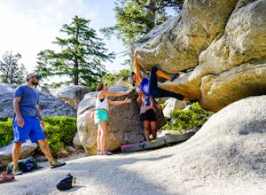
John Muir once wrote, "The view from San Jacinto is the most sublime spectacle to be found anywhere on this earth!" So it's no surprise that this is a sought after destination for hikers and climbers alike. Named after the fact that most climbers use the Palm Springs Aerial Tramway to reach this...Read more -
Palm Springs, California
Winter Climb San Jacinto from the Tram
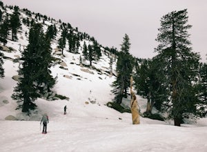
5.08 mi / 2400 ft gainIntermediate: No snow.Advanced: Lots of snow.Expert: Snow w/ high winds and low temps. GPX: https://www.gaiagps.com/datasu... San Jacinto, at 10,834 feet, is the second-highest peak in the Southern California. It's unique in that it has a rotating tram car (think slow motion disco floor) that r...Read more

