Rancho Palos Verdes, California
Looking for the best photography in Rancho Palos Verdes? We've got you covered with the top trails, trips, hiking, backpacking, camping and more around Rancho Palos Verdes. The detailed guides, photos, and reviews are all submitted by the Outbound community.
Top Photography Spots in and near Rancho Palos Verdes
-
Malibu, California
Newton & Zuma Canyon Falls
4.32 mi / -600 ft gainThree waterfalls in one short hike?!...I'll take it! That's what you'll get if you make the visit to these falls in the Santa Monica mountains in Malibu. The trailhead starts on Kanan Dume road, which is also where the Backbone trail meets. Park in the designated (free) parking area and take the ...Read more -
Los Angeles, California
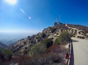
Verdugo Peak via Hostetter Fire Road
5.07.39 mi / 1627 ft gainVerdugo Peak, at 3000 feet, is accessible from multiple directions and trails along the Verdugo Range. The most direct route to the top is Hostetter Fire Road, a 3.6-mile hard-packed dirt trail that climbs 1600 feet to the 3,126-foot summit. The hike begins at the dirt parking lot off of La Tuna ...Read more -
Pasadena, California
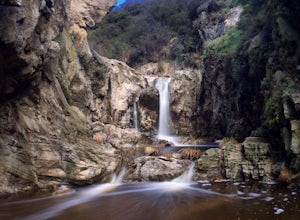
Eaton Canyon Falls via Eaton Canyon Trailhead
4.23.54 mi / 528 ft gainThe hidden forty-foot-tall Eaton Canyon Falls fills an amphitheater at the top of Eaton Canyon Trail, tumbling into a wide pool that you can rest alongside or wade in. Normally the water is waist deep, but during this recent trip, we found the water only to stop at our ankles as it tends to fluct...Read more -
Ventura County, California
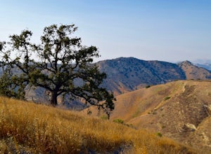
Hike the Upper Las Virgenes Canyon Open Space Preserve Trail
8.6 mi / 1851 ft gainThe most popular point of entry is through the Victory Trailhead, which has ample parking. You can park on the street or you can pay $3 to park at the trailhead parking lot. You can also enter at the Upper Las Virgenes Canyon Trailhead at the northern end of Las Virgenes Canyon Road in Calabasas....Read more -
Malibu, California
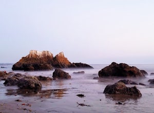
El Matador Beach
4.6There's something magical about this strip of beach and it never fails to deliver at sunset. Lined with strange and jagged rock formations/caves, there are endless opportunities for finding unique compositions and new perspectives. Although it's become quite the popular spot for photographers and...Read more -
Laguna Beach, California
El Moro Canyon Trail to Lower Moro Campground
3.56.37 mi / 997 ft gainLocated off of Pacific Coast Highway in Laguna Beach is Crystal Cove State Park. There are three primitive sites located in Crystal Cove: Deer Canyon, Upper Moro, and Lower Moro. The site I stayed at was Lower Moro campground. All three of these sites require the backpacker to hike everything in...Read more -
Laguna Beach, California
El Moro Canyon Trail
5.04.94 mi / 814 ft gainThe trail features a waterfall and is open year-round, but is best used in the spring. Remember to bring $15 cash for the parking fee. The Laguna Beach trail is shared by trail runners, mountain bikers, hikers, and the occasional horseback rider. Dogs are not allowed in Crystal Cove State Park.Read more -
Los Angeles, California
Cave of Munits
4.51.53 mi / 299 ft gainAre you looking for a hike that offers trail running, scenic views, hiking, and CAVE exploring? This short, but exciting trail leads you on a short 0.8 mile hike to the Cave of Munits. When starting at the main trailhead, El Scorpion Park, take the wide paved dirt road all the way till you get to...Read more -
Altadena, California
Echo Mountain and Inspiration Point Loop
4.110.16 mi / 3369 ft gainThe trail switchbacks up the mountain before reaching the first historic marker, in 3 miles. These are the remains of the Mount Lowe Railroad, which brought customers to Echo Mountain Resort, also in ruins, nearby. Explore the historic sites, then head up Castle Canyon Trail. A steep climb will ...Read more -
Newport Beach, California
Bommer Ridge from the Pacific Ridge Trailhead
7.54 mi / 394 ft gainThe Bommer Ridge West Trailhead aka The Pacific Ridge Trailhead begins at the edge of Ridge Park Road, overlooking CA State Highway 73, and marks the northwest entrance to the Laguna Coast Wilderness and its neighbor, Crystal Cove State Park. From the well-marked trailhead follow the trail south...Read more -
Newport Beach, California
Explore Deer Canyon
6.9 mi / 1489 ft gainThe Deer Canyon Loop Trail is an easy drive from Orange County and Newport Beach. In the spring, wildflowers are abundant along the trial. This is a favorite spot for trail runners, hikers, and mountain bikers. The trail is kept in great condition year-round and is very wide. There is very little...Read more -
Laguna Beach, California
B.F.I. Trail in Crystal Cove State Park
5.00.78 mi / 125 ft gainTo get to the trailhead, enter Crystal Cove State Park through the Crystal Cove El Moro Campground entrance immediately next to El Moro Elementary School. Follow the road behind the school which leads to the main gate where you will need to pay a day-use parking fee of $15. Drive past the Campgr...Read more -
Laguna Beach, California
Crystal Cove Loop Trail
4.04.05 mi / 676 ft gainThe trail begins and ends at the El Moro Visitor Center. Parking requires either a $15 day use parking pass, which is available in the visitor center. This hike we are focusing on is called the Difficult Loop Trail and it is the third most difficult trail the canyon offers. You take Moro Canyon,...Read more -
Altadena, California
Thalehaha Falls
1.71 mi / 679 ft gainThe trails starts in a foothill neighborhood of Altadena CA at the corner of Pleasantridge Dr. and Rubio Vista Rd. This is one of the better entries into the Angeles National Forest because it is one of the lesser known. Find a place to park on the street and head out on the trail into Rubio Cany...Read more -
Laguna Beach, California
Photograph the Pacific Coast Highway over Crystal Cove Beach
4.4To get to the bluffs overlooking Crystal Cove State Park Beach to the south, you'll need to pull off onto the side of the Pacific Coast Highway *before* Morro Ridge Road.The easiest and most obvious turnoff is on the right side of the highway southbound, just past the "Adopt a Highway" sign and w...Read more -
Altadena, California
Millard Falls
3.01.27 mi / 289 ft gainTo get to the trail, park at the Millard Campground Trailhead parking lot, where you'll find plenty of parking. Follow the trail that leads away from the lot and past the Millard Campground. If necessary, you'll find bathrooms at the campground. Follow signs for Millard Falls as the trail veers r...Read more

