Prunedale, California
Looking for the best hiking in Prunedale? We've got you covered with the top trails, trips, hiking, backpacking, camping and more around Prunedale. The detailed guides, photos, and reviews are all submitted by the Outbound community.
Top Hiking Spots in and near Prunedale
-
Marina, California
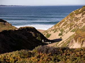
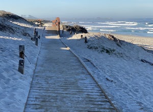
Explore Fort Ord Dunes State Park
5.0One of the best parts of Monterey is the beaches – but their popularity is also their weakness, so if you want seclusion head to the lesser-known Fort Ord Dunes for solitude and beautiful views of Monterey Bay and the Pacific Coast. Historically, this location was chosen as the location for Fort ...Read more -
Salinas, California
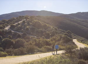
Hike or Trail Run around Toro Park
Just a short drive from downtown Monterey you will find yourself amongst the rugged yet serene hills ofToro Park. For a $2 admission fee you will have access to 20+ miles of trails that climb through canyons and run along ridgelines to peaks with views of the ocean in the distance. While the map ...Read more -
Pacific Grove, California
Visit the Monarch Grove Butterfly Sanctuary
1 miThousands of monarchs can be found here October through February. It's a small park with a path through the center. Park near the Monarch Grove hotel at the sign that says "Caution: Butterflies present", and cross the street to walk down the short path (pink houses will be on your right) and to t...Read more -
Pacific Grove, California
Spanish Bay Trail
5.02.8 mi / 78 ft gainSpanish Bay Trail is an out and back trail that takes you past scenic views located near Monterey, California.Read more -
Aptos, California
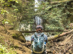
Hike to Nisene Marks' Maple Falls
4.68.5 mi / 900 ft gainAs you enter the park, you'll need to pay $8 for parking via a self-pay envelope, so it's recommended that you bring exact change. At the park booth, be sure to grab a map. The hike can be a little tricky with no cell service and limited trail signage. Once you've grabbed your map, keep driving p...Read more -
Capitola, California
New Brighton Beach Trail
0.85 mi / 112 ft gainNew Brighton Beach Trail is an out-and-back trail that takes you past scenic surroundings located near Aptos, California.Read more -
Capitola, California
Camp at New Brighton Campground
/ 0 ft gainThis Capitola camping spot is the place to be if you're looking to do a variety of activities in a variety of landscapes. You can swim, fish, or explore the nearby forest of Monterey Pine and coastal Oak. In the evening, walk into Capitola for live music and great fish tacos. The S.S. Palo Alto,...Read more -
Carmel-by-the-Sea, California
Hike to the Top of Inspiration Point
5.01.3 mi / 850 ft gainThis magnificent trail was recently converted into part of the Monterey Regional Parks System. Walk through pastures of cows, through coast oaks, up a steep incline with vast views of Carmel Valley, Carmel and the Pacific Ocean up to the top where a picnic table awaits you at Inspiration Point. T...Read more -
Carmel-by-the-Sea, California
Hike along the Carmel River Beach Trail
1 mi / 100 ft gainKnown as "Ribera Beach" by locals, this stretch of land nestled between Carmel River State Beach and Monastery Beach is not to be missed! The trails are easy to get to and can be accessed by 4 locations. The first entrance is on Highway 1 at the Bay School (between Ribera Road and Monastery Beach...Read more -
Soquel, California
Land of Medicine Buddha Loop
4.55.74 mi / 915 ft gainNear the retreat, there is a short trail called "Eight Verses Pilgrimage Trail" providing people with the opportunity to meditate on thought transformation in a peaceful and picturesque outdoor setting. From there, a beautiful 6 mile loop will take you up to the top of the ridge and then back aro...Read more -
Morgan Hill, California
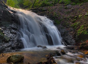
Uvas Canyon Waterfall Hike
4.01.5 miUvas Canyon offers up to 6-miles of hiking trails, which includes a 1.5 mile loop, which runs along Swanson Creek and passes many of the park's waterfalls. To take short loop, head North out of the parking lot to the Swanson Creek Trail. Once you find Swanson Creek Trail, you'll be on the Waterfa...Read more -
Carmel-by-the-Sea, California
Whalers Cove Loop
4.31.42 mi / 253 ft gainPoint Lobos is one of the hidden gems of the California coast. Located just off of Route 1 right after Monterey, Point Lobos is a state park on the coast. The cost to explore inside is ten dollars, but so worth it. As you explore, be sure to hike around Whalers Cove, which is incredible at sunse...Read more -
Carmel, California
Point Lobos Natural Preserve Loop
4.77.14 mi / 640 ft gainPoint Lobos contains headlands, coves and rolling meadows, and its offshore area forms one of the richest underwater habitats in the world, popular with divers. Wildlife includes seals, sea lions, sea otters, migrating gray whales (from December to May), and thousands of seabirds, who also make t...Read more -
Gilroy, California
Redfern Pond via Hunting Hollow
5.07 mi / 1263 ft gainHenry W. Coe State Park, northern California's largest, provides outdoor enthusiasts with over 89,000 acres of land to explore, as well as 22,000 acres of designated wilderness area. With all of this space, the outdoor adventures are seemingly endless. We recommend a multi-day backpacking trip to...Read more -
Carmel-by-the-Sea, California
Cypress Grove Trail via South Shore Trail
5.01.72 mi / 121 ft gainCypress Grove Trail via South Shore Trail is a family-friendly loop hiking trail located near Carmel-by-the-Sea, California. Along this hike in Point Lobos State Natural Reserve, you'll get a chance to see beautiful coastal views with rugged cliffs, views across Monterey Bay, and Cypress trees as...Read more -
Carmel-by-the-Sea, California
Soberanes Point
1.82 mi / 295 ft gainGarrapata State Park is located along California's Highway 1, roughly 5 miles south of Carmel, California. The park is entirely free with multiple pull-outs and serves as one of the first grand views travelers encounter while heading south from the Monterey Peninsula to southern California. Garra...Read more

