Pinecrest, California
Looking for the best backpacking in Pinecrest? We've got you covered with the top trails, trips, hiking, backpacking, camping and more around Pinecrest. The detailed guides, photos, and reviews are all submitted by the Outbound community.
Top Backpacking Spots in and near Pinecrest
-
Mariposa County, California
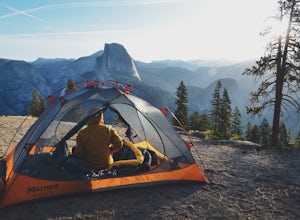
Camp at Glacier Point
4.79.17 mi / 3491 ft gainEveryone that knows Yosemite, knows Glacier Point. An overlook that attracts thousands of people per day that drive up via Glacier Point Road is rarely vacant of the hustle and bustle of people. However, there is a loop hole here, and when the stars align you can have Glacier Point ALL to yoursel...Read more -
Bridgeport, California
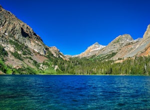
Backpack to Green Lake and Virginia Pass
17 mi / 4452 ft gainDay 1 Green Creek Trailhead to Green Lake When we went on this hike, it was primarily to explore the area and see if it would be a feasible entrance to Northern Yosemite for extended backpacking trips. However, it also is a great two night trip to a lovely area of the Hoover Wilderness. Best...Read more -
37.739698,-119.564018
Snow Creek Trail
5.020.43 mi / 2700 ft gainThis is truly a beautiful hike. Although it’s not the easiest, you are rewarded by the views. From the Mirror Lake trailhead (shuttle stop #17), it is 0.9 miles to the Snow Creek trailhead and 1.7 miles to the Snow Creek overlook where you can camp in close proximity. Once you reach the top, you...Read more -
Yosemite Valley, California
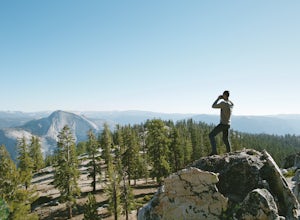
Hike to Basket Dome
9.45 miGetting There Starting in Yosemite Valley, head to the Snow Creek trailhead just past Muir Meadows. Start the hike early in the morning, since it gets pretty hot in the summer and the last part of the hike is in the sun. The Trail You'll hike more than 140 switchbacks to reach the top of Ba...Read more -
Yosemite Valley, California
Thru-Hike the John Muir Trail
5.0203.17 mi / 44944 ft gainTo thru hike the JMT is probably one of the sickest trips to do! It's not a heavy commitment like the PCT or AT but it's also no week long vacation from work, backpacking the woods of your local forests either. There's a sweet spot in thru hiking and I believe this trail gives the full taste. You...Read more -
Mariposa County, California
John Muir Trail: Camping at Lower Cathedral Lake
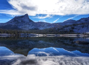
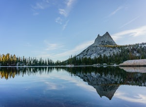
5.0Make the .75 miles detour off of the John Muir Trail to reach this spot and you won't regret it. Lower Cathedral Lake is typically less populated than nearby Upper Lake and has some of the mot beautiful scenery on the JMT. Sunrise and sunset with the reflection of Cathedral Peak on the glassy wat...Read more -
Mariposa County, California
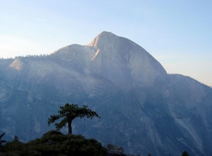
Little Yosemite Valley Campsite and Half Dome
4.613.88 mi / 4800 ft gainFirst things first. You will need to get a wilderness pass by entering the lottery for Half Dome access. If you don't get a pass via lottery just go to the Yosemite Valley visitor center, tell the clerk you are backpacking to Little Yosemite Valley and that you would like to hike up Half Dome. Th...Read more -
37.732842,-119.557782
Panorama Trail
4.816.87 mi / 3200 ft gainThe Panorama Trail is an outstanding hike that takes you from the Yosemite Valley floor up to Glacier Point. Or you can hike it downhill going from Glacier Point to Yosemite Valley. You can camp and make it an overnight trip or do it as a day trip by leaving a car at one end and taking a park sh...Read more -
Mariposa County, California
Backpack to Clouds Rest from Glacier Point
4.023.85 mi / 6942 ft gainStart from Glacier Point around 7,200 feet leaving on the Panoramic Trail. Head down 2 miles to Illilouette Falls (5,800 feet). Once you cross the bridge at Illilouette Falls you go up Panorama Point and head back down to Nevada Falls (5,971 feet). Once you reach Nevada Falls fill up on as much w...Read more -
Mariposa County, California
Sentinel Dome and Taft Point Loop
5.05.17 mi / 1076 ft gainSENTINEL DOME & TAFT POINT TRAILHEAD: About an hour drive from Yosemite Valley campgrounds. This trailhead is an intersection of the starting point of the Taft Point trail and Sentinel Dome trail. It is a short walk (and visible) from the parking lot. In doing both trails, it would be an esti...Read more -
Cathedral Lakes Trailhead
Tuolumne Meadows to Yosemite Valley
5.030.82 mi / 6109 ft gainYosemite is an iconic park, and if you are looking for isolation with spectacular views of the backcountry this trip is for you. The trail itself is approximately 33 miles and can be done in 3-4 days, but I recommend a 6 day hike to enjoy the scenery and to have the opportunity to soak in each lo...Read more -
Wawona, California
Cathedral Lakes
4.89.04 mi / 1100 ft gainStarting at the Cathedral Lakes Trailhead near the Tuolumne Meadows parking lot (if parking is full at the TH), this trail wanders through the classic High Sierra forest with large white granite boulders and pine trees. After approximately 4 miles of quiet solitude in the forest, you will reach ...Read more -
Tuolumne County, California
Backpack to Boothe Lake
5.016.6 mi / 1400 ft gainStarting at the Tuolomne Meadows Visitor Center you will head south to jump on the John Muir Trail, move east for 2.8 miles on the JMT until the trail intersects with the Vogelsang High Sierra trailhead, you head south when you reach this trail. Once you hit the Vogelsang trail you are 5.5 miles ...Read more -
Tuolumne County, California
Tulomne Meadows to Donohue Pass via JMT
5.027.56 mi / 2953 ft gainDonohue Pass lies on the border of Yosemite National Park and the Ansel Adams Wilderness. Both the John Muir Trail (JMT) and the Pacific Crest Trail (PCT) route through this pass at 11,056 ft. A challenging but beautiful hike that starts from Tuolumne Meadows and follows the JMT for 12.5 miles t...Read more -
37.872112,-119.370472
Hike to Waterwheel Falls
17.32 miWaterwheel Falls may be the most unique waterfall in Yosemite. During high waterflow an extraordinary phenomenon appears as the raging water hits a series of ledges creating a plume, this coupled with strong gust blowing upward create cyclical "waterwheel" effect hence the name. On a good day th...Read more -
Yosemite National Park, California
Winter Backpack to Sentinel Dome in Yosemite
5.019.23 mi / 860 ft gainThe goal for our weekend was to do some winter camping in the Yosemite backcountry; we decided on Sentinel Dome as our destination. The trail is a cakewalk during the summer, but winter turns it into a 10 mile uphill grind from the car. Most people opt to head for the ski hut at Glacier Point, bu...Read more

