Olympic Valley, California
Looking for the best hiking in Olympic Valley? We've got you covered with the top trails, trips, hiking, backpacking, camping and more around Olympic Valley. The detailed guides, photos, and reviews are all submitted by the Outbound community.
Top Hiking Spots in and near Olympic Valley
-
South Lake Tahoe, California
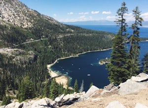
Backpack to Eagle Lake and Dick's Lake
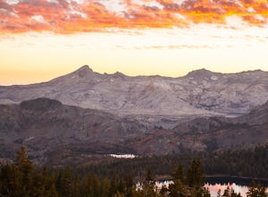
4.513 mi / 1500 ft gainGet ready to get your lake on! This backpacking trip will take you 13+ miles through awesome scenery to several alpine lakes.Starting at the Bayview Campground, off of HWY 89, this hike follows the Granite Lake Trail along a difficult climb. Don't let the climb discourage you! As you climb, the v...Read more -
South Lake Tahoe, California
Hike to Snow Lake in Desolation Wilderness
5.05 miThis wonderful alpine lake is a relatively short hike in Desolation Wilderness and is a perfect introduction to off trail exploration. This area lacks the crowds that other lakes in Desolation garner because most maps don't show the trail leading to the lake. Although there is a rough trail, the ...Read more -
South Lake Tahoe, California
Lower, Middle, and Upper Velma Lakes
3.010.14 mi / 2316 ft gainThe hike starts at Bayview Trailhead (Latitude: 38.938619 | Longitude: -120.14197). A wooden sign points right to "Desolation" and left to Cascade Falls. Follow the sign towards Desolation. The first 3/4 mile is comprised of switch-backs that lead to a high point with a spectacular view of Lake T...Read more -
South Lake Tahoe, California
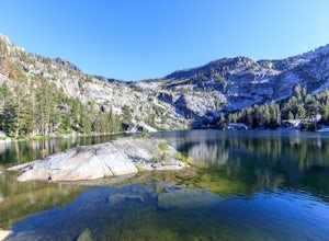
Swim in Granite Lake
5.01.25 mi / 900 ft gainGranite Lake is a pristine alpine lake near Lake Tahoe just off the Highway 89 above Emerald Bay. To get there park at the Bayview Campground Trailhead, which can be pretty crowded in peak season so get there early. The trail begins with an split: right takes you into the Desolation Wilderness (a...Read more -
Glenbrook, Nevada
Camp at Zephyr Cove
Zephyr Cove on the eastern shore of Lake Tahoe is a fantastic starting point for a host of water sports and outdoor activities, from wake surfing to backpacking to trail running on the Tahoe Rim Trail. The Zephyr Cove Resort campground has 47 walk-in campsites and 10 drive-in campsites in additio...Read more -
El Dorado County, California
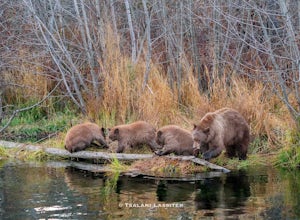
Photograph Black Bears at Taylor Creek, South Lake Tahoe
/ 30 ft gainLake Tahoe is a tourist attraction filled with spectacular views and a plethora of wildlife. However, one species in particular has made a lasting impression on both locals and tourists - black bears. The area around Lake Tahoe is prime bear habitat and cities in the vicinity are seeing a rising ...Read more -
South Lake Tahoe, California
Hike Mount Tallac
4.99.5 mi / 3255 ft gainThe classic 9½ mile out-and-back day hike to Mount Tallac begins at the trailhead on the southwestern side of Lake Tahoe, between Emerald Bay and Camp Richardson. When driving to the trailhead, make a turn inland at Mt. Tallac Road and follow the well-signed route to the reasonably sized parking ...Read more -
South Lake Tahoe, California
Hike the Fallen Leaf Lake Trail
5.08.1 mi / 859 ft gainThe Fallen Leaf Lake Trail is located in South Lake Tahoe, California. It is important to note that there is no trail on the east side of the lake. The trail turns into a paved road when you reach the marina after passing the campground. Additionally, lots of small trails jut out from the main tr...Read more -
Carson City, Nevada
Kings Canyon Falls
4.00.63 mi / 233 ft gain...Living in California, I know all about waterfalls! For me personally though, no matter the shape or size of the waterfall, it has my interest. Now when it comes to Nevada, I honestly can't think of too many waterfalls off the top of my head, but when you're passing through a town that you're u...Read more -
Reno, Nevada
Church's Pond via the Jones-Whites Creek Trail
4.06.49 mi / 2185 ft gainFor the first 0.6 miles the trail follows a peaceful creek, before upping the steepness as it ascends the mountain sides via multiple switchbacks. At 2.5 miles in, you reach a peak that allows you to see from Reno to Washoe City; a perfectly good place for sane people to enjoy and turn back. Howe...Read more -
Reno, Nevada
Jones Creek Loop
1.5 mi / 335 ft gainNestled in a forested area on the eastern slope of the Sierra Nevada, Galena Creek Regional Park is seven miles up the Mt. Rose Highway from the intersection with I-580. Galena Creek flows through the park creating separate north and south portions of the park, and the Jones Creek Loop is a great...Read more -
Reno, Nevada
Jones Whites Creek Loop
5.09.65 mi / 2405 ft gainStarting at about 6500 ft of elevation Jones Creek Trail is a 9.2 mi loop trail starting in Galena Creek Park. The park itself is very accessible off of Mt. Rose Highway, parking is free, and there is plenty of it during a typical weekend. When entering the park simply follow the signs that say "...Read more -
Stateline, Nevada
Hike the Lam Watah Trail
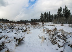
5.02.2 mi / 85 ft gainLam Watah Trail is a 2.2 mile out and back hike, that will take you through Lam Watah meadows and ends at Nevada Beach. I did the hike in December and although the best time to do it is May through October, I think it had more charm during the winter time. The trail head begins from the parking ...Read more -
Stateline, Nevada
Stroll through Rabe Meadows
1.5 miRabe Meadows is a tranquil and peaceful stroll next to Burke Creek as it flows to Lake Tahoe and Nevada Beach State Park. Very easy 1.5 mile paved trail. Perfect when there isn't any snow and a short easy hike is in need. Take in the scenery and peacefulness and be happy to be outside.Read more -
Zephyr Cove, Nevada
Castle Rock Loop
5.02.84 mi / 630 ft gainThis hike is located near Stateline, Nevada. The trail joins the Tahoe Rim Trail for part of the hike. Be aware that there will be snow on the trail from November - late May, early June depending on snowfall. Bring snowshoes / appropriate boots if you wish to use the trail in the winter. Experien...Read more -
Kyburz, California
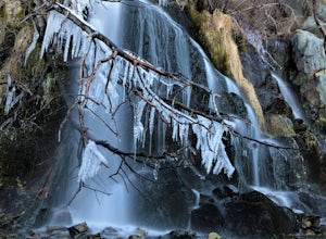
Hike to Bassi Falls
4.61.22 mi / 194 ft gain109' tall Bassi Falls is located in the Crystal Basin area of the El Dorado National Forest. These gorgeous falls at peak Springtime flow crash over enormous boulders and the water sheets over huge, flat slabs of granite. It is located off a rural, pot-holed dirt road (high clearance vehicles re...Read more

