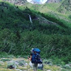
Castle Rock Loop
Zephyr Cove, Nevada
Details
Distance
2.84 miles
Elevation Gain
630 ft
Route Type
Loop
Description
Added by The Outbound Collective
The Castle Rock Loop is a trail in Toiyabe National Forest that offers beautiful views of Lake Tahoe and the surrounding forests. The trail is approximately 2.8 miles long, and is great for beginner - intermediate hikers. In the spring and summer months, there is an abundance of wildflowers along the trail.
This hike is located near Stateline, Nevada. The trail joins the Tahoe Rim Trail for part of the hike. Be aware that there will be snow on the trail from November - late May, early June depending on snowfall. Bring snowshoes / appropriate boots if you wish to use the trail in the winter. Experienced rock climbers can reach the top of Castle Rock.
Download the Outbound mobile app
Find adventures and camping on the go, share photos, use GPX tracks, and download maps for offline use.
Get the appFeatures
Castle Rock Loop Reviews
It you want to get to the top of the rock get ready to do some rock climbing. You will also have to do some scrambling once you get to the base.
5.0
Leave No Trace
Always practice Leave No Trace ethics on your adventures and follow local regulations. Please explore responsibly!
Nearby
Castle Rock via Tahoe Rim Trail
Stroll through Rabe Meadows
Hike the Lam Watah Trail
Photograph Zephyr Cove at Sunset
Explore Emerald Bay by Boat from Zephyr Cove
Kayak Zephyr Cove
Community
© 2024 The Outbound Collective - Terms of Use - Privacy Policy


