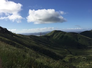
Novato, California
The best Trails and Outdoor Activities in Novato, California, offer top outdoor adventures. The Indian Tree Preserve is a must-visit for hikers, renowned for its scenic views and diverse vegetation. This 6.5-mile loop trail is moderately difficult, with an elevation gain of 1,200 feet. The trail features a stunning array of native plants and wildlife, with a creek crossing adding to its allure. For those interested in bird watching, the Rush Creek Open Space Preserve is a prime location. The flat terrain and wetlands attract a variety of bird species. The Stafford Lake Park, set against the backdrop of Mount Burdell, offers fishing, picnicking, and disc golf. For rock climbing, Ring Mountain is the place to be, known for its unique rock formations and panoramic views of the bay. These attractions make Novato a top spot for outdoor activities.
Top Spots in and near Novato
-
Point Reyes Station, California
Sky Campground via Sky Trail
2.66 mi / 495 ft gainEntering Point Reyes National Seashore from Bear Valley Road the Sky Trailhead is a 4.9 mile drive. Camping in Sky Camp requires a Camping Permit. Once at the Sky Trailhead parking lot. The Sky Trailhead will be on the left side pulling in. The hike is not very strenuous and not all that lo...Read more -
Inverness, California
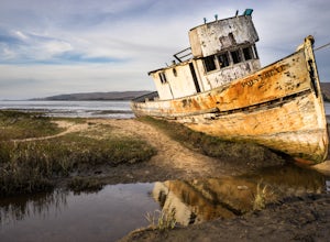
Explore the S.S. Point Reyes Shipwreck
3.9Explore the shipwreck of the S.S. Point Reyes, perched on a sand bar off the shoreline of Tomales Bay. It is located in the small town of Inverness, just behind the grocery store. If you are driving North on Sir Francis Drake Blvd it will be on your right side. Parking is easy and you will see a ...Read more -
Bolinas, California
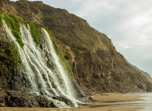
Alamere Falls via Palomarin Trailhead
4.513.54 mi / 1614 ft gainAlamere Falls is the tallest waterfall in the bay area. It is known as a tide fall because it empties directly into the Pacific Ocean. This is extremely unique because there are only 34 tide falls in the world and two in California, the other being McWay Falls in Big Sur. Enjoy stunning views of...Read more -
Bolinas, California
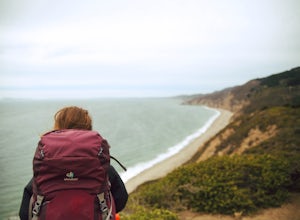
Point Reyes' Wildcat Camp via Coast Trail
5.011.19 mi / 1926 ft gainIn order to make this trip possible, go to recreation.gov and make a reservation for Wildcat Camp (available year-round). On your way to the trailhead, make sure to stop by the Bear Valley Visitor Center to grab your camping permit. For more information, visit: http://www.nps.gov/pore/planyourvis...Read more -
Bolinas, California
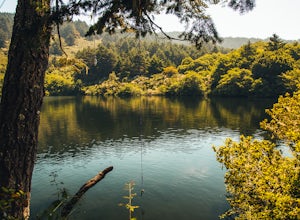
Bass Lake via Palomarin Trailhead
4.26.11 miFollow the Coast Trail from Palomarin Trailhead to Bass Lake. It's a fairly easy ~2.5-3 miles to the Lake. As soon as you pass the lake, on the left you will see a narrow unmarked dirt trail. Take this trail and you'll get to a nice clearing with easy lake access (this will be a great spot for lu...Read more -
Bolinas, California
Glen Camp Loop via the Palomarin Trailhead
4.715.72 mi / 3091 ft gainDay 1 Before heading to the trailhead, make sure to stop by the Bear Valley Visitor Center to pick up your permit. To stay overnight in Point Reyes, you must stay at one of the trail camps. Camping anywhere else in the park is not allowed. Permits for the trail camps can be booked up to 6 mo...Read more -
Bolinas, California
Backpack to Coast Camp in Point Reyes via Palomarin Trailhead
20.5 mi / 2705 ft gainSpanning from just north of the small town of Bolinas (about an hour north of San Francisco) across Inverness ridge and to the top of Tomales Point, Point Reyes National Seashore is as stunning park featuring breathtaking ocean views and solitude among the grassy hillsides and forested ridges. Th...Read more -
Stinson Beach, California
Rock Climbing Mickey's Beach
3.5Mickey's Beach is a great spot for experienced climbers to challenge themselves. The west face of the main rock is home to some local favorites like Sex Porpoises (12c), named for the apparently promiscuous local marine life. There are only a couple routes rated as 5.10s, the rest are mostly 5.12...Read more -
Stinson Beach, California
Rock Climbing The Egg
5.0Once you've seen The Egg, you'll understand where it gets its name. This giant, egg shaped boulder near Stinson Beach provides about a dozen routes ranging from 5.6-5.12c. There is no trad climbing, only top rope and sport.You'll find all the easier slab routes on the eastern face. These are perf...Read more -
Stinson Beach, California
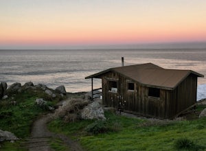
Steep Ravine Cabins
5.0Although these cabins are bare bones, lacking both water and electricity, they couldn't put you in a better spot for views of the Pacific Ocean. From your cabin, you can enjoy amazing sunsets, possibly whale watching, and access to trails like the cabin's namesake, Steep Ravine Trail. The cabins...Read more -
Stinson Beach, California
Steep Ravine Environmental Campground
5.0Gain access through a private locked gate, and descend about 1 mile down to the bluff's edge. There is only parking for 1 car per site and also several cabins that can be rented. A camp host is on site and there are bathrooms and water spigots throughout the campground. Each site has a fire ring...Read more -
Inverness, California
Kayak Camping in Point Reyes
4.9Like camping in remote locations? Love oysters? This is it! Tomales Bay offers boat-in only campgrounds along the east side of the peninsula. We departed from Chicken Ranch Beach, which is on the west side of Tomales Bay. We jumped in our kayaks and headed north in the bay for a quick breather at...Read more -
Point Reyes Station, California
Coast Campground via Laguna Trailhead
4.34.02 mi / 633 ft gainThis campground is the closest you can get to staying overnight on Pt. Reyes coastline if you're backpacking in. Once you get there, enjoy the view! The easiest way to get to the camp is from the slightly uphill hike along the Laguna Trail and the Firelane Trail. The trailhead for the Laguna Tra...Read more -
Point Reyes Station, California
Hike the Laguna Trail & Coast Trail Loop
5.05.2 mi / 300 ft gainLeave your car on a side of the road. When navigating there, put "HI Hostel Point Reyes" in your navigation - you park literally on the other side of the road, opposite to the hostel. Go to the west and soon you'll find the start of Coast Trail with a tsunami warning sign. During first 1.8 mile y...Read more -
Mill Valley, California
Oakwood Trail, Marin Headlands
5.02.56 mi / 538 ft gainLooking to escape the hustle of San Francisco, but don't want to commit to an entire day on the trail? When setting out for this morning hike, be prepared for about 1.5 hour hiking adventure (longer if you stop for extra photos) and a 20 minute commute from San Francisco. This hike is recomend...Read more -
Santa Rosa, California
Hike Crane Creek Regional Park
4.03.5 miWith multiple loops of varying length, this park is great for anyone looking for a casual hike around a beautiful area in the foothills of Rohnert Park. Crane Creek has nice secluded picnic areas next to the creek in the cover of willow, alder, buckeye and bay trees. There's also an 18-hole disc ...Read more


