Marshall, California
Looking for the best photography in Marshall? We've got you covered with the top trails, trips, hiking, backpacking, camping and more around Marshall. The detailed guides, photos, and reviews are all submitted by the Outbound community.
Top Photography Spots in and near Marshall
-
Occidental, California
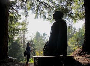
LandPaths Grove of Old Trees
5.00.7 mi / 92 ft gainThe Grove of Old trees is a privately-owned preserve in Western Sonoma County that is open to the public year round. It is not large, only about 33 acres, but it makes a wonderful spot to go on a walk and to soak in the beauty of the redwoods. To get there from downtown Occidental, drive West up...Read more -
Novato, California
Buck Gulch Falls Trail
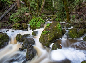
5.01.26 mi / 203 ft gainBuck Gulch Falls (also known as Fairway Falls) is an easy, scenic hike that takes you through a beautiful forest on your way to a 15-foot waterfall. This little neighborhood treasure is tucked away in Novato, CA at the end of Fairway Drive and there is ample parking near the trailhead. If you v...Read more -
Bolinas, California
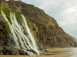
Alamere Falls via Palomarin Trailhead
4.513.54 mi / 1614 ft gainAlamere Falls is the tallest waterfall in the bay area. It is known as a tide fall because it empties directly into the Pacific Ocean. This is extremely unique because there are only 34 tide falls in the world and two in California, the other being McWay Falls in Big Sur. Enjoy stunning views of...Read more -
Bolinas, California
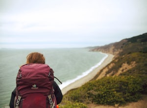
Point Reyes' Wildcat Camp via Coast Trail
5.011.19 mi / 1926 ft gainIn order to make this trip possible, go to recreation.gov and make a reservation for Wildcat Camp (available year-round). On your way to the trailhead, make sure to stop by the Bear Valley Visitor Center to grab your camping permit. For more information, visit: http://www.nps.gov/pore/planyourvis...Read more -
Bolinas, California
Glen Camp Loop via the Palomarin Trailhead
4.715.72 mi / 3091 ft gainDay 1 Before heading to the trailhead, make sure to stop by the Bear Valley Visitor Center to pick up your permit. To stay overnight in Point Reyes, you must stay at one of the trail camps. Camping anywhere else in the park is not allowed. Permits for the trail camps can be booked up to 6 mo...Read more -
Bolinas, California
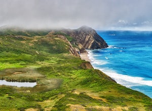
Backpack to Coast Camp in Point Reyes via Palomarin Trailhead
20.5 mi / 2705 ft gainSpanning from just north of the small town of Bolinas (about an hour north of San Francisco) across Inverness ridge and to the top of Tomales Point, Point Reyes National Seashore is as stunning park featuring breathtaking ocean views and solitude among the grassy hillsides and forested ridges. Th...Read more -
Fairfax, California
Carson Falls
4.03.75 mi / 863 ft gainAre you tired of crowds on your hikes? First, shame on you for getting up so late and moving so slowly. Did you really need Philz before you got on the trail? Ok, now that you’ve been thoroughly chastised, let’s start planning a hike to the less-frequented Carson Falls. Like any of the falls in ...Read more -
Bodega Bay, California
Camp at Wright's Beach Campground
/ 32 ft gainThis campground is defined by the scenery: rugged headlands, craggy coastlines, natural arches, and quiet coves.Wright's Beach Campground features primitive camping - basic tent sites with picnic tables, fire rings, and amazing ocean views. This is a great location for Bay Area campers who want t...Read more -
Sonoma County, California
Kortum Trail
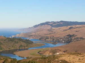
9.27 mi / 968 ft gainThe Kortum Trail in the Sonoma Coast State Park connects Goat Rock with Wrights Beach, winding along the top of the sea cliffs and affording incredible views of the California Coast and its numerous sea rocks and arches. To get there take the Pacific Coast Highway / Highway 1 to either Wright's...Read more -
Stinson Beach, California
Cataract Falls
4.22.81 mi / 1184 ft gainThe Bay Area is home to many beautiful waterfalls, but Cataract Falls located about an hour north of San Francisco is one of the most stunning. Be sure to head out on this hike after a recent rain. Cataract Falls is a picturesque waterfall located in the Mt. Tamalpais Watershed near Stinson Be...Read more -
Sonoma County, California
Red Hill and Pomo Canyon Loop
4.84.73 mi / 981 ft gainPark in the Shell Beach parking lot, north of Bodega Bay proper but just south of Goat Rock State Beach on Highway 1. Cross the road to pick up the Dr. David C. Joseph Memorial Trail heading up away from the ocean. Follow the trail, staying right toward Red Hill. (The trail forks off down Pomo Ca...Read more -
Glen Ellen, California
Wolf House in Jack London SP
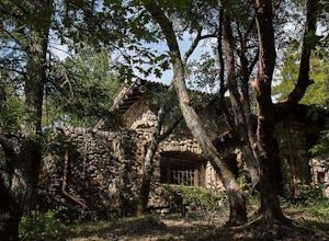
There is a museum in "The House of Happy Walls" which Mrs. London built in redwood grove find park information, exhibits and a small sales area there. A nearby trail leads to Jack London’s grave and to the remains of "Wolf House," London’s dream house which was destroyed by fire in 1913. The par...Read more -
Jenner, California
Bouldering at Lamb's Rock, Sunset Boulders
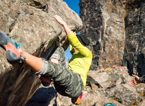
5.0Lamb Boulder, located within the "Sunset Boulders" collection, contains four fun and challenging V2 - V6 bouldering routes. They are: Calambity: V6Rock Scar: V3+Skullcracker: V2 RThe Specialist: V4 Lamb Boulder is located directly across from the Sunset Boulder itself and its trad routes. To get ...Read more -
Stinson Beach, California
Cruising Pacific Coast Highway in Northern California
4.8Start your drive on US Highway 1 aka Pacific Coast Highway just North of San Francisco. The drive will take about 1 -2 days so plan on overnighting somewhere. Hotels are scarce in the unpopulated areas but there all lots of Cabin rentals throughout and several campgrounds around. Just make sure y...Read more -
Stinson Beach, California
Matt Davis-Steep Ravine Loop
4.76.62 mi / 1726 ft gainThis loop is made up of three of the most popular Marin trails and for good reason. These trails offer not only expansive ocean views, but a variety of topography and environments. This 6+ mile loop offers up waterfalls, dense forests, redwoods, and open grasslands overlooking the pacific. Starti...Read more -
Stinson Beach, California
Cataract Trail Loop
4.58.7 mi / 1670 ft gainDuration: 3.5-4 hour hike at a moderate to quick pace with a short break for lunch. Starting at an elevation of 1989ft and maxing at 2001ft, you achieve 1428 of elevation gain through a beautiful peak and valley hike. From the free Rock Springs Parking Area, the basic trailheads to follow along...Read more

