Maricopa, California
Maricopa, California offers some of the best outdoor activities and attractions in the area. From scenic trails and nature walks to must-visit outdoor adventures, there is something for everyone. Whether you are looking for a peaceful hike through the woods or an exciting kayaking trip down the river, Maricopa has something for everyone. Popular attractions include the Maricopa Trail, the Maricopa Nature Center, and the Maricopa Wildlife Refuge. There are also plenty of other trails, parks, and outdoor activities to explore. No matter what type of outdoor activity you are looking for, Maricopa has something to offer. If you are looking for the best trails and outdoor activities in the area, Maricopa is the perfect destination.
Top Spots in and near Maricopa
-
Ojai, California
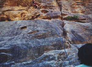
Rock Climb at Foothill Crag
2 miFrom downtown Ojai, head north on N Signal Street. Head up the hill and turn left onto a gravel road next to a chainlink fence once you get to the top.(There should be a sign that points to "Pratt/Foothill Trailhead.") Continue past a water tank on the right to a trailhead parking area. I've gon...Read more -
Santa Barbara, California
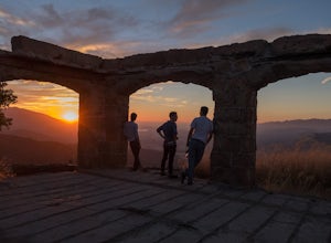
Hike to Knapp's Castle
4.20.8 miOne of the many hidden gems near Santa Barbara, Knapp's Castle is an abandoned home built in 1916 by George Knapp. Finding the trailhead can be difficult because it's not clearly marked and the road it's starts from is long, winding and narrow. Coming from the 154, turn right on East Camino Cielo...Read more -
Montecito, California
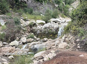
Tangerine Falls
4.51.15 mi / 886 ft gainThis waterfall can be fairly dry during the year, so keep your eyes out for a recent rainstorm to get things going. When you start the hike on East Folk Trail, at 0.25 miles, cross over the creek and join West Fork Trail. A little over another half mile, West Fork starts to head uphill, but you c...Read more -
Montecito, California
West Fork of Cold Spring Trail
3.45 mi / 1135 ft gainIf you love the mountains above Santa Barbara but hate the crowds, stick to the canyon trails on the east side. The trails running up Cold Spring canyon offer a variety of experiences without all the noise. To find the West Fork of Cold Spring Trail, take the Olive Mill Rd. exit from the 101 fre...Read more -
Montecito, California
Cold Spring Trail Loop
5.02.67 mi / 883 ft gainCold Spring Trail Loop is a loop trail that takes you by a river located near Santa Barbara, California.Read more -
Montecito, California
Saddle Rock Loop
4.03.37 mi / 984 ft gainBegin at the trailhead in the parking area on E. Valley Road. You'll gain some elevation (don't forget your water). You'll know when you arrive at Saddle Rock--you can't miss this conspicuous rock formation. Enjoy the sights from here. If you plan carefully and hike up on a clear day, you may eve...Read more -
Ojai, California
Camp at Dennison Park in Ojai Valley
Great little campsite very close to the town of Ojai. My discovery of this gem was totally coincidental. I was trying to book a hotel room in Ojai; however, that particular weekend all the rooms that were within my budget were sold out. Instead of giving up, I looked for alternative options and ...Read more -
Santa Barbara, California
La Cumbre Peak via Tunnel Trail
9.96 mi / 3310 ft gainTunnel Trail is a great way to get to the top of La Cumbre Peak. You get to the trailhead by taking Tunnel Road until it dead ends at a large water tower, there you can park your car and start on foot. You take Spyglass Ridge Road up which is a paved fire road until it becomes dirt when you get o...Read more -
Santa Barbara, California
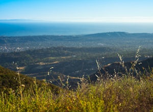
Inspiration Point
4.03.82 mi / 1109 ft gainHike up the 3.5 mile trail to an unbeatable vista that will leave you smiling! This hike has a steady uphill climb from the trailhead off of Tunnel Rd into Los Padres National Forest. Keep in mind this trail can get pretty crowded on weekends, so you're best to be at the trail early in the mornin...Read more -
Santa Barbara, California
Camp at Lake Cachuma
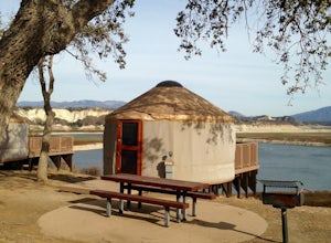
The campground here is extremely well developed and tightly run (for better or worse). The sites afford very little privacy: I recommend looking for the "Prime" campsites along the bluff, or choosing a weekday. If you can afford to spend a little extra, the park offers yurt rentals, which have th...Read more -
Carpinteria, California
Camp at Carpinteria State Beach
3.7There are 2 campgrounds close to Rincón, but Carpinteria State Beach is a little bigger and easier to find a spot. There are 4 campgrounds: Santa Cruz, Anacapa, San Miguel and Santa Rosa. Most of them are RV sites, but if you stay at Santa Cruz Campground you can set your tent right at the beach,...Read more -
Santa Paula, California
Santa Paula Punch Bowls
3.66.5 mi / 1037 ft gainThis is a 6.5 mile trail, out and back. Parking is available along Ojai St, and the trail starts at the entrance of Thomas Aquinas College. Follow the paved road that goes around the school, until you reach a fork on the road, then stay right. The trail will take you through Ferndale Ranch, just ...Read more -
Ventura, California
Bike the Sulphur Mountain Loop
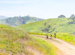
28.6 mi / 2884 ft gainThe Sulphur Mountain Loop is a 28 mile cycling and mountain biking loop that begins in Ventura Canyon at the Sulphur Mountain Trailhead and loops through Ojai Valley. Beginning at the Sulphur Mountain Road trailhead off Highway 33, follow the road up and over Sulphur Mountain and down until it co...Read more -
Rincon Point, California
Surf Rincon Point
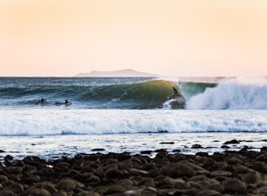
5.0A cobblestone rocks cover a crescent shaped bay and a creek mouth spreads sand perfectly along the bay after a winter rain. Not to mention the indicator that refracts waves into the inside cove. It's no wonder famous surfers, such as Kelly Slater, Bobby Martinez, Tom Curren, Connor and Parker Cof...Read more -
Lake Hughes, California
Hike the Pacific Crest Trail from Horse Trail to Bear Campground
11.63 mi / 2396 ft gainThis is part of the Pacific Crest Trail. If you're through-hiking or sectional hiking, you'll have to hit it eventually. Try and avoid it in the late summer or early fall because of heat, and gnats. Find a way to check the bug report, we got marauded by gnats 90% of the way (early October) and ap...Read more -
Castaic, California
Hiking the Piru Creek Gorge Trail
Take the I-5 exit North of Castaic, CA at Templin Hwy. Turn onto Golden State Hwy heading the only direction it goes from the exit, North. When it dead-ends in a few miles at the National Forest Gate, you are at Frenchman's Flat.You can camp here, or hang with the day hikers. Heading North along ...Read more

