Lytle Creek, California
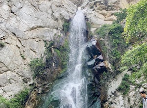
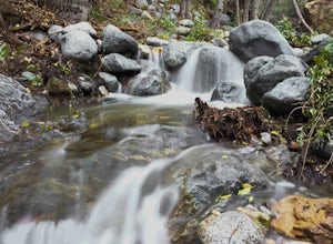
Lytle Creek, California is a top destination for outdoor adventures. It offers some of the best trails and outdoor activities in the region. The Middle Fork Lytle Creek Trail is a must-visit for hikers. This 6.4-mile trail is moderately difficult, with scenic views of the creek, waterfalls, and diverse vegetation. For a more challenging hike, the Cucamonga Peak via Icehouse Canyon is a 10.5-mile trail with stunning views of rock formations and a river. Nearby, the Bonita Falls Trail is a 1.5-mile trail leading to one of the tallest waterfalls in Southern California. It's a great spot for picnics and bird-watching. In addition to hiking, Lytle Creek is also known for its fishing spots, notably in the Lytle Creek North Fork.
Top Spots in and near Lytle Creek
-
Arcadia, California
Sturtevant Falls
4.61.61 mi / 423 ft gainThis trail is currently closed. Visit the Forest Service website for updates. As you head down to Roberts Camp, a historic set of historic cabins, you’ll head out on a steep, paved road for approximately 0.6 miles. Once you reach the camp, head over the bridge and keep an eye out for the sign f...Read more -
Arcadia, California
Mt. Wilson Loop from Chantry Flat
5.012.74 mi / 4852 ft gainMt. Wilson is one of the more difficult mountains in the San Gabriel to hike, making this adventure Intermediate. While 5,700 feet doesn't seem that tall, the mountain has a prominence of almost 5,300 feet, meaning that hike is steeper and longer than some of the other popular mountains that star...Read more -
Fawnskin, California
Castle Rock Trail at Big Bear Lake
4.52.7 mi / 719 ft gainFollow the directions to the trail head, and park on the side of the road. You will see a sign that says Castle Rock Trail, and the path is directly behind that sign. The hike up to the peak is steep, sandy, and very rocky, so shoes with good traction is recommended. There are also lots of oak a...Read more -
Forest Falls, California
Summit Mt. San Bernardino from Angelus Oaks
16 mi / 4775 ft gainThe trailhead is somewhat 'interesting' to get to given the dirt roads are in questionable shape and some of the roads in Angelus Oaks are not easily identifiable but I didn't have any problems finding it by closely following Google Maps. Trailhead parking requires an Adventure Pass parking pe...Read more -
Angelus Oaks, California
San Bernardino Peak
3.015.82 mi / 4911 ft gainThe San Bernadino Peak Trail out of Angelus Oaks is a very challenging hike, which can either be done as a day hike or an overnight trip. Free permits are required for day hiking and overnights in the San Gorgonio Wilderness. These permits can be accessed via Sgwa.org/permits. If you choose to ...Read more -
Fawnskin, California
Grays Peak Trail
1.06.95 mi / 1293 ft gainThis is a fairly easy mountain peak to climb. The trailhead is easily accessible right off of Hwy 38 by the town of Fawnskin. There is a large National Forest sign noting the parking area to Grays Peak Trail. Note that parking in this lot requires either a day pass or a California Adventure pa...Read more -
Anaheim, California
Oak Canyon Bluebird and Wren Trail
1.42 mi / 187 ft gainThe Oak Canyon Bluebird and Wren Trail features beautiful wildflowers and is accessible year-round. The trail is well kept and offers lots of shady spots. The first portion of this hike will take you up a hill, and then to a fork. One direction will take you around a reservoir and another will ta...Read more -
Big Bear Lake, California
Grand View Point
6.9 mi / 1312 ft gainGrand View Point is accessed via Pine Knot Trail, a 6.5 mile out and back hiking trail located at the Aspen Glen Picnic Area, 1 mile from Big Bear Village. With its close proximity to town, Pine Knot Trail is popular in the summer with mountain bikers and the trailhead is often crowded in the win...Read more -
Big Bear, California
Cougar Crest Trail
5.05.57 mi / 892 ft gainOn the north side of Big Bear Lake, just off the 38, you will find a turn off for the Cougar Crest Trail. The parking lot is well marked, and signs for the trailhead are easy to spot. Parking is not an issue if you come in later in the afternoon, but the hike can get crowded during peak hours. Fo...Read more -
Big Bear Lake, California
Knickerbocker Road & Pine Knot Trail
5.06.1 mi / 1007 ft gainPark at the free parking lot behind the village off Knickerbocker Rd between Village Drive and Pedder Road. Ride up Knickerbocker Rd towards the mountain. Look out for the fire service road 2N08 that veers left and uphill. The first 2 miles are challenging steep uphill, but beautiful nonetheless....Read more -
Los Angeles County, California
San Gabriel Peak
4.02.79 mi / 1040 ft gainAt 6,000 feet, San Gabriel Peak gives you one of the best views of the Los Angeles basin on the front range of the San Gabriel Mountains National Monument. As you pass through Muller Tunnel, the trail will be littered with rocks and boulders. A little over 100 feet in, the road will fork in thre...Read more -
Los Angeles County, California
Idlehour Trail
4.014.89 mi / 4665 ft gainIdlehour Trail located near Mount Wilson, California, is an out-and-back trail that is strenuous and can take 8-10 hours if done all at once. There are opportunities to camp off the trail, making this a backpacking trail in the Angeles National Forest as well. To access the Idlehour Campground ...Read more -
Los Angeles County, California
Mt. Disappointment via Billy Riley Trail
3.5 mi / 1132 ft gainFrom the 210 Freeway in La Cañada, take California Highway 2 north 14 miles up into the San Gabriel Mountains. Make sure you have your National Forest Pass (sold at REI or Ranger Station) or your Interagency Pass because they have started checking parked vehicles. At the Red Box Picnic area, make...Read more -
Pasadena, California
Eaton Canyon Falls via Eaton Canyon Trailhead
4.23.54 mi / 528 ft gainThe hidden forty-foot-tall Eaton Canyon Falls fills an amphitheater at the top of Eaton Canyon Trail, tumbling into a wide pool that you can rest alongside or wade in. Normally the water is waist deep, but during this recent trip, we found the water only to stop at our ankles as it tends to fluct...Read more -
Altadena, California
Eaton Canyon to Idlehour Trail Camp
4.510.99 mi / 3291 ft gainIdlehour is nestled deep in the Angeles National Forest, so it feels like you're in the heart of some untapped wilderness instead of six miles away from a bustling metropolis. The trail camp is accessible by foot through a variety of locations, but the most popular route is through Eaton Canyon, ...Read more -
Big Bear, California
Holcomb Valley Campground
This campground is awesome! With great views, plenty of space and clean bathrooms it'll have you in for a treat! Whether it be a multiple day trip or just one night this campground is awesome. Read below for information if you are looking for a trip in the mountains! Cost: This campground is a ...Read more

