Los Angeles County, California
Looking for the best mountain biking in Los Angeles County? We've got you covered with the top trails, trips, hiking, backpacking, camping and more around Los Angeles County. The detailed guides, photos, and reviews are all submitted by the Outbound community.
Top Mountain Biking Spots in and near Los Angeles County
-
Laguna Beach, California
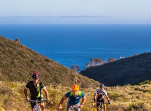
Emerald Canyon & Bommer Ridge Loop
5 mi / 873 ft gainThere a numerous trails in the Laguna Coast Wilderness that proceed up and along the ridges and down into the canyons (or the reverse), and are quite popular for mountain biking, hiking, and trail running. A great mountain biking loop begins in Emerald Canyon at the end of Emerald Canyon Road an...Read more -
Laguna Beach, California
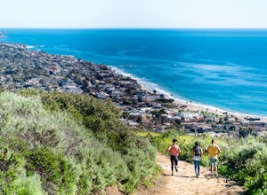
Trail Run the Boat Road and Laguna Ridge
4.34 mi / 600 ft gainThere a numerous trails in the Laguna Coast Wilderness that proceed up and along the ridges and down into the canyons (or the reverse), and most are excellent for trail running, hiking, and mountain biking. A classic out-and-back (with many options for loops) begins at the end of Dartmoor Street ...Read more -
Laguna Beach, California
Water Tank Trail
4.33.05 mi / 502 ft gainThere a numerous trails in the Laguna Coast Wilderness that proceed up and along the ridges and down into the canyons (or the reverse), and most are excellent for hiking, trail running, and mountain biking. A classic out-and-back (with many options for loops) begins in Irvine Bowl Park at the en...Read more -
Burbank, California
Old Youth Camp Loop
2.59 mi / 732 ft gainThe Old Youth Camp Loop is a 2.6-mile loop with over 700 feet of elevation gain that can be ran, hiked, or even mountain biked if you prefer. While not completely empty the area receives very little visitors and is a great place to enjoy a little more solitude than near by hiking locations. The l...Read more -
Arcadia, California
Mt. Wilson Loop from Chantry Flat
5.012.74 mi / 4852 ft gainMt. Wilson is one of the more difficult mountains in the San Gabriel to hike, making this adventure Intermediate. While 5,700 feet doesn't seem that tall, the mountain has a prominence of almost 5,300 feet, meaning that hike is steeper and longer than some of the other popular mountains that star...Read more -
Aliso Viejo, California
Top of the World via West Ridge Trail
5.04.76 mi / 443 ft gainDirections to get here are pretty straight forward via the map. You park your car in a residential neighborhood along the street, and from there, you can't miss the entrance. The trail is paved for the first 100yds or so and after you make a right turn at the top, you'll be on dirt and sand the r...Read more -
Topanga, California
Eagle Rock in Topanga State Park
4.45.99 mi / 1106 ft gainEagle Rock is located in Topanga State Park in the Santa Monica Mountains, and it is a unique formation that provides an amazing panoramic view of Santa Monica. On a clear day, the Catalina Islands and Palos Verdes Peninsula are visible. You can park on along the street of Entrada Rd. or pay $10 ...Read more -
Topanga, California
Parker Mesa Overlook via Trippet Ranch
4.06.75 mi / 1181 ft gainThis is a 6.8 mile round-trip hike that starts at Trippet Ranch in Topanga Canyon. Even though the range in elevation is 400 feet from peak to trough, the up and down trail totals to approximately 1800 feet elevation gain making this a beginner to intermediate adventure. The trail itself is pre...Read more -
Los Angeles County, California
Bikepack Catalina Island
5.043.5 mi / 5700 ft gainThis is a great introductory overnight bikepacking adventure. With restaurants, water, and stores at each end of the ride, your packing list is minimal. Head out on Saturday morning and make it back in time for dinner on Sunday evening. Packing List Your Bike – I did this ride on my drop bar grav...Read more -
Laguna Beach, California
Hike the West Ridge Trail
5.01.5 mi / 150 ft gainBeginning at Alta Laguna Park at Top of the World, the West Ridge Trail is a popular starting (and ending) point for adventures into the Laguna Coast Wilderness, leading to trails and areas like Car Wreck, Big Bend, and Willow Canyon. You can also do it in reverse from the north. The ridge itself...Read more -
Laguna Beach, California
West Ridge to Car Wreck Trail and Mathis Canyon Loop
4.53.31 mi / 856 ft gainThere are numerous ways to incorporate the Car Wreck trail into a larger loop through the Laguna Coast Wilderness and Aliso Canyon Park, but a common route is to begin at Alta Laguna Park at "Top of the World" in Laguna Beach. Take the West Ridge Trail .5 miles, bearing right onto the marked Car...Read more -
Los Angeles, California
Verdugo's North Ridge Trail
12.7 mi / 2684 ft gainThe Verdugo Mountain Range is a small, rugged range spanning across the northeast end of the San Fernando Valley from Sun Valley to Glendale. With close to 50 miles of graded and well-maintained trails, the Verdugos are surprisingly underutilized and make a great place for someone looking to esca...Read more -
Los Angeles, California
Verdugo Mountain Traverse
5.012.13 mi / 0 ft gainThe Verdugo Mountain Range is a small, rugged range spanning across the northeast end of the San Fernando Valley from Sun Valley to Glendale. With close to 50 miles of graded and well-maintained trails, the Verdugos are surprisingly underutilized and make a great place for someone looking to esca...Read more -
Los Angeles, California
Verdugo Peak via Hostetter Fire Road
5.07.39 mi / 1627 ft gainVerdugo Peak, at 3000 feet, is accessible from multiple directions and trails along the Verdugo Range. The most direct route to the top is Hostetter Fire Road, a 3.6-mile hard-packed dirt trail that climbs 1600 feet to the 3,126-foot summit. The hike begins at the dirt parking lot off of La Tuna ...Read more -
Los Angeles County, California
Idlehour Trail
4.014.89 mi / 4665 ft gainIdlehour Trail located near Mount Wilson, California, is an out-and-back trail that is strenuous and can take 8-10 hours if done all at once. There are opportunities to camp off the trail, making this a backpacking trail in the Angeles National Forest as well. To access the Idlehour Campground ...Read more -
Laguna Niguel, California
Dripping Cave in the Aliso & Wood Canyons Wilderness
4.47.68 mi / 889 ft gainDripping Cave sits tucked away in a corner of Wood Canyon, part of the Aliso and Wood Canyons Wilderness Park, and the trail to the cave, while short, requires *at least* a 2.25 mile hike in from the nearest trailhead (West Ridge Trail to Mathis Canyon), though this is less than ideal as that rou...Read more

