Long Barn, California
Looking for the best hiking in Long Barn? We've got you covered with the top trails, trips, hiking, backpacking, camping and more around Long Barn. The detailed guides, photos, and reviews are all submitted by the Outbound community.
Top Hiking Spots in and near Long Barn
-
YOSEMITE NATIONAL PARK, California
Dog Lake Loop
3.03.71 mi / 740 ft gainThis 3.7 mile roundtrip hike begins at the center of Tuolumne Meadows (shuttle stop #2) at the Lembert Dome/Glen Aulin trailhead parking lot. There are restrooms and picnic tables at the east side of the lot, there you will also find the trailhead to Dog Lake. The trail begins at 8,500 ft and c...Read more -
Mariposa County, California
Camp at Wawona in Yosemite National Park
Wawona offers over 90 campsites in 3 loops, including 1 group site, 2 horse sites, and RV/ camper access.Every loop has at least 1 bathroom with flush toilets, but keep in mind that there are no showers at this campground.Pets are allowed, but must be kept on leash at all times.Each campground co...Read more -
37.876736,-119.346085
Glen Aulin
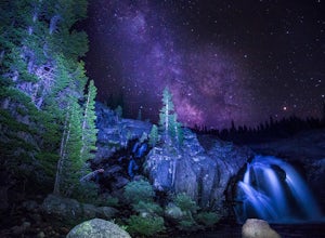
4.812.19 mi / 600 ft gainStart your hike to this waterfall oasis in the heart of the sierra at the parking lot for the Tuolumne Meadows Visitor Center. The Glen Aulin High Sierra Camp sits along the beautifully winding Tuolumne River. White Cascade an 80ft waterfall sits at the edge of camp and provides an excellent swim...Read more -
Bridgeport, California
Backpack to Green Lake and Virginia Pass
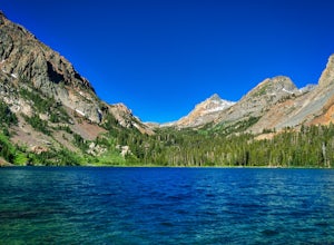
17 mi / 4452 ft gainDay 1 Green Creek Trailhead to Green Lake When we went on this hike, it was primarily to explore the area and see if it would be a feasible entrance to Northern Yosemite for extended backpacking trips. However, it also is a great two night trip to a lovely area of the Hoover Wilderness. Best...Read more -
Yosemite National Park, California
Buena Vista Lake via Chilnualna Falls Trailhead
24.64 mi / 5453 ft gainHiking and camping at Buena Vista Lake is a beautiful way to see the south side of Yosemite… the name says it all. With beautiful 360 degree views from Buena Vista Peak you get to look at the backside of Half Dome, up to Clouds Rest and all the domes and peaks in-between. You can reach the trail...Read more -
Yosemite National Park, California
Hike to the Top of Chilnualna Falls
4.39.2 mi / 2300 ft gainMany visitors to Yosemite head straight to the valley and don't often explore the other areas of the park. So if you are interested in staying away from the massive crowds and getting to enjoy the beauty of the park a little more quietly, the Wawona is a great option for a getaway. The Chilnualna...Read more -
Yosemite National Park, California
Backpack to Johnson Lake
24 mi / 4500 ft gainYour trek begins at the Chilnualna Falls trailhead in Wawona near the South Gate in Yosemite. The first suggestion I have is to check the weather in the area to make sure you won't be slowed down by rain or snow. It's about 12 miles from the trailhead to the lake and if you are a swift hiker and ...Read more -
Yosemite National Park, California
Backpack to Crescent Lake
20 mi / 4100 ft gainCrescent Lake is another beautiful spot a long the Beuna Vista loop. Starting at the Chilnualna Trailhead in Wawona, you start your journey climbing about 4.6 miles and 2,300 feet to the top of Chilnualna Falls (always a good place to rest). Beyond the falls, continue a long the trail and always ...Read more -
Wawona, California
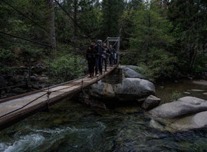
Wawona Swinging Bridge Trail
1.29 mi / 121 ft gainThe hike to the Wawona Swinging Bridge is a 0.7 mile dirt path. Start at the trailhead located next to the parking lot. The hike is surrounded by many trees which offers a lot of shade. For the first couple of minutes the trail is fairly straight. You then begin to hike down for just a minute or ...Read more -
Bridgeport, California
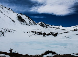
Snowshoe to Cooney Lake
3.5 miWhen it's winter time, one of the best things you can do is experience the snow in the Eastern Sierra! If you've ever been hiking and/or backpacking in the Sierra, you know it's one of the most beautiful mountainous ranges in the US. Driving up the Hwy 395 North past Conway Summit, turn left on ...Read more -
Bridgeport, California
Virginia Lakes Trail
4.09.22 mi / 2464 ft gainIf you are looking for a hike with a view every half mile or so, then Virginia Lakes Trail is one to mark on your must-see list. You start at the parking lot near the first lake where bathrooms are available onsite. Try to hike right before the first snow in November so you can see the fall col...Read more -
Lee Vining, California
Backpack Virginia Lakes to Green Creek
10.5 mi / 1234 ft gainKeep in mind that this is a point to point hike, so you will need to park a vehicle at Green Creek trailhead in Bridgeport as well as your start point at Virginia Lakes Resort.Starting at 9,886' at The Virginia Lakes Trailhead, you will begin by heading Northwest towards Virginia Pass. During yo...Read more -
Lee Vining, California
Hike to the Waterfalls of Lundy Canyon
3 mi / 200 ft gainIn order to get to the trail you first have to drive past the beautiful Lundy Lake nestled in deep canyon. When the pavement ends continue for a couple miles as the scenery gets more amazing passing two beaver ponds and an Indian head. The hike begins where the dirt road ends in a loop. The trail...Read more -
Lee Vining, California
20 Lakes Basin Loop
5.07.81 mi / 915 ft gainThis trail is overall very easy to hike, but the 9.1mi distance at a 10,000ft altitude is what makes it a bit of a doozy for people who aren't frequent hikers. That said, if you are a relatively in-shape individual, you should have no problem with this trail. Remember to take frequent water bre...Read more -
Lee Vining, California
Climb North Peak via the NW Ridge
DirectionsAlthough North Peak lies right on the border of Yosemite, the hike starts just outside the park at the Saddle Bag Lake trail-head. There are also some campsites here if you wish to spend the night, but I think they are usually in high demand and hard to come by. To get to Saddlebag Lak...Read more -
South Lake Tahoe, California
Hike to Round Lake through Big Meadow
3 mi / 1197 ft gainYou will start out at the Big Meadow trailhead at the Luther Pass parking lot. It's three miles one way. Near the end of the hike just before the lake the rock formations are prime...big trees, a crystal stream. The trail is well defined and easy going even though it's an 1100 foot gain in eleva...Read more

