Loch Leven Lakes, California
Top Spots in and near Loch Leven Lakes
-
Reno, Nevada
5.0
10.74 mi
/ 2392 ft gain
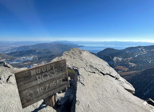
This challenging hike offers great views of the greater Tahoe area. The first part of the hike to the waterfall is relatively easy, but once you pass that, you'll be doing a decent climb to the summit. During the summer months, you'll want to get an early start as there can be a decent crowd head...
Read more
-
Carson City, Nevada
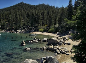
The parking for Skunk Beach is very limited and a little difficult to find. Make sure you get there early if you want a spot. The parking is a turnoff along highway 28, about two miles north of the junction with highway 50. There is no trail sign or anything but there is an old green pipe gate wh...
Read more
-
Carson City, Nevada
4.0
2.83 mi
/ 564 ft gain
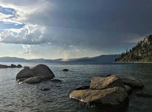
Skunk Harbor is an out-and-back trail that takes you by a lake located near Glenbrook, Nevada.
Read more
-
Plumas County, California
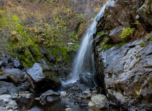
To get to the falls from the town of Graeagle, CA take Graeagle-Johnsville off Highway 89 towards the town of Johnsville. After 4.5 miles take a left on a dirt road to Jamison Mine Day Use Parking. If you go over the bridge and into the town of Johnsville, you have gone too far. Continue down th...
Read more
-
New Washoe City, Nevada
The Resort is located about 30 miles (50 km) south of Reno in the Carson Range. Mt. Rose is Tahoe's highest base elevation at about 8,260 ft (2,520 m) and the summit is 9,700 ft (3,000 m). The resort area is 1,200 acres (4.9 km2), and is located in the Toiyabe National Forest.See the resort map h...
Read more
-
South Lake Tahoe, California
Explore Lake Tahoe's southern shores by paddling from Baldwin Beach to Emerald Bay. There are many places to stop along the way for photographs, snorkelling, or swimming.
The more popular ways to paddle from Baldwin Beach to Emerald Bay are by SUP or kayaks. But paddling a foamie can be extra f...
Read more
-
South Lake Tahoe, California
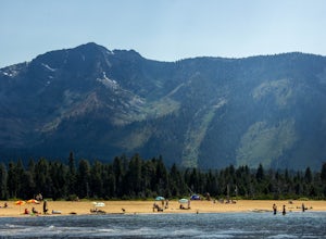
Baldwin Beach offers a half mile of views of Lake Tahoe and the Sierra Nevada mountains. People come to this beach to relax and picnic. This is also a popular launch spot for those kayaking or stand up paddling to Emerald Bay.
This beach is on national forest land and has a parking fee of $8.00...
Read more
-
Kyburz, California
4.4
26.28 mi
/ 5151 ft gain
This 26 mile loop meanders through some of the most primitive trails in Desolation Wilderness. Starting from Wrights Lake, the route proceeds over Rockbound Pass, loops around several lakes, and returns to Wrights Lake. Not many hikers venture past the steep and rocky Rockbound Pass to enter this...
Read more
-
Grass Valley, California
While all of the hiking trails to the Wolf Mountain summit cross private land, Wolf Mountain Road provides public access to several excellent viewpoints overlooking the Central Valley and the nearby ruins of old radio towers.To get there take McCourtney Road west from CA Highway 49/20 and go 3.2 ...
Read more
-
-
Kyburz, California
5.0
5.6 mi
/ 1750 ft gain
To get to the Twin Lakes Trailhead from the Bay Area/Sacramento, head east on HWY 50 past Kyburz for 4 miles until you see the left-hand turnoff for Wrights Road. If coming westbound on HWY 50, this will be a right-hand turn 5 miles past Strawberry. Follow this paved road for 8 miles (watch for p...
Read more
-
Kyburz, California
5.0
6.26 mi
/ 1237 ft gain
The Twin Lakes trail starts winding through a pine forest, with a couple of bridge crossings over crystal clear trout-filled streams. The marsh-like water is very slow-moving, and even though it is indeed beautiful, it is also a prime location for pesky mosquitoes in the summertime. Be sure to ...
Read more
-
Kyburz, California
Starting from the Wright's Lake parking area, walk past the service gate to find the loop trail. Follow the loop trail to the signed trail for Twin, Grouse, Island, and Hemlock Lakes heading toward the right. You will begin an approximate 150 foot ascend before coming to a saddle. Another 150 foo...
Read more
-
Twin Bridges, California
Mount Price (9,975') is the second highest summit in the Desolation Wilderness, standing just eight feet lower than Pyramid Peak to the south. In between these two peaks stands Mount Agassiz (9,967'), whose overhanging summit resembles a granite wave poised to crash down into the Desolation Vall...
Read more
-
Carson City, Nevada
The Spooner Lake Loop is perfect for any ages since there is basically no elevation gain and many benches along the trail to rest. The trail offers many educational signs describing the history, and flora and fauna of the area. This man made lake is perfect for the kids and pup. They will love th...
Read more
-
South Lake Tahoe, California
Kiva is a secluded sandy crescent beach flanked by a beautiful meadow and mountain backdrop. This beach is rarely crowded and has free parking unlike other beaches in Tahoe. Kiva is a great place to bring dogs and is actually well known as a dog beach. Kiva is also accessible from the bike trail...
Read more

