Lake Forest, California
Looking for the best photography in Lake Forest? We've got you covered with the top trails, trips, hiking, backpacking, camping and more around Lake Forest. The detailed guides, photos, and reviews are all submitted by the Outbound community.
Top Photography Spots in and near Lake Forest
-
Los Angeles, California
Hollywood Sign via Brush Canyon Trail
4.65.04 mi / 1155 ft gainGetting to the parking lot near the trailhead and finding an open space can seem like the most daunting part of this whole excursion. There are free parking lots along the road to the trailhead, so keep an eye out. There are also several ways to get to the trailhead from other parking areas; I ad...Read more -
Avalon, California
Visit Two Harbors, Catalina Island
5.0Just 30 miles from the commotion and congestion of Los Angeles, is a small island village that time seems to have left behind. You won't find the usual traffic, development, and big crowds here. You won't find movie theaters, concert venues, hotels, nightclubs, or sporting events either. At Cata...Read more -
Los Angeles, California
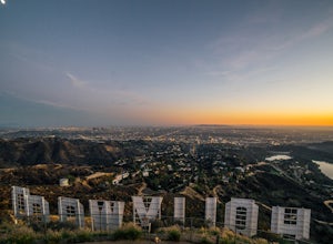
Hollyridge Trail to the Hollywood Sign [Closed]
4.13.5 mi / 383 ft gainThis trail is closed as is the Beachwood Gate which is used to access the Hollyridge Trail will be permanently closed on April 18th, 2017 due to a court order. Check out Hollywood Sign via Brush Canyon Trail for an available option. There are three ways to get to the Hollywood Sign. This route ...Read more -
Marina del Rey, California
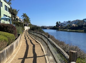
Ballona Lagoon
5.01.8 mi / 95 ft gainSuch a relaxing and beautiful stroll in the Marina Del Rey/Venice area! Park in Marina Del Rey #13 lot (4601 Vía Marina, Marina Del Rey, CA 90292). Don't forget to pay the meter! The rate as of 2021 is $0.50/15mins, or $6 for 24hrs on weekdays, and $8 for 24hrs on weekends. Once parked, walk ...Read more -
Encinitas, California
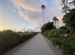
Encinitas Coastal Rail Trail
2.61 mi / 33 ft gainThe Cardiff/Encinitas Coastal Rail Trail (part of the longer, ongoing project to eventually run 44 miles between Oceanside and San Diego) is a beautiful, mellow, and well-maintained pathway that runs from the corner of Chesterfield Dr. & San Elijo Ave. (right across the street from the Patago...Read more -
Azusa, California
Little Jimmy Trail Camp
4.33.36 mi / 607 ft gainTake Hwy 2 out of La Canada north along Angeles Crest Highway. Follow this for quite some time enjoying the fine views in all directions. After traveling through two consecutive tunnels continue to the Islip Saddle parking lot (on left). There will be a vault toilet & a picnic table. Display ...Read more -
La Cañada Flintridge, California
Teepee Trail
5.02.55 mi / 1145 ft gainHidden in the small community of La Canada, California, the trailhead is pretty hidden! From the 210, take the exit for Highway 2/Angeles Crest Highway. Head north (towards the mountains) for about a mile. As the highway begins to curve, you will come across a small side-street, Harter Lane. Turn...Read more -
Pearblossom, California
Snowshoe Buckhorn Ridge Trail
2.5 mi / 700 ft gainLocated 1 mile east of the Mt Waterman Ski Resort, Buckhorn Ski Hill is a great place to enjoy a leisurely stroll through a snow-covered forest, complete with views of towering Mt Waterman. To get here take I-210 toward La Canada, exit on to California Highway 2 (Angeles Crest Highway) heading no...Read more -
Los Angeles, California
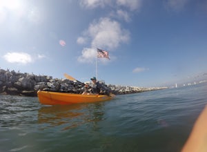
Kayak the Marina Del Rey Harbor
5.0The Marina Del Rey harbor covers 1.5 square miles making it the world’s largest small-craft harbor. Located southwest of Los Angeles, it is the homeport to nearly 6,500 local boats, ranging from small fishing boats, large private yachts, and even a multitude of unique houseboats. The harbor is ea...Read more -
Los Angeles, California
Aileen Getty Ridge Trail
5.03.55 mi / 1194 ft gainThe Aileen Getty Ridge Trail is a singletrack trail that runs between Mt. Lee and Burbank Peak (the location of the Wisdom Tree). Though there are many options to access this trail, the most direct route is from the west via the Wonder View Trailhead. Start by parking on Lake Hollywood Drive near...Read more -
Escondido, California
Lake Hodges Overlook
4.66.73 mi / 1407 ft gainElfin Forest is one of the most beautiful and unique trails in all of San Diego, CA. The parking is free as well as the overflow parking area. There is an Interpretive Center located in the staging area where you can speak to park rangers, learn about the wildlife and trail locations. The parking...Read more -
Escondido, California
Camp at Dixon Lake
2.1 mi / 295 ft gainDixon Lake is Escondido's best kept secret! A man-made reservoir located right next to Daley Ranch, Dixon Lake offers overnight camping, boat rentals, fishing, and hiking, along with picnic areas, a kids park, and more. The campground is open year-round and is located next to the lake with a lof...Read more -
Los Angeles County, California
Mt. Williamson via Islip Saddle
4.16 mi / 1519 ft gainThe trailhead is immediately off of Angeles Crest Highway CA-2 at Islip Saddle. It's just a touch over 2 miles to reach the summit, through which you'll be hiking among the pine tree forest practically the entire way up (part of this trail doubles as the Pacific Crest Trail). The summit is larg...Read more -
Glendale, California
Brand Library Loop
5.06.56 mi / 2648 ft gainYour adventure will start at the Brand Library parking lot. Walk behind the library towards the gated day use area and you will find the start of the trail on your right, Las Flores MTWY. The first half-mile rises over 500 feet to a plateau, equipped with benches, a park map and views of Griffit...Read more

![Hollyridge Trail to the Hollywood Sign [Closed]](https://images.theoutbound.com/contents/101823/assets/1421740399247?w=300&h=220&fit=crop&q=60&s=2a530c5406ca77dd7baf662c74a58ba1)
