La Verne, California
Looking for the best hiking in La Verne? We've got you covered with the top trails, trips, hiking, backpacking, camping and more around La Verne. The detailed guides, photos, and reviews are all submitted by the Outbound community.
Top Hiking Spots in and near La Verne
-
Los Angeles, California
Lake Hollywood Trail
4.73.35 mi / 249 ft gainThe Lake Hollywood Trail features beautiful wildflowers in the spring and is wheelchair accessible. A majority of the trail is paved, but approximately .6 miles is on dirt. Some of the trail is shaded, but bring sun protection regardless - especially in the summer. Dogs are not allowed on this tr...Read more -
Corona, California
Hike to Santiago Peak via Holy Jim
5.015 mi / 4500 ft gainWhen you think of Orange County, you think of beaches, boardwalks, but what you may not know is that there are some great hikes in our very own backyard! My favorite is a fairly strenuous day hiking adventure that only the strong survive. Not to dissuade any interested parties, since this is a ...Read more -
Corona, California
Hike to Holy Jim Falls
3.02.9 mi / 570 ft gainTo start, directions on how to get to the trail there are two different ways, the most common , which I will explain, being through Rancho Santa Margarita you will head east on Santa Margarita Parkway, turn left at the dead end (into a parking lot for a shopping center) on Plano Trabuco Road, thi...Read more -
Los Angeles, California
Cahuenga Peak Loop Trail
3.88 mi / 1237 ft gainThe Cahuenga Peak Loop is perfect for trail runners and hikers. The trailhead is in Hollywood Hills - park off to the side on a street. This trail features beautiful wildflowers in the spring. Dogs are allowed on the trail if kept on leash. The trail can be dusty and dirty, so watch your step. Ke...Read more -
Los Angeles, California
Cahuenga Peak via Burbank Peak Trail
2.23 mi / 719 ft gainCahuenga Peak via Burbank Peak Trail is an out-and-back trail that takes you past scenic surroundings located near Los Angeles, California.Read more -
Trabuco Canyon, California
Hike the Bellview to Dove Lake Trail
2.5 mi / 75 ft gainThis hike will be about going from the Bellview Trailhead to Dove Lake and back. Note that once you get to Dove Lake there are numerous offshoots that can take you in different directions (you can follow the road into the Dove Canyon housing community, take a paved road back to the Bellview parki...Read more -
Lake Elsinore, California
Explore Walker Canyon
4.3Walker canyon is within easy driving distance from most places in Orange County and San Diego which makes for a great day trip. While there is no official parking lot for the trail you will be able to find parking all along Lake Street and Walker Canyon Road. The trail begins at the corner of L...Read more -
Los Angeles, California
Runyon Canyon Loop
3.22.67 mi / 728 ft gainLocated in the Hollywood Hills, Runyon is an iconic workout run/ hike that can give you great views all the way to the ocean. There are a few different loop trails/ hikes you can take ranging from ~1.5mi to 3.25mi all with a decent amount of elevation gain. Also, remember this is Hollywood, so yo...Read more -
Newport Beach, California
Newport Beach Back Bay Trail
4.010.62 mi / 499 ft gainThe Newport Beach Back Bay Trail features beautiful wildflowers and is open for use year round. Very minimal elevation gain makes this hike food for all skill levels, but be mindful of the distance. Dogs are allowed on the trail but must be kept on leash. Cooling sea breezes make this one of th...Read more -
Los Angeles, California
Verdugo's North Ridge Trail
12.7 mi / 2684 ft gainThe Verdugo Mountain Range is a small, rugged range spanning across the northeast end of the San Fernando Valley from Sun Valley to Glendale. With close to 50 miles of graded and well-maintained trails, the Verdugos are surprisingly underutilized and make a great place for someone looking to esca...Read more -
Los Angeles, California
Verdugo Mountain Traverse
5.012.13 mi / 0 ft gainThe Verdugo Mountain Range is a small, rugged range spanning across the northeast end of the San Fernando Valley from Sun Valley to Glendale. With close to 50 miles of graded and well-maintained trails, the Verdugos are surprisingly underutilized and make a great place for someone looking to esca...Read more -
Newport Beach, California
Bommer Ridge from the Pacific Ridge Trailhead
7.54 mi / 394 ft gainThe Bommer Ridge West Trailhead aka The Pacific Ridge Trailhead begins at the edge of Ridge Park Road, overlooking CA State Highway 73, and marks the northwest entrance to the Laguna Coast Wilderness and its neighbor, Crystal Cove State Park. From the well-marked trailhead follow the trail south...Read more -
Newport Beach, California
Explore Deer Canyon
6.9 mi / 1489 ft gainThe Deer Canyon Loop Trail is an easy drive from Orange County and Newport Beach. In the spring, wildflowers are abundant along the trial. This is a favorite spot for trail runners, hikers, and mountain bikers. The trail is kept in great condition year-round and is very wide. There is very little...Read more -
Los Angeles, California
Kenneth Hahn Recreation Area Loop
2.85 mi / 328 ft gainThe Kenneth Hahn Recreation Area is just outside of downtown LA, a perfect location for hiking, trail running, and biking. The trail loops up to the top of a hill, where hikers get sweeping views of LA. Dogs are allowed, but must be kept on leash. This is also a great location for trail running...Read more -
Newport Beach, California
Exploring the Arches at Little Corona del Mar
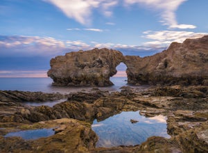
4.9Little Corona del Mar Beach is a secluded beach located on Poppy Avenue across Ocean Boulevard in Corona del Mar. Known as one of the less crowded beaches in the area, this spot is the perfect place to chill for the day or photograph a sunset. You will find plenty of free street parking in the ne...Read more -
Aliso Viejo, California
Top of the World via West Ridge Trail
5.04.76 mi / 443 ft gainDirections to get here are pretty straight forward via the map. You park your car in a residential neighborhood along the street, and from there, you can't miss the entrance. The trail is paved for the first 100yds or so and after you make a right turn at the top, you'll be on dirt and sand the r...Read more

