Jamul, California
Looking for the best hiking in Jamul? We've got you covered with the top trails, trips, hiking, backpacking, camping and more around Jamul. The detailed guides, photos, and reviews are all submitted by the Outbound community.
Top Hiking Spots in and near Jamul
-
Poway, California
Mount Woodson and Potato Chip Rock
4.66.45 mi / 900 ft gainMt. Woodson is located in Poway's most eastern region and is one of San Diego's most popular and most iconic hiking trails. Known for its grand photo opportunistic "Potato Chip Rock", Mt. Woodson is a 7.5mi out-and-back trail with amazing vistas, convenient rest stops and breathtaking views. The...Read more -
Santa Ysabel, California
Three Sisters Falls
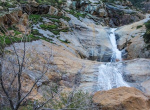
4.93.42 mi / 906 ft gainThree Sisters Falls is by far the best hike, for the most reward, that I've gone on in the close vicinity of San Diego. Only a short hour and a half drive from downtown San Diego, the hike offers all the draws of a National Park: remote wilderness, strenuous hiking, scenic mountain views, and ama...Read more -
San Diego, California
Los Penasquitos Waterfall via Los Penasquitos Canyon Trailhead
4.34.15 mi / 115 ft gainThe Los Penasquitos Preserve waterfall is a hidden gem of San Diego and a popular spot for locals within the area. The hike to the waterfall lies within a preserve of approximately 4,000 acres. There are many different trailheads that lead to the waterfall all offering a unique experience. I alwa...Read more -
San Diego, California
Black Mountain via Nighthawk Trail
5.04.05 mi / 764 ft gainStarting at the trail head at the end of Oviedo way, you will see a power line on top of the small hill across from the rec center, which is the start of the South Point View Trail. Follow this trail about a mile until you see a sign for the 'Little Black Mountain Loop' . This is a 4.1 mile loop ...Read more -
Poway, California
Blue Sky Ecological Reserve to Ramona Dam
3.05.3 mi / 984 ft gainStarting at the trail head where you park your car, head south along the Green Valley Truck Trail. After less than a mile, you will notice the city and noise start to fade behind you, and a beautiful sight of towering oaks, willows, and sycamores appear as you walk along the Creekside Trail. You ...Read more -
Campo, California
Kitchen Creek Falls Trail
4.04.83 mi / 722 ft gainKitchen Creek Falls Trail is an out-and-back trail that takes you by a waterfall located near Pine Valley, California.Read more -
San Diego County, California
Hiking the Laguna Hills via the PCT
5.020 mi / 2000 ft gainThis trail is well-maintained, but gets a little rocky on the PCT, and the Chariot Fire burn-zone between Penny Pines and Hayes peak will have a few downed trees and some overgrown grasses. On the other hand, the trail network of the BLT is confusing to follow as the entire network is named "Big ...Read more -
San Diego, California
Black Mountain Peak via Miner's Ridge Loop Trail
2.54.3 mi / 951 ft gainThe Miner's Ridge Loop Trail is a relatively mild 4.3-mile loop that takes you to the 1554-foot summit of Black Mountain Peak. Even from the parking lot, the views to the east are stunning. Get there early in the morning on a clear day, or arrive just before sunset to get the full experience. T...Read more -
Julian, California
Hike Cuyamaca Peak
4.55.5 mi / 1700 ft gainThis peak is one of the tallest in the county. Reaching the summit of the peak takes you to an elevation of 6500'. Although this peak isn't as challenging as others nearby, it's located in the center of San Diego, which offers up amazing views, which is the main reason to take this hike. The best...Read more -
Julian, California
Hike Stonewall Peak
4.73.82 mi / 820 ft gainThis hike is one of the most popular in the Cuyamaca Rancho State Park. When you reach Stonewall Peak's summit, enjoy the view of the surrounding park and nearby Lake Cuyamaca. The hike up the east side is a popular and relatively easy trail. Although you'll be gaining 800 feet, the hike is relat...Read more -
San Diego, California
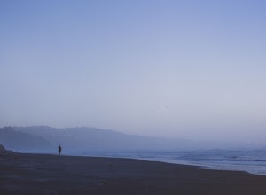
Surfing at Black's Beach via the Main Gate
5.01 mi / 650 ft gainWith arguably some of San Diego’s best waves, Black’s Beach can be found in the vicinity of the University of California San Diego campus, at the southern end of Torrey Pines State Beach and north of La Jolla Shores. Stately eight-figure mansions now line the bluffs where pastures and the Black f...Read more -
San Diego, California
Black's Beach via the Ho Chi Minh Trail
4.30.61 mi / 259 ft gainFinding the actual trail is 80% of the adventure. Once you turn down La Jolla Farms Road you will follow it for about 3/4 of a mile and there won't be anything too apparent that you are there, except a few cars parked along the street. Make sure to plug in the directions from the map so you know ...Read more -
San Diego, California
Black's Beach via the Gliderport
4.30.7 mi / 269 ft gainPark at the Torrey Pines Gliderport, which is conveniently empty before sunrise. The hike down to Black's Beach features a steep hike down a winding path of natural and manmade steps along the cliff face, but stay left and cruise the bluff for endless opportunities to observe, reflect and explor...Read more -
San Diego, California
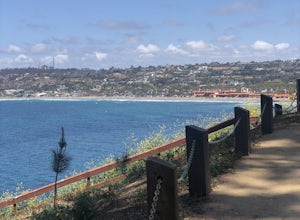
La Jolla Coast Walk Trail
5.02.32 mi / 295 ft gainLa Jolla Coast Walk is a beautiful coastline trail, but is a bit of a heavily trafficked tourist trail. The hike can be started and ended at 3 separate locations. The trail is easily accessible with a small parking lot and tons of restaurants nearby. The trail begins near another popular touris...Read more -
San Diego, California
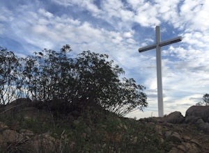
Battle Mountain's Cross
5.00.45 mi / 256 ft gainThis is a quick and easy hike for everyday explorers desiring a 20-minute sweat-inducing power walk leading to incredible views of urban development, Iron Mountain, Mt. Woodson, Mule Hill, and The 15. Come enjoy the views while sitting under the beautiful 20ft cross you've been admiring from the ...Read more -
Campo, California
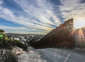
Photograph the Mexican Border on the PCT Southern Terminus
4.5From San Diego head East on Hwy 8 for roughly 60 miles to Buckman Springs Road (Exit 51). Take a right on Buckman Springs road an drive South for 10 miles. Turn right on CA-94 W (Campo Rd) and drive for 1.5 miles. After crossing the railroad tracks turn left on Forrest Gate Road. Take this road f...Read more

