Jamestown, California
Jamestown, California, is a must-visit for outdoor adventures, offering some of the top hiking trails. One of the best trails is the Table Mountain Trail. This moderate difficulty trail is known for its unique volcanic rock formations and a stunning seasonal waterfall. The trail also leads to a scenic overlook of New Melones Lake, providing beautiful views. Another popular trail is the Dragoon Gulch Trail, featuring oak woodlands and panoramic views of the Sierra Nevada. For a more relaxed activity, Jamestown also offers gold panning in Woods Creek. The best Trails and Outdoor Activities are waiting for you in Jamestown, California.
Top Spots in and near Jamestown
-
Arnold, California
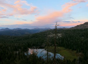
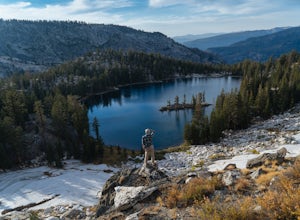
Backpack To Wheeler Lake
5.07.8 mi / 1000 ft gainThe trail to Wheeler Lake begins at the Woodchuck Basin Trailhead. This trailhead is located a little over a mile east of Lake Alpine on Highway 4. The trail starts off relatively flat and winds through forests and meadows, taking you into the Mokelumne Wilderness. Time it right and you'll be met...Read more -
Pinecrest, California
Camp at Baker Campground
5.0/ 6224 ft gainBaker Campground is a first come, first serve campground. Each site is equipped with a fire ring, picnic table, and bear boxes. The cost for a single family site is $20 per night and a double family site is $40 per night. The campground provides bathrooms and potable water. The campground is typi...Read more -
YOSEMITE NATIONAL PARK, California
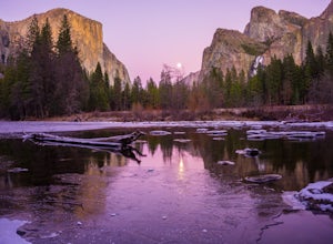
Photographing Valley View
4.5Valley View is a must stop viewpoint in Yosemite National Park. Most people visit Valley View on their way out of the park as it is the last stop, located along the one-way Northside Drive. Look for a small parking area to your left just before Pohono Bridge. There are only about a dozen parkin...Read more -
Mariposa County, California
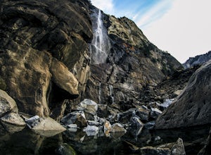
Hike to Bridalveil Fall
3.81.2 mi / 200 ft gainSince most things you want to see in Yosemite require a hike, this place is a nice change to see something without having to walk for hours. From the parking lot it is just about a 10 minute walk to the falls.If you scramble up the rocks, you can get a nice view of the falls and the pond. It used...Read more -
YOSEMITE NATIONAL PARK, California
Hike to Eagle Peak via Rockslides Trail
4.016.07 mi / 5568 ft gainA Yosemite Valley trip in May has tourist filled buses, noisy car alarms, and crowded trails written all over it. Thus, I wanted to avoid the beaten path. Looking into possible destinations, John Muir once said in regards to Eagle Peak, "where the most comprehensive of all the views to be had on ...Read more -
Yosemite Village, California
Watch the Sunset in El Capitan Meadow
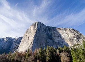
After entering the park, keep driving the loop until you get onto Northside Drive, and then park once you are right below El Capitan (the 3,000ft granite monolith that is very hard to miss).Once you've parked, grab a blanket, snacks, and a beverage. With these items in hand, walk over to the eas...Read more -
Yosemite National Park, California
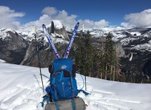
Winter Backpack to Sentinel Dome in Yosemite
5.019.23 mi / 860 ft gainThe goal for our weekend was to do some winter camping in the Yosemite backcountry; we decided on Sentinel Dome as our destination. The trail is a cakewalk during the summer, but winter turns it into a 10 mile uphill grind from the car. Most people opt to head for the ski hut at Glacier Point, bu...Read more -
Yosemite National Park, California
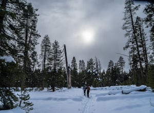
Dewey Point via Badger Pass Ski Area
5.07.36 mi / 761 ft gainTake the one-hour shuttle ride from the Yosemite Lodge to the Yosemite Ski Area, so that you don't have to worry about driving in the snowy conditions, or finding parking. If you don’t own snowshoes, you can easily rent a pair from the rental shop for the day. Current rates are $24.00 for a full ...Read more -
YOSEMITE NATIONAL PARK, California
Nordic Ski and Snowshoe to Glacier Point
5.021 miKnown for its breathtaking vistas, towering granite faces, and thundering waterfalls, Yosemite National Park truly is one of the world’s most astounding landscapes. Though the park covers nearly 1200 square miles, the vast majority of the ~4 million annual visitors spend almost all their time ar...Read more -
YOSEMITE NATIONAL PARK, California
Cross-Country Ski to the Ostrander Ski Hut
Start your trip from the Badger Pass ski area. The Glacier point road is closed past here, and you'll spend your first couple of miles skiing mostly downhill to the Bridalveil Falls trailhead.The Bridelveil Creek trail gains slightly less elevation but is less scenic and longer than the more popu...Read more -
Wawona, California
Dewey Point Trail
4.95 mi / 315 ft gainThis approximately 5-mile out-and-back trail is a great hike in Yosemite National Park. This trail starts off of Dewey Point's Meadow Trail, but you can also start from the Dewey Point Ridge trail, which you'll pass first when coming up Glacier Point Road. This trail is not dog friendly, but is a...Read more -
Arnold, California
Hike To Bull Run Lake
4.3The hike to Bull Run Lake is about 7.8 miles, roundtrip, and begins at the Stanislaus Meadows Trailhead, located about 10 miles West of Ebbetts Pass. There is plenty of parking near the trailhead, off of the South side of CA 4. The trailhead GPS coordinates are: N38 30.376' / W119 56/617'Once you...Read more -
Mariposa County, California
10 Lakes Basin in Yosemite
5.013.38 mi / 2200 ft gainBeginning at the Ten Lakes trailhead, the trail to the lakes is a moderately strenuous uphill grind to Ten Lakes pass, followed by a quick downhill into the lake basin. We met a woman at the top who made sure we didn’t miss the short side trail to a vista point on the pass that offered a sweeping...Read more -
Mariposa County, California
Grant Lake via Ten Lakes Trailhead
4.012.24 mi / 2000 ft gainThe trail begins at the Ten Lakes trailhead (7600 ft) right beside Yosemite Creek. The first 4 miles start you on the ascent through the wooded forest, however there are portions of the trail that will take you through granite rock valleys marked with only cairns so keep your eyes peeled througho...Read more -
Yosemite Village, California
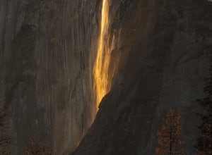
Witness Yosemite's Firefall
5.00.1 mi / 0 ft gainOver 5 million visitors flock to Yosemite National Park in California's Sierra Nevada Mountain Range every year to take in the geological splendor. While most visitors get to see the park's waterfalls, very few ever get to witness the Firefall. For two weeks between mid-late February, a small wat...Read more -
Mariposa County, California
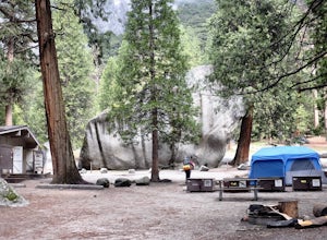
Camp at Camp 4, Yosemite NP
4.5Camp 4 is located in Yosemite Valley near Yosemite Valley Lodge. It's a popular spot for climbers as there is bouldering within the site. It's also located close to the Upper Yosemite Falls trail. Pets are not allowed. First come, first serve, $6/night. More info at https://www.nps.gov/yose/plany...Read more

