Inyo, California
Looking for the best camping in Inyo? We've got you covered with the top trails, trips, hiking, backpacking, camping and more around Inyo. The detailed guides, photos, and reviews are all submitted by the Outbound community.
Top Camping Spots in and near Inyo
-
Inyo County, California
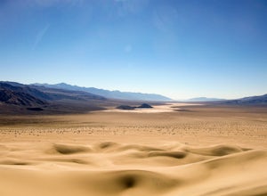
Panamint Dunes
5.07.23 mi / 935 ft gainYou can do this as a day trip and just wander the dunes, but I really enjoyed the overnight with great evening views, amazing stargazing, and a sunrise exploration of the sand dunes. For an overnight trip I recommend you start hiking later in the day, when the temperature is a bit cooler. If you...Read more -
Inyo County, California
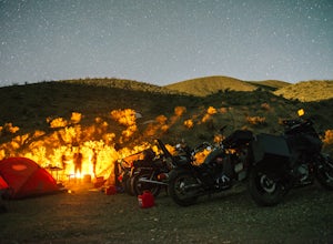
Camp at Death Valley's Wildrose Campground
There is a ton to see here, exploring Death Valley is the perfect way to spend a weekend away. We decided to explore it with a group of friends on motorcycles but a car will do just fine too.Death Valley is located in Eastern California's Mojave Desert. From LA, take highway 395 and meet up with ...Read more -
Inyo County, California
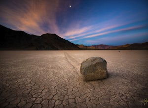
Racetrack Valley
5.0Death Valley National Park is home to some remarkably surreal landscapes, none stranger than Racetrack Valley and its famous moving rocks. For decades, the mechanism of the rocks’ movement was unknown and the subject of much speculation, some scientific and some not, but the mystery was finally ...Read more -
Death Valley, California
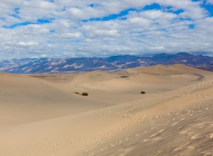
Sandboarding the Mesquite Sand Dunes
3.0Snow level is a little lacking this year? No time or money to fly out to Park City or Whistler? Head over to Death Valley, America's second largest National Park and give sand boarding a try while exploring this amazing park. It's a unique and adrenaline filled activity with one of the most beaut...Read more -
Inyo County, California
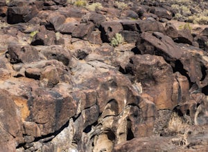
Fossil Falls Trail
4.30.58 mi / 43 ft gainFossil Falls is located east of Highway 395, a few miles south of Coso Junction, 45 min north of Ridgecrest. There is Bureau of Land Management sign pointing the way, but it is small, faded, and easy to miss, so be on the lookout. After about a mile drive on a marked dirt road, you'll reach the ...Read more -
Lone Pine, California
Rock Climb the Candy Store
The Candy Store is a group of boulders and small spires with around 30 climbing routes ranging from 5.6 to 5.11. The majority are trad routes with a significant portion toprope and a couple of sport. The major features/boulders are: First BoulderThe GumdropLollipop BoulderRock Candy TowerSecond B...Read more -
Inyo County, California
Backpack Mount Langley
5.021 mi / 4000 ft gainMt. Langley sits four hours north of Los Angeles and is one of the easier 14ers to bag in California. Mt. Whitney absorbs most of the foot traffic, so enjoy the relative quiet and seclusion.The trailhead starts at Horseshoe Meadows/Cottonwood Lakes Trailhead Campgrounds and meanders for 7.5 miles...Read more -
Lone Pine, California
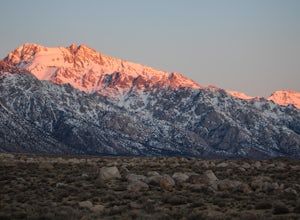
Camp at Tuttle Creek Campground
4.5Tuttle Creek Campground is a beautiful place to camp during any time of year. The campground offers uninterrupted breath taking views of the entire Eastern Sierra Nevada and Owens Valleys. Whether you are looking for a place to crash for the night while traveling down the 395, rock climbing in th...Read more -
Inyo County, California
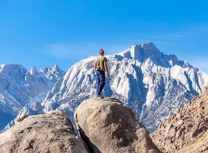
Camp in the Alabama Hills
4.8The Alabama Hills Recreation Area is a area owned by BLM and open to the public. Camping is free and you can say for a max of 14 days.The are has 100+ open desert sites that are shadowed by some of the tallest peaks in the Sierra Nevada range. And if that wasn't enough, the area was the backdrop ...Read more -
Inyo County, California
Backpack Fall Canyon
8 miThe trail head is north of Furnace Creek at the Titus Canyon parking lot which is clearly marked on any park map. On a busy weekend cars are lined up along the road leading to the parking lot which has a restroom. Note that there is no water source here. To begin the hike in, take the trail on th...Read more -
Inyo County, California
Camp at Lone Pine Campground
4.0The Lone Pine Campground is located 6 miles west of Lone Pine California, and 7 miles east of Mt Whitney Portal. The campsite is nestled next to Lone Pine Creek, which is the perfect place to fish for Sierra Nevada trout. The campground sits at 6,000 feet and in clear view of Mt. Whitney, the hig...Read more -
Inyo County, California
Texas Spring Campground
This is one of the best campgrounds in Death Valley that gives you the true experience of camping in the middle of a desert. The campground is surrounded with badlands and hills where you can climb to explore and see a panoramic view of mountains all around. Texas Spring campground offers 92 sit...Read more -
Inyo County, California
Scramble up Mt. Muir
5.018.5 mi / 6200 ft gainFrom the Whitney Trail - beyond trail crest - you will see a big cairn (right side). If you make it to the first "window of Mt. Whitney" you have gone too far. The cairn marks the start of an class 2 use trail up to the Mt. Muir headwall.The headwall is a fun climb with good handholds and has lit...Read more -
Inyo County, California
Winter Summit Mt. Whitney
22 mi / 6500 ft gainDay 1: We arrived at the Lone Pine Visitors Center at the intersection of HWY 395 and HWY 136 just south of Lone Pine, CA. We issued ourselves our overnight permits to climb Mt. Whitney and picked up our Wag Bags. You can self issue yourself the free permit Nov. 2 through Apr 30. Climbing during ...Read more -
Seven Pines, California
Mt. Williamson via Shepherd Pass
5.026.66 mi / 10653 ft gainThis trail starts at the lowest, and generally regarded hardest, trailhead in the Southern Sierras. You quickly gain elevation in what many describe as manageable but relentless. The first section of the hike has nice shade and adequate water access. Very enjoyable company to boot! Once you cros...Read more

