Independence, California
Looking for the best photography in Independence? We've got you covered with the top trails, trips, hiking, backpacking, camping and more around Independence. The detailed guides, photos, and reviews are all submitted by the Outbound community.
Top Photography Spots in and near Independence
-
Sequoia National Park, California
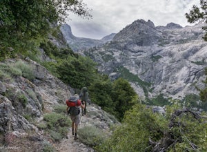
Backpack the High Sierra Trail
5.071 miThe High Sierra Trail begins at Crescent Meadow in Sequoia National Park, on the West side of the Sierra Nevada range, and ends at Whitney Portal on the East, traversing the highest and most beautiful part of the Sierras. From deep river canyons to high alpine peaks, lakes, and meadows, this hike...Read more -
Sequoia National Park, California
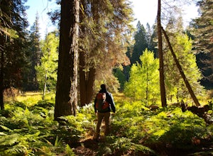
Hike Crescent Meadow
4.51.6 miCrescent Meadow is a collection of loops in the Giant Forest in Sequoia National Park. The trailhead is located just past the tunnel log east of General's Highway 198. The main loop is 1.6mi total. However you can take any of the loops to the General Sherman tree 3mi, Tharp's Log trail 0.5mi, or ...Read more -
Sequoia National Park, California
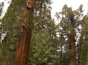
Hike through the Giant Forest in Sequoia NP
5.02 mi / 154 ft gainTake a drive to Sequoia National Park and take in the beautiful views of the second oldest national park. If you go in the winter or early spring time, be sure to check the weather beforehand and be prepared for the cold.If you are an avid traveler to national parks, I'd recommend that 2 weeks b...Read more -
Big Pine, California
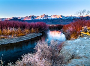
Trout Fishing in the Owens River
3.0Surrounded by the Sierra Nevada, Inyo, and White Mountains, the Owens River Valley is picturesque and home to some quality trout fishing on the Owens River. If you like to pair photography with fishing then this is the ideal location for you - the color pallet is beautiful, especially in the wint...Read more -
Sequoia National Park, California
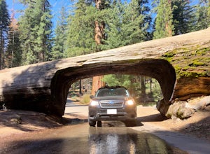
Drive through Tunnel Log
Tunnel log is a massive fallen sequoia across the middle of the road, which is a great photo opportunity for visitors of the national park. The mammoth tree fell over in 1937, but a year later, a car tunnel was carved in the middle of its trunk so vehicles could still pass through. Although the...Read more -
Inyo County, California
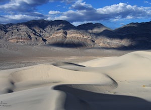
Explore Eureka Dunes and Hidden Dunes
THE HIDDEN DUNES HIKEFrom the well, you will want to hike towards a gap in the mountains off to the West. Hopefully, you were able to see the dunes on the way in as described above to help gauge the direction to head in. A map, or GPS, can make this easier too, but probably isn’t needed. Just oc...Read more -
Three Rivers, California
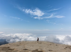
Hike Little Baldy
5.03.5 mi / 700 ft gainA short hike with impressive views of Sequoia National Park, the Little Baldy trail is the less touristy version of Moro Rock. When we hiked it on a beautiful Sunday morning in the summer, we had the entire summit to ourselves. Even if other hikers had been up there, it would have still felt em...Read more -
Sequoia National Park, California
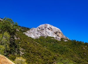
Hike Moro Rock
5.0Moro Rock is a granite dome with a staircase leading to the 6,725 foot summit, where you can enjoy a spectacular view of the Great Western Divide. From Generals Hwy, you can drive up Crescent Meadow Road to the parking lot at the base of Moro Rock (summer weekends the road is closed for shuttles ...Read more -
Inyo County, California
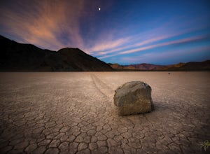
Racetrack Valley
5.0Death Valley National Park is home to some remarkably surreal landscapes, none stranger than Racetrack Valley and its famous moving rocks. For decades, the mechanism of the rocks’ movement was unknown and the subject of much speculation, some scientific and some not, but the mystery was finally ...Read more -
Bishop, California
Sailor Lake Backpack & Climb of Mt. Haeckel
5.013 mi / 2500 ft gainThe basic part of this adventure is a backpack to Sailor Lake. From there you can enjoy small dayhikes to the nearby lakes or waterfalls, go fishing, enjoy some photography or just lounge in camp and gaze at the beautiful scenery. Although Sailor Lake looks smaller than the nearby lakes it stil...Read more -
Bishop, California
Backpack the Piute Pass Trail in the John Muir Wilderness
21 mi / 2000 ft gainWith so many famous hiking trails in the Sierras, its hard to find a trail as isolated as the Piute Pass Trail. This trail allows you to hike in the John Muir Wilderness, Inyo National Forest, and Sierra National Forest in one 20 mile section of trail. You will encounter amazing wilderness, spect...Read more -
Bishop, California
Backpack Across Mt. Humphreys Basin
30 mi / 3375 ft gainBefore heading out, you will need to get a backpacking permit to stay overnight in this area. You can buy one here to pick up in town at the Bishop, CA Ranger Station, in the morning.The trailhead begins at North Lake campground (9,345'), in a beautiful lush area, with streams and aspen groves. A...Read more -
Bishop, California
Backpack to Upper Lamarck Lake
5.05.8 mi / 1562 ft gainStarting out at North Lake Campground, the trail to Lamarck Lakes is a fairly gradual ascent. After climbing out of the meadows near the trailhead, you will find yourself on a ridge with few trees to block the great views of Grass Lake and the valley below. Lake Sabrina is on the other side of ...Read more -
Tulare County, California
Hike to the Summit of Big Baldy, Kings Canyon National Park
4.55 mi / 650 ft gainThis short and easy trail to the summit of Big Baldy in Kings Canyon National Park is not to be missed if you are in the area.The trail winds through forest and boulders as it climbs the north shoulder of Big Baldy. When you think you have reached the end, and you see people sitting down with the...Read more -
Bishop, California
Snowshoe to Blue Lake
6.2 mi / 1350 ft gainStarting in Aspendale at 8500 feet, this 5 mile hike is very invigorating and beautiful. To get here, take hwy 395 until in Bishop. Turn onto hwy 168 until you pass the small town of Aspendale. The road dead ends about another mile up the road and you can park. Walk past the yellow gate toward la...Read more -
Hume, California
Hike and Fish Hume Lake
2.73.5 mi / 100 ft gainThis spot is less than four hours from the Bay Area and offers everything you would ever want to do in the outdoors. The interesting thing about Hume Lake is that it is actually a Middle School and High School camp in the Summer and Winter. That being said, it is not the place to go if you are lo...Read more

