Independence, California
Looking for the best photography in Independence? We've got you covered with the top trails, trips, hiking, backpacking, camping and more around Independence. The detailed guides, photos, and reviews are all submitted by the Outbound community.
Top Photography Spots in and near Independence
-
Bishop, California
First and Second Lake via Big Pine Creek North Fork
5.09.57 mi / 2392 ft gainThe North Fork of Big Pine Creek is often cited as having the most unbelievable scenery reachable in a single day. And it's hard to disagree. The Big Pine Creek North Fork trail is just minutes outside of Big Pine off the 395. If going in the winter, access to the trailhead can be closed off, so...Read more -
Bishop, California
Evolution Basin via South Lake
35.66 mi / 7769 ft gainIt’s been called the crown jewel of the Sierra Nevada, the highlight of the entire 211-mile John Muir Trail. Whatever superlatives are used to describe it, Evolution Basin is undoubtedly one of the most incredible landscapes you’ll ever explore. There is a small catch, though: There is no easy ...Read more -
Bishop, California
Bishop Pass Trail
5.011.13 mi / 2165 ft gainTo get to the hike drive twenty miles west from the town of Bishop, California up Hwy 168 to South Lake. There are two parking lots but make sure to get there early because later in the day it's harder to get a spot. The trail starts from South Lake at an an elevation of 9,750 feet. Initially ...Read more -
Bishop, California
Treasure Lakes Trail
5.05.79 mi / 1375 ft gainThe Treasure Lakes Trail is dog and kid friendly, just make sure all parties can handle the elevation gain. The scenery throughout the entire hike is amazing, and early in the summer, the creeks roar. The lake is perfect for cooling off on a hot summer day. The trail is best used in the summer an...Read more -
Bishop, California
Long Lake via Bishop Pass
5.51 mi / 991 ft gainDirections The trailhead for Long Lake starts by South Lake outside Bishop, CA. You'll want to take Line Street, which is the 168, West out of Bishop. Approximately 14 miles up, you'll want to merge left towards South Lake. This junction is well-signed if you keep an eye out for it. Head th...Read more -
Bishop, California
Climb Columbine Peak's NE Ridge
15 mi / 5000 ft gainDirections This Bishop Pass Trail starts by South Lake outside Bishop, CA. You'll want to take Line Street, which is the 168, West out of Bishop. Approximately 14 miles up, you'll want to merge left towards South Lake. This junction is well-signed if you keep an eye out for it. Head the rest ...Read more -
Sequoia National Park, California
Mount Silliman, Sequoia NP
5.011.24 mi / 4449 ft gainThere is available parking at the campgrounds at the Lodgepole Visitor Center. Lodgepole's elevation starts at 6720 ft. Twin Lakes Trailhead starts right at the base, which you will be following to get to Mount Silliman. Along Twin Lakes Trail are several campgrounds for your journey, you can go...Read more -
Three Rivers, California
Backpack to Crystal Lakes
5.09.8 mi / 2200 ft gainThe trail to Crystal Lakes begins at the Timber Gap/Sawtooth Trailhead (7,800 feet elevation), which is located at the end of Mineral King Valley Rd. The trail immediately ascends through a meadow boasting dramatic alpine views and a roaring waterfall. Eventually you'll cross Monarch Creek and b...Read more -
Three Rivers, California
Hike to Lower Monarch Lake
5.08.4 miThe drive takes about 90 minutes to get to the trailhead from Three Rivers, CA so plan accordingly and make sure you get there early. Lower Mineral Lake is located below Sawtooth Peak in Sequoia National Park.Once you're parked and ready to jump on the trail, head to the Sawtooth Trailhead. You'l...Read more -
Bishop, California
Keough Hot Springs Creek
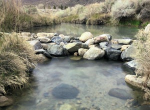
...As many of us enjoy a good hot spring to relax in, I think most will agree that it’s even better when it’s free and out in nature. If you decide to have a little bit more of a luxurious hot spring experience, you can continue to take that road about another mile to the Keough Hot Springs campi...Read more -
Sequoia National Park, California
Hike to Emerald Lake, Sequoia National Park
4.510.4 mi / 2200 ft gainBegin this hike at the Alta Peak Trailhead in the Sequoia National Park. The trail initially takes you east-southeast through a loosely forested area that is stark and arid. Around 1.5 miles in you'll cross a small creek, but this creek may dry up in the late spring/summer. Shortly after the cree...Read more -
Sequoia National Park, California
Hike to Pear Lake via the Lakes Trail
5.012.4 mi / 2300 ft gainThe Lakes Trail to Pear Lake can be done as either an overnight stay or a day hike. For overnight, you'll need to get a permit but there are beautiful camping spots available at both Emerald Lake and Pear Lake. As a day hike, plan to spend all day since you'll undoubtedly pause at each lake for...Read more -
Three Rivers, California
Backpack to Franklin Lakes & Franklin Pass
11.4 mi / 2500 ft gainFranklin Lakes is part of the Sequoia National Park and can be reached from the trailhead starting near the Mineral King Ranger Station. Bear containers are required and can be rented at the Ranger Station. The hike to Franklin Lakes campground will take 6 hours or less (depending on your speed/h...Read more -
Three Rivers, California
Backpack in Mineral King
5.030 miThe trailhead is right near the Mineral King Ranger Station (on Mineral King Rd) in Sequoia National Park. Depending on where you're coming from I would recommend driving in and camping at Cold Springs Campground (which is also in close proximity to the ranger station) the night before you begin ...Read more -
Sequoia National Park, California
Hike the Congress Trail
5.03.1 mi / 500 ft gainWhile the General Sherman Tree is the main attraction in this area, the Congress Trail allows you to get away from the majority of the crowd and explore the giant sequoias at your leisure. The vast majority of visitors only walk to and from the General Sherman Tree. The trail starts out from the ...Read more -
Tulare County, California
Jennie Lake via Fox Meadows
4.510.71 mi / 1929 ft gainJennie Lake is a beautiful subalpine lake located in the Jennie Lakes Wilderness just outside of Sequoia National Park. There are no backpacking quota restrictions making this a perfect trip that requires little planning. Your journey starts at the Fox Meadows trailhead on paved Forest Service R...Read more

