Happy Camp, California
Top Spots in and near Happy Camp
-
Del Norte County, California
Backpack to Raspberry Lake
1.012 mi / 1800 ft gainIf you wish to experience the beauty of the Siskiyou Wilderness and avoid the crowds associated with The Devil’s Punchbowl, then consider a visit to Raspberry Lake. Beginning at the Young’s Valley Trailhead (Coordinates: 41.889919, -123.654755), this hike is a great option for those seeking wide...Read more -
Crescent City, California
Devil's Punchbowl, Six Rivers National Forest
4.08.33 mi / 1660 ft gainLocated in extreme Northern California, the Siskiyou Mountains are the largest sub-range of the Klamath Mountain range and among the most rugged. The Siskiyou Wilderness, designated in 1984, encompasses three national forests: Siskiyou, Klamath and Six Rivers for a total of 182,802 acres. Because...Read more -
Fort Jones, California
Sky High Lakes in the Marble Mountains
5.011.88 mi / 2070 ft gainThe Marble Mountains are part of the Klamaths, a biologically and geologically diverse range of peaks and ridges often overshadowed by its western neighbors in the Cascades. The Marble Rim is the signature feature of this subrange, a white wall of rock that glimmers in the sun. The nearby Sky Hig...Read more -
Etna, California
Hike to the Etna Mountain Summit
6 mi / 800 ft gainTo start off, you're going to want to navigate to the Etna Summit Trailhead (5956 ft). There's a small parking lot off to the side and we did not need any passes for our overnight trip. Since the summit isn't the main destination for many people in this area, you'll want to follow the Pacific Cre...Read more -
Crescent City, California
Smith River Confluence
Smith River Confluence located in Jedediah Redwoods State Park is a great swimming area especially from June to October. From the parking area for the boat launch, follow the trail back toward Nels Christensen Memorial Bridge (aka "Second Bridge"). A rope swing is usually attached to the bridg...Read more -
Crescent City, California
Hike Stout Grove via the Stout Grove Trailhead
4.50.6 miMarked with adequate signage, parking for the Stout Grove Trailhead is off Highland Hill Road, a road through the south end of the park. It's a narrow, dirt road so be cautious traveling through the state park. Pit toilets are available in the parking area. The trail is a .6-mile loop. It is wide...Read more -
Crescent City, California
Camp at Jedediah Smith Redwoods Campground
5.0/ 0 ft gainJedediah Smith Redwoods State Park offers activities for everyone: you can backpack and hike through lush rainforests, or fish, snorkel, and kayak in the Smith River (popular film The Last of the Mohicans was filmed just upstream!). Howland Hill Road is perfect for a scenic drive filled with uniq...Read more -
Crescent City, California
Drive Walker Road
5.0Walker Road is one of the places where parts of Star Wars IV: A New Hope were filmed! It's a beautiful site in the Redwoods with an extra amount of huge, leafy ferns. Once you turn onto Walker Road, it's a quick drive through the redwood trees and ferns to the Smith River at the end. There are a ...Read more -
Crescent City, California
Fern Falls via Boy Scout Tree Trail
4.93 mi / 1050 ft gainFern Falls via Boy Scout Tree Trail is an out-and-back trail that takes you by a waterfall located near Crescent City, California.Read more -
Crescent City, California
Hike the Boy Scout Tree Trail
5.0With a profusion of titanic trees and an ever expanding landscape, the extraordinary Boy Scout Tree Trail is not so much a hike as it is a showcase of the world's most scenic old growth redwoods. Located within Redwood National and State Parks, this pristine trail feels wonderfully remote. Hardly...Read more -
Klamath, California
Damnation Creek Trail
Located right on Highway 101, the Damnation Creek Trail is one of the best trails in Redwood National and State Parks. What makes this trail so special is that the hiker gets to experience nearly all of the various ecosystems within the park in only a few short miles. The trail descends from an a...Read more -
Klamath, California
Relax at False Klamath Cove
4.0Wilson Beach in False Klamath Cove is a small but scenic spot in Del Norte Coast Redwoods State Park. Surrounded by thick forest, the dark gray sandy beach is scattered with driftwood, interesting rocks formations, and tide pools. The small free parking area has picnic tables and is a popular spo...Read more -
Ashland, Oregon
Summit Mt. Ashland
5.05 mi / 1550 ft gainSituated in Southern Oregon right near the California border lies the Siskiyou Mountain Range's tallest peak, Mount Ashland. Mount Ashland is a very popular area for many recreational activities, one of the most popular activities is skiing. The ski area was opened up in 1963 and has changed hand...Read more -
Klamath, California
Hike the Yurok Loop Trail
4.01 mi / 20 ft gainThe Yurok Loop Trail is a small loop on the northern end of the growing California Coastal Trail. This family-friendly hike starts at a picturesque lagoon near False Klamath Cove before crossing a bridge and entering the Sitka spruce forest. From the trail junction, you have the choice of passin...Read more -
Crescent City, California
Explore Stout Grove via the Howland Hill Road
4.4The Howland Hill Road is the premier drive through Redwood National and State Parks. Approximately 6 miles long, the hard-packed gravel road varies in surface durability depending on season and when the road was last graded. Expect plenty of dust in the dry summer months and keep an eye out for p...Read more -
Crescent City, California
Camp at Nickel Creek
4.05 mi / 300 ft gainFirst, check in at the Crescent City Ranger Information Center in Crescent City to pick up your free backcountry permit and get permission to park your car at the Crescent City Beach Education Center off of Enderts Beach Road. This is the safest place to park at due to numerous car break-ins at t...Read more
Top Activities
Camping and Lodging in Happy Camp
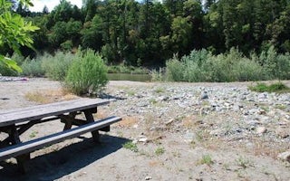
Happy Camp, California
Curly Jack Campground
Overview
Curly Jack Campground is situated along the Klamath Wild and Scenic River near the town of Happy Camp. Visitors enjoy whitewater...
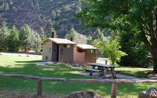
Siskiyou County, California
Tree Of Heaven Campground
Overview
Tree of Heaven Campground is situated next to the Klamath Wild and Scenic River, making it popular with whitewater boaters and a...
Siskiyou County, California
Sarah Totten Campground
Overview
Sarah Totten Campground is located next to the Klamath Wild and Scenic River, about 33 miles east of the town of Happy Camp. The...
Fort Jones, California
Indian Scotty Group Site
Overview
Indian Scotty Group Site is located next to the Wild and Scenic Scott River in Klamath National Forest. Visitors enjoy swimming,...
Jacksonville, Oregon
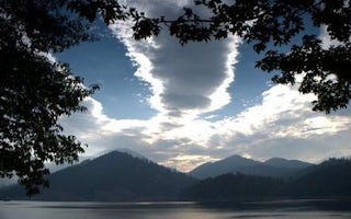
Hart Tish Park At Applegate Lake
Overview
Located in southwest Oregon in the Rogue River-Siskiyou National Forest, Hart-Tish Park is surrounded by a variety of landscapes...
Cave Junction, Oregon
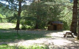
Chinquapin Group Campground
Overview
The Chinquapin Group Campground is located at the former site of the Camp Oregon Caves Civilian Conservation Corps (CCC) camp. D...


