Curly Jack Campground
Book this listing through our partner Recreation Gov
About Curly Jack Campground
Overview
Curly Jack Campground is situated along the Klamath Wild and Scenic River near the town of Happy Camp. Visitors enjoy whitewater boating and fishing on the river, and exploring local hiking trails.Recreation
Fishing, birding, hiking and whitewater boating are popular options, as is scenic driving along the State of Jefferson Scenic Byway. Visitors can access a Class III section of the Klamath River from the campground. The campsite is a put-in and take-out point for whitewater rafting - boats must be carried across a gravel bar.Facilities
The campground offers shaded single family sites, as well as four group sites that can accommodate up to 30 people each. Many sites have a view of the river. Group sites feature a general area for dispersed tent camping and a large gravel parking area for extra vehicles and trailers.Natural Features
The campsground sits at an elevation of 1,075 feet on the banks of the Klamath River opposite the town of Happy Camp. The Klamath National Forest is comprised of a vast array of mountains, streams and lakes straddling the California and Oregon border. The nearly 2-million acre forest includes five wilderness areas, one scenic byway, 200 miles of wild and scenic river and 1,100 miles of hiking and equestrian trails. Elevations range from 450 to 8,900 feet, making for varied topography and diverse plant and animal life.Nearby Attractions
The campground is within walking distance to the town of Happy Camp, where there are restaurants and a grocery store. A whitewater rafting outfitter and several fishing guides are based in Happy Camp.Curly Jack Campground Reviews
Have you stayed here? Be the first to leave a review!
Top Spots in or near Happy Camp
Backpack to Raspberry Lake
Del Norte County, California
1.0
12 mi
/ 1800 ft gain
If you wish to experience the beauty of the Siskiyou Wilderness and avoid the crowds associated with The Devil’s Punchbowl, then consider a visit to Raspberry Lake. Beginning at the Young’s Valley Trailhead (Coordinates: 41.889919, -123.654755), this hike is a great option for those seeking wide mountain views and plenty of fresh air. Starting at 5,400 feet, the trail is a prime example of sub...
Devil's Punchbowl, Six Rivers National Forest
Crescent City, California
4.0
8.33 mi
/ 1660 ft gain
Located in extreme Northern California, the Siskiyou Mountains are the largest sub-range of the Klamath Mountain range and among the most rugged. The Siskiyou Wilderness, designated in 1984, encompasses three national forests: Siskiyou, Klamath and Six Rivers for a total of 182,802 acres. Because it is geologically young, the area saw minimal glaciation during recent ice ages and as a result, t...
Sky High Lakes in the Marble Mountains
Fort Jones, California
5.0
11.88 mi
/ 2070 ft gain
The Marble Mountains are part of the Klamaths, a biologically and geologically diverse range of peaks and ridges often overshadowed by its western neighbors in the Cascades. The Marble Rim is the signature feature of this subrange, a white wall of rock that glimmers in the sun. The nearby Sky High Lakes basin adds to the scenery, making this a great overnight trip, and perhaps an even better mu...
Hike to the Etna Mountain Summit
Etna, California
6 mi
/ 800 ft gain
To start off, you're going to want to navigate to the Etna Summit Trailhead (5956 ft). There's a small parking lot off to the side and we did not need any passes for our overnight trip. Since the summit isn't the main destination for many people in this area, you'll want to follow the Pacific Crest Trail southbound toward Upper Ruffey Lake (6885 feet). It's a relatively easy walk with a steady ...
Smith River Confluence
Crescent City, CaliforniaSmith River Confluence located in Jedediah Redwoods State Park is a great swimming area especially from June to October. From the parking area for the boat launch, follow the trail back toward Nels Christensen Memorial Bridge (aka "Second Bridge").
A rope swing is usually attached to the bridge for added excitement at this swimming hole.
SAFETY:There may be people jumping off rocks at this...
Hike Stout Grove via the Stout Grove Trailhead
Crescent City, California
4.5
0.6 mi
Marked with adequate signage, parking for the Stout Grove Trailhead is off Highland Hill Road, a road through the south end of the park. It's a narrow, dirt road so be cautious traveling through the state park. Pit toilets are available in the parking area.
The trail is a .6-mile loop. It is wide, well-marked, and full of photo-ops. You'll see trees that touch the sky, as well as redwood cross ...
Camping and Lodging in Happy Camp
Siskiyou County, California
Tree Of Heaven Campground
Overview
Tree of Heaven Campground is situated next to the Klamath Wild and Scenic River, making it popular with whitewater boaters and a...
Siskiyou County, California
Sarah Totten Campground
Overview
Sarah Totten Campground is located next to the Klamath Wild and Scenic River, about 33 miles east of the town of Happy Camp. The...
Fort Jones, California
Indian Scotty Group Site
Overview
Indian Scotty Group Site is located next to the Wild and Scenic Scott River in Klamath National Forest. Visitors enjoy swimming,...
Jacksonville, Oregon
Hart Tish Park At Applegate Lake
Overview
Located in southwest Oregon in the Rogue River-Siskiyou National Forest, Hart-Tish Park is surrounded by a variety of landscapes...
Cave Junction, Oregon
Chinquapin Group Campground
Overview
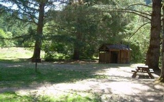
The Chinquapin Group Campground is located at the former site of the Camp Oregon Caves Civilian Conservation Corps (CCC) camp. D...
Jacksonville, Oregon
Squaw Lakes
Overview
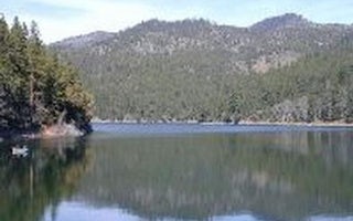
Squaw Lakes Campground is nestled in the deep shade of a mixed-conifer forest on the banks of Squaw and Little Squaw Lakes. The ...
Unfortunately, we don't have up-to date pricing data for this listing, but you can check pricing through Recreation Gov.
Book NowAdd your business today to reach The Outbound's audience of adventurous travelers.
Community
© 2024 The Outbound Collective - Terms of Use - Privacy Policy


