Glendale, California
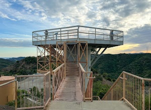
Glendale, California offers a lot of options for those looking for some of the best trails and outdoor activities. From hiking to camping to kayaking, there are plenty of must-visit spots with scenic views. The San Rafael Hills provide a great panorama of the city and the Verdugo Mountains offer fun and exciting hikes. The Glendale Narrows is perfect for kayaking and canoeing. The Glendale Sports Complex offers a great selection of outdoor sports and activities. The nearby Griffith Park provides ample opportunities for hiking, biking, and horseback riding. There are also plenty of picnic spots and other attractions for visitors to enjoy. Whether you're looking for an adventure or a day of relaxation, Glendale, California has something for everyone.
Top Spots in and near Glendale
-
Culver City, California
Culver City Stairs
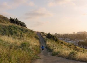
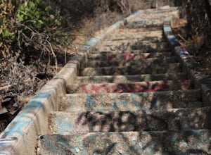
4.11.32 mi / 344 ft gainThe Culver City Stairs are an outdoor staircase designed into the trails leading up to the Baldwin Hills Scenic Overlook. This particular staircase is uniquely constructed to blend into the landscape and is comprised of 282 uneven stairs. The stairs vary in height from 3 inches to nearly 2 ft...s...Read more -
Los Angeles County, California
Idlehour Trail
4.014.89 mi / 4665 ft gainIdlehour Trail located near Mount Wilson, California, is an out-and-back trail that is strenuous and can take 8-10 hours if done all at once. There are opportunities to camp off the trail, making this a backpacking trail in the Angeles National Forest as well. To access the Idlehour Campground ...Read more -
Los Angeles County, California
San Gabriel Peak
4.02.79 mi / 1040 ft gainAt 6,000 feet, San Gabriel Peak gives you one of the best views of the Los Angeles basin on the front range of the San Gabriel Mountains National Monument. As you pass through Muller Tunnel, the trail will be littered with rocks and boulders. A little over 100 feet in, the road will fork in thre...Read more -
Los Angeles County, California
Mt. Disappointment via Billy Riley Trail
3.5 mi / 1132 ft gainFrom the 210 Freeway in La Cañada, take California Highway 2 north 14 miles up into the San Gabriel Mountains. Make sure you have your National Forest Pass (sold at REI or Ranger Station) or your Interagency Pass because they have started checking parked vehicles. At the Red Box Picnic area, make...Read more -
Arcadia, California
Sturtevant Falls
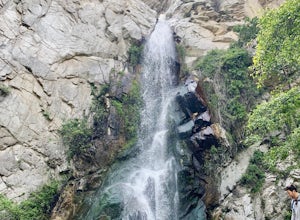
4.61.61 mi / 423 ft gainThis trail is currently closed. Visit the Forest Service website for updates. As you head down to Roberts Camp, a historic set of historic cabins, you’ll head out on a steep, paved road for approximately 0.6 miles. Once you reach the camp, head over the bridge and keep an eye out for the sign f...Read more -
Arcadia, California
Mt. Wilson Loop from Chantry Flat
5.012.74 mi / 4852 ft gainMt. Wilson is one of the more difficult mountains in the San Gabriel to hike, making this adventure Intermediate. While 5,700 feet doesn't seem that tall, the mountain has a prominence of almost 5,300 feet, meaning that hike is steeper and longer than some of the other popular mountains that star...Read more -
Arcadia, California
Hermit Falls Trail
4.82.49 mi / 1014 ft gainNote: Hermit Falls is Temporarily Closed From Roberts Camp, many hikers will head to Sturtevant Falls, which is an amazing 60-foot waterfall. But, if you choose to head in the opposite direction on First Water Trail, you’ll be rewarded with a fresh water swimming hole at this 35-foot tumbling wa...Read more -
Los Angeles, California
Watts Towers
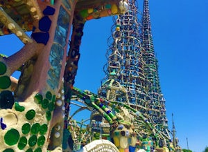
3.0Watts Towers are a quick 15-20 minute ride from Downtown Los Angeles on the Metro. Since I love weird, interesting things, plus the towers are in my backyard, I had to take a trip to check them out! When getting off the train, I half expected to see the towers spiraling off in the distance. After...Read more -
San Fernando, California
Pacoima Park Natural Wash Park
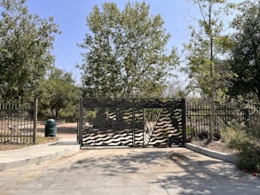
0.54 mi / 13 ft gainPacoima Park Natural Wash Park makes for a wonderful & pleasant walk. The entrance to the park is located at the corner of Newton St and 8th St and runs up to Foothill Blvd in San Fernando California. The park is ADA accessible and allows for dogs on leash. There are also picnic tables and dr...Read more -
Los Angeles, California
Canyonback Nike Loop
4.06.02 mi / 1693 ft gainCanyonback Nike Loop is a loop trail that takes you by a river located near Encino, California.Read more -
Los Angeles, California
Sepulveda Basin: Upstream Of Balboa
4.03.7 mi / 75 ft gainSepulveda Basin: Upstream Of Balboa is a loop trail that takes you by a river located near Encino, California.Read more -
Whittier, California
Sycamore Canyon Trail in Turnbull Canyon
2.03.47 mi / 627 ft gainThe Sycamore Canyon Park Trailhead can be found at the end of the dirt parking lot off Workman Mill Road. The entrance is off a small road which is pretty easy to miss, but there is a sign off the main road. Soon after you start on the trail, the path opens up onto a larger dirt road for vehicle ...Read more -
Los Angeles, California
Murphy's Ranch
4.83.21 mi / 679 ft gainThis three-mile out-and-back hike begins at the beginning of a very nice neighborhood in Santa Monica. You will be trekking on a dirt road for about 1.5 miles until you reach some stairs that will be visible on your left-hand side. You will need to descend down those (what seem to be never-ending...Read more -
Monrovia, California
Monrovia Falls
3.71.46 mi / 459 ft gainMonrovia Falls is closed indefinitely due to the Bobcat Fire and mudslides. Read more on the CityofMonrovia.org website. The Monrovia Falls are at the end of the main trail located in Monrovia Canyon Park. The park is easy to locate and has ample parking. Keep in mind you do have to pay a fee of...Read more -
1501 Will Rogers State Park Road, California
Backbone Trail via Will Rogers State Park
5.03.02 mi / 656 ft gainYou'll make your way up Will Rogers State Park Road, located just minutes from Santa Monica, Brentwood, Westwood, Malibu, Palisades, and much of west Los Angeles. Once on the road, head all the way to the top and you'll dead end into the parking lot. Always worth supporting State Parks with the p...Read more -
Los Angeles, California
Inspiration Point Loop Trail
2.36 mi / 486 ft gainThe Inspiration Point 2.3 mile loop hike in Will Rogers State Park is a family-friendly hike or after-work run near Los Angeles, California. It’s a great dirt trail for all skill levels and features scenic views and beautifully budding wildflowers. You’ll get to escape the city and take in the br...Read more

