Fairfax, California
Looking for the best hiking in Fairfax? We've got you covered with the top trails, trips, hiking, backpacking, camping and more around Fairfax. The detailed guides, photos, and reviews are all submitted by the Outbound community.
Top Hiking Spots in and near Fairfax
-
Daly City, California
San Bruno Mountain
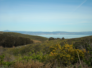
4.03.63 mi / 781 ft gainSan Bruno Mountain is a fun, mellow hike that climbs easily on a well-graded path to the ridge line, and then drops back to the trailhead. Along the way, the trail runs along a creek, ascends through chaparral, and provides excellent views of downtown San Francisco, the East Bay hills, and the Sa...Read more -
San Francisco, California
San Francisco Crosstown Trail
5.016.71 mi / 1975 ft gainThe San Francisco Crosstown Trail runs point-to-point from Candlestick Point to Land End. The SF Crosstown Trail officially opened in 2014. It connects park trails to neighborhoods and communities. In it's in entirety it's almost 17 miles long with 5 Sections available for those looking to bre...Read more -
Daly City, California
Mussel Rock Loop
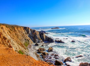
4.01.95 mi / 322 ft gainMussel rock, a three-story, 50 million year old rock that has been carried some 500 miles northwest from Southern California, is where the San Andreas fault meets the Pacific Ocean. It's also an excellent spot to drink some wine and catch a sunset. From San Francisco, take Highway 1 south towar...Read more -
Oakland, California
Sibley Volcanic Trail Labyrinths
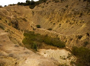
3.52 mi / 144 ft gainFrom Skyline Blvd, pull into the staging area for Sibley Volcanic Regional Preserve, you'll see the sign. Parking here is usually easy to find. You'll find an unstaffed visitor center with a restroom, park maps and informational displays featuring the history and geology of the park. Sibley is a...Read more -
Inverness, California
Watch the Sunset at Point Reyes Lighthouse
3.7From San Francisco, drive north over the Golden Gate Bridge and onto the scenic Route One. Plan to spend a full day on the round trip if you're going for the first time; along the drive, you'll most likely want to stop every ten minutes to check out the charming seaside towns or the stunning coas...Read more -
Inverness, California
Tomales Point Trail
4.79.47 mi / 1165 ft gainThis hike will take you through the Tule Elk Preserve in Point Reyes Nation Seashore, and offers fantastic views of Bodega and Tomales Bay, as well as the Pacific Ocean. Start at the Tomales Point Trailhead near the Historic Pierce Point Ranch. Follow the trail for roughly three miles. This trai...Read more -
Inverness, California
McClures Beach
1.44 mi / 243 ft gainThis beach is really easy to get to. Just follow Pierce Point Road until you see the sign to the beach. It's an easy hike down from the parking lot. There is very little shade, so make sure to bring some sunscreen. Be extremely cautious with getting into the water. There is likely underwater cu...Read more -
Oakland, California
East & West Ridge Loop
4.53.47 mi / 833 ft gainTucked away in the hills of Oakland, you will find one of the homes of California's Coastal Redwoods. Created by a unique geographical circumstance, this forest breathes winds funneled through the Golden Gate across the bay, which created environment opportune for Redwood growth. These Redwoods a...Read more -
Santa Rosa, California
Hike Crane Creek Regional Park
4.03.5 miWith multiple loops of varying length, this park is great for anyone looking for a casual hike around a beautiful area in the foothills of Rohnert Park. Crane Creek has nice secluded picnic areas next to the creek in the cover of willow, alder, buckeye and bay trees. There's also an 18-hole disc ...Read more -
Martinez, California
Muir Farm And Mount Wanda: John Muir Nature Trail
2.59 mi / 512 ft gainMuir Farm And Mount Wanda: John Muir Nature Trail is a loop trail located near Martinez, California.Read more -
Pacifica, California
Milagra Overlook Trail
5.02.51 mi / 558 ft gainFound this hike with some friends after spending some time googling in my car when we were in the area looking for a quick hike with a view! Dog friendly Free parking (but quite limited) Ocean views Known to have gorgeous wildflower blooms (we were not there during this)Porta-potty type toilet...Read more -
Lafayette, California
Lafayette Reservoir via Nature Area Rim Trail
5.05 mi / 758 ft gainLafayette Reservoir is perfect for canoeing, mountain biking, trail running, and hiking. The Reservoir trail system is also used for nature walks and birding. The loop has several high points that have amazing views. The trails become very muddy after wet weather - so tread with caution. Th...Read more -
Glen Ellen, California
Sonoma Ridge Trail
9.2 mi / 1955 ft gainSonoma Ridge Trail is a beautiful 9.2-mile out-and-back hike located near Glen Ellen, California. This hike is moderately difficult, with about 1955 feet in elevation change. 95% of the trail is covered in forest shade. Important Notes:Bikes and Horses are permitted on the trails. Dogs are NOT p...Read more -
Glen Ellen, California
Wolf House in Jack London SP
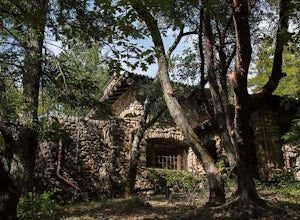
There is a museum in "The House of Happy Walls" which Mrs. London built in redwood grove find park information, exhibits and a small sales area there. A nearby trail leads to Jack London’s grave and to the remains of "Wolf House," London’s dream house which was destroyed by fire in 1913. The par...Read more -
Oakland, California
Hike Redwood Regional Park via the Dunn Loop
5.03.6 mi / 606 ft gainThe Redwood Regional Dunn Loop is just outside of Oakland, and can be reached from anywhere in the Bay Area for a fun day or half-day trip. The trail is open year-round. In the spring, wildflowers are abundant. The trail has a great mix of sun and shade. Dogs are allowed, but must be kept on leash.Read more -
Napa, California
Westwood Hills Park Loop
4.02.12 mi / 476 ft gainThis park can get a little crowded on weekends, so best to go early if possible. In terms of parking, there's a lot at the trailhead, but also plenty of available street parking. The loop can be broken up in a various ways as there are several offshoots from the main trailhead/trail leaving fro...Read more

