Encinitas, California
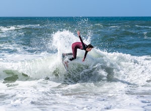
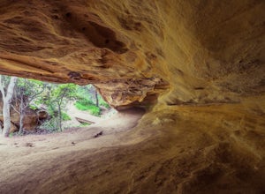
One of the top outdoor adventures in Encinitas, California, is hiking the Annie's Canyon Trail. This must-visit trail is known for its unique sandstone walls and narrow passages. It's a moderate difficulty trail, making it suitable for most fitness levels. Along the trail, you'll see the San Elijo Lagoon, a vibrant ecosystem home to various bird species. If you're into mountain biking, the Manchester Preserve is a great spot with miles of dirt trails and stunning views of the Pacific Ocean. For those interested in water activities, Moonlight Beach is a popular spot for surfing and swimming. In conclusion, Encinitas is packed with scenic outdoor activities and attractions, from hiking and biking trails to beaches, making it a top destination for outdoor adventures.
Top Spots in and near Encinitas
-
Lake Elsinore, California
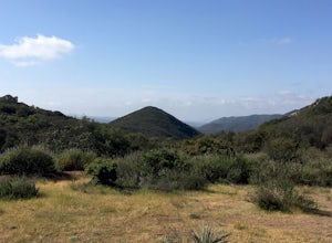
Sitton Peak
9.36 mi / 2011 ft gainIt's amazing what you can find in your own backyard if you really do you research. In Orange County there are so many awesome hiking options that are often overlooked. The Bear Canyon to Sitton Peak Trail in the San Mateo Wilderness is one of those. Sitton tops out at 3,273 feet and it's a 5 mil...Read more -
Warner Springs, California
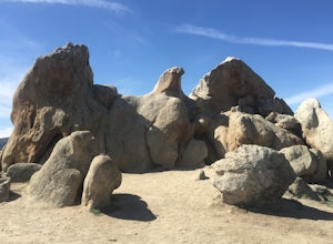
Eagle Rock via the Pacific Crest Trail
5.06.2 mi / 807 ft gainWith doing more hikes in the SoCal area, I've realized half the battle is just trying to find the damn trailhead.Technically you have 2 ways to enter this trail ... Start from 79 and add a very enjoyable extra 3ish miles, or start from the Warner Springs Fire Station, for a total 7 mile hike.We c...Read more -
Laguna Beach, California
Laguna Beach Caves
3.8Explore some beautiful caves right on the beach in Laguna. The stairs leading down to the beach are just off the side of PCH at 9th st. You can park anywhere along the PCH on both sides near 9th st. Head down the stairs and the main caves are on the left. To the right there are also some small c...Read more -
Laguna Beach, California
Skimboard Table Rock Beach
Laguna Beach is both the birthplace *and* and the capital of skimboarding, and for good reason: it boasts an impressive array of beaches where (if you know where to look) you can find one where the conditions are right for one of the most difficult but rewarding of water sports. Table Rock is one...Read more -
Laguna Beach, California
Aliso Peak via the Valido Trail
5.01.14 mi / 325 ft gainThe Valido Trail trailhead can be found just off West street off the Pacific Coast Highway, just south of Aliso Beach. Park on West Street past the trailhead. The trail proceeds approximate .5 miles till it intersects with the Aliso Peak Trail. Go left .4 miles to the obvious summit and wooden p...Read more -
Julian, California
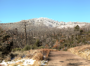
Hike Cuyamaca Peak
4.55.5 mi / 1700 ft gainThis peak is one of the tallest in the county. Reaching the summit of the peak takes you to an elevation of 6500'. Although this peak isn't as challenging as others nearby, it's located in the center of San Diego, which offers up amazing views, which is the main reason to take this hike. The best...Read more -
Julian, California
Hike Stonewall Peak
4.73.82 mi / 820 ft gainThis hike is one of the most popular in the Cuyamaca Rancho State Park. When you reach Stonewall Peak's summit, enjoy the view of the surrounding park and nearby Lake Cuyamaca. The hike up the east side is a popular and relatively easy trail. Although you'll be gaining 800 feet, the hike is relat...Read more -
Descanso, California
Green Valley Falls
5.00.36 mi / 98 ft gainGreen Valley Falls is an out-and-back trail that takes you by a waterfall located near Descanso, California.Read more -
Laguna Beach, California
Bodysurf at Aliso Beach
5.0This wave is super fun to bodysurf and shoot photos of when there is a swell. It is a shorebreak so be careful of shallow water and little rocks. It usually isn't too crowded especially on weekdays. Bring your fins and a smile and you have a good time.Read more -
Laguna Niguel, California
Kick Back at Laguna Niguel Regional Park
This is an awesome tucked away little adventure that will have you occupied all day! With plenty of picnic tables you can be sure to have your own privacy tucked into a corner free from other people. Grab a lake side picnic table or even the numerous ones around the grass fields, they are all won...Read more -
Laguna Beach, California
Explore Laguna Beach's Pirate Tower
4.4To find this little hidden treasure, put Victoria Beach into your phone as your destination and park for free on S Coast Highway anywhere between Sunset Terrace, McAulay Place, or Victoria Drive. Make your way down any of these streets toward the beach and you will see stairs going down at the en...Read more -
Laguna Niguel, California
Dripping Cave in the Aliso & Wood Canyons Wilderness
4.47.68 mi / 889 ft gainDripping Cave sits tucked away in a corner of Wood Canyon, part of the Aliso and Wood Canyons Wilderness Park, and the trail to the cave, while short, requires *at least* a 2.25 mile hike in from the nearest trailhead (West Ridge Trail to Mathis Canyon), though this is less than ideal as that rou...Read more -
Lake Elsinore, California
Ride the San Juan Trail
4.511 mi / 3400 ft gainThe San Juan Trail is located off the Ortega Highway (Hwy 74) in Southern Orange County. It is done frequently as a long, 11 mile climb that is rewarded by an almost continuous descent of 3400ft. The out-and-back trail head is back Hot Spring Canyon Rd from the San Juan Fire Station. It can also ...Read more -
Laguna Beach, California
Exploring Pearl Street Beach's Arch Rock
4.0Pearl Street Beach is a great spot to just chill and watch (and photograph) the sunset with friends and family. Parking for the beach can be found on S. Coast Hwy (the 1) and is meter parking. There is also free, but limited parking available along the smaller streets closer to Pearl Street Beach...Read more -
Laguna Beach, California
Surf Brooks Street Beach
5.0Brooks Street Beach is just a couple of blocks off the Pacific Coast Highway in Laguna Beach. Parking can be tricky, so be forewarned that you may need to walked a few blocks. Winter can be good, but during the summer and big south swells are when you want to go surfing, so be sure to check out ...Read more -
Laguna Beach, California
West Ridge to Car Wreck Trail and Mathis Canyon Loop
4.53.31 mi / 856 ft gainThere are numerous ways to incorporate the Car Wreck trail into a larger loop through the Laguna Coast Wilderness and Aliso Canyon Park, but a common route is to begin at Alta Laguna Park at "Top of the World" in Laguna Beach. Take the West Ridge Trail .5 miles, bearing right onto the marked Car...Read more

