Discovery Bay, California
Looking for the best running in Discovery Bay? We've got you covered with the top trails, trips, hiking, backpacking, camping and more around Discovery Bay. The detailed guides, photos, and reviews are all submitted by the Outbound community.
Top Running Spots in and near Discovery Bay
-
San Francisco, California
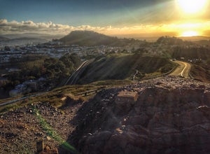
Twin Peaks Loop
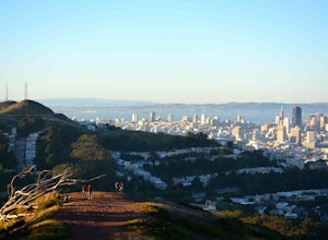
4.02.04 mi / 259 ft gainThere are a ton of ways to get here (and obviously that can affect the total distance) but this is starting from Clarendon. Follow along up Twin Peaks boulevard where you'll see the peaks upon your approach. Keep an eye out for traffic as there may be visitors driving toward and away from Twin Pe...Read more -
San Francisco, California
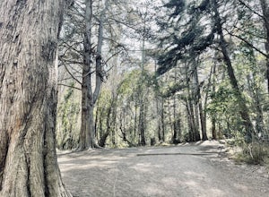
Presidio Ecology Trail
5.01.82 mi / 427 ft gainPresidio Ecology Trail is a loop trail through the Presidio located near San Francisco, California. This loop can be started at the Upper Ecology Trail off of Arguello Blvd near Pacific or down at the Lower Ecology Trail near the Inn at the Presidio. This trail is dog friendly on-leash.Read more -
San Francisco, California
Twin Peaks and Mt. Sutro Loop
4.26 miAre you thinking, hit up two of the bigger peaks in SF, what a great idea? Well, you thought right! The first mile and a half is uphill as you charge to the top of Twin Peaks. This 6% grade leads to a 460 ft elevation gain. The good news is, if it's not foggy, the views of the bay are stunning, e...Read more -
San Francisco, California
Presidio Bay Area Ridge Trail
5.02.73 mi / 203 ft gainPresidio Bay Area Ridge Trail is a point-to-point trail where you may see wildflowers located near San Francisco, California.Read more -
San Francisco, California
Presidio Loop
5.95 mi / 823 ft gainThis route starts and ends on Jackson street in the Presidio Terrace neighborhood of San Francisco. This loop can be started in several areas of the Presidio including off of the Lyon street steps, but this starting point creates a good midpoint of the loop. Along the route, be sure to keep an ...Read more -
Belmont, California
Hike San Mateo's Sugarloaf Mountain
5.01.5 mi / 500 ft gainSugarloaf is tucked away in Laurelwood Park which is located in a residential neighborhood right off of Hwy 92 in San Mateo, making this a great hiking & trail running option for Peninsula residents.I always park on Glendora Dr. and follow the paved path down towards the playground. At the bo...Read more -
Napa, California
Westwood Hills Park Loop
4.02.12 mi / 476 ft gainThis park can get a little crowded on weekends, so best to go early if possible. In terms of parking, there's a lot at the trailhead, but also plenty of available street parking. The loop can be broken up in a various ways as there are several offshoots from the main trailhead/trail leaving fro...Read more -
San Francisco, California
Fairy Gates Trail
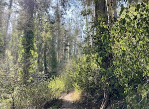
5.00.89 mi / 328 ft gainFairy Gates Trail is an out-and-back trail that takes you through a nice forest located near San Francisco, California.Read more -
Palo Alto, California
Hike the Arastradero Preserve Loop
3.04.5 mi / 600 ft gainGetting There: From Hwy 280, take the Page Mill Road exit and head West on Page Mill Road, away from Downtown Palo Alto (if you're taking 101, exit on Oregon Expressway). Then turn right on Arastradero Road. There will be a small sign indicating the dirt parking lot on the eastern side of the str...Read more -
Redwood City, California
Hike the Pulgas Ridge Open Space Preserve Loop
3.75.5 mi / 1000 ft gainGetting there: exit Highway 280 at Edgewood Road, travel .75 miles east, turn left on Crestview Drive, then immediately left again on Edmonds Road.Once parked, there are several different path options through the park. All of them connect in a large loop, and return to the parking lot. The Cordil...Read more -
San Francisco, California
Mount Davidson
4.51.03 mi / 299 ft gainMount Davidson Park is located in the southwestern part of the city nestled between Diamond Heights and Portola Dr. The climb isn't too difficult, but to reach the top of the 928ft summit, you should wear close-toed shoes and be ready for some loose gravel or mud if it's been raining. The hike is...Read more -
Tiburon, California
Bouldering at Ring Mountain
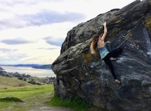
0.5 mi / 400 ft gainItching to climb outdoors near San Francisco? With only a quick drive from the city, Ring Mountain is a beautiful nature preserve overlooking the city of San Francisco offering two main rock formations, Turtle Rock (Pictured) and Split Rock. Split Rock is the slabby rock south of the parking ar...Read more -
San Francisco, California
Run to Hopper's Hands
4.6Hundreds of people touch Hopper's Hands every day as a turn-around point on their runs in and around Crissy Field and The San Francisco Bay Trail. Running west through Crissy Field, passing the Warming Hut and pier, you follow Marine Drive until you dead end at Fort Point. If you continue through...Read more -
San Jose, California
Explore Santa Teresa County Park
4.58.3 mi / 2053 ft gainThe Santa Teresa County Park loop is perfect for wildlife viewing! Be ready to see deer, coyote, hawks, turkeys, pigs and cows. The trail is rated as moderate - be cautious with mud if you are visiting the park after a rain shower. Dogs are allowed in the park, but must be kept on leash. There i...Read more -
Sand Ladder, California
Baker Beach Sand Ladder
4.40.25 mi / 138 ft gainThe Baker Beach Sand Ladder is a section of the Pacific Coast Trail that is comprised of 200 ten foot poles tied together to form stairs down to North Baker Beach from Lincoln Blvd. If you’re looking for a lung and butt-busting workout, and you’d like a break from your standard routine, you need...Read more -
San Francisco, California
Stow Lake And Strawberry Hill
4.92.09 mi / 253 ft gainStrawberry Hill is one of the hidden gems of Golden Gate Park. It is named after the once abundant strawberry fields that inhabited the island. The hill, which reaches up to 430ft, is located in the middle of Stow Lake and has 2 foot bridges for access. This is a great place to run if you're look...Read more

