Dana Point, California
Looking for the best photography in Dana Point? We've got you covered with the top trails, trips, hiking, backpacking, camping and more around Dana Point. The detailed guides, photos, and reviews are all submitted by the Outbound community.
Top Photography Spots in and near Dana Point
-
Temecula, California
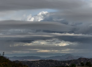
Dripping Springs Trail
4.013.68 mi / 3287 ft gainThe trail immediately begins to climb out of the campground on a well-graded incline. The next mile contains some climbing leading to a set of switchbacks. A long strenuous climb ensues until the 3200' elevation is reached. The trail then makes an easy southward traverse to the basin before resum...Read more -
Riverside, California
Hike Two Trees Trail
2.5 mi / 977 ft gainParking is free at the trailhead, but there is only room for approximately five cars. The trailhead is on the edge of a neighborhood, so you can park there if needed. From the parking lot, head west, and immediately veer right and across the bridge. If you go left at the first fork, you can stay ...Read more -
Whittier, California
Sycamore Canyon Trail in Turnbull Canyon
2.03.47 mi / 627 ft gainThe Sycamore Canyon Park Trailhead can be found at the end of the dirt parking lot off Workman Mill Road. The entrance is off a small road which is pretty easy to miss, but there is a sign off the main road. Soon after you start on the trail, the path opens up onto a larger dirt road for vehicle ...Read more -
Escondido, California
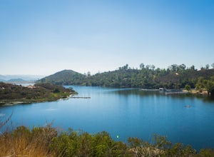
Camp at Dixon Lake
2.1 mi / 295 ft gainDixon Lake is Escondido's best kept secret! A man-made reservoir located right next to Daley Ranch, Dixon Lake offers overnight camping, boat rentals, fishing, and hiking, along with picnic areas, a kids park, and more. The campground is open year-round and is located next to the lake with a lof...Read more -
Rancho Palos Verdes, California
Abalone Cove Shoreline Park
4.3Abalone Cove Shoreline Park is a Palos Verdes gem. This 64-acre reserve is a state ecological preserve. There is something for everyone here, whether you want to relax and lay out or be adventurous and swim across channels to get to sea caves. The large parking area is very easy to find and costs...Read more -
Rancho Palos Verdes, California
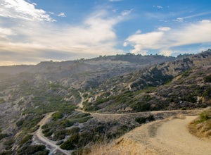
Burma Road Trail & Ishibashi Trail Loop
4.35.09 mi / 1148 ft gainGetting There: The easiest way to get to Portuguese Bend Nature Reserve is by following Crenshaw Boulevard up Rancho Palos Verdes to the very end of the street. You can park on either side of the street near Del Cerro Park, which also happens to be a great place for picnics if you want to eat bef...Read more -
Del Mar, California
Sunset Seat in Del Mar
3.8In a place in our country where you can take an epic sunset picture nearly everyday, its hard say there is one location tin San Diego that is better than another. I'll let you in my new favorite secret spot to take amazing sunset pictures with a cool piece of art work at the location. Visit the t...Read more -
Rancho Palos Verdes, California
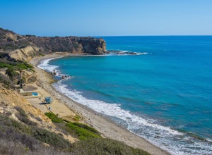
Terranea Beach Sea Cave
4.31.63 mi / 210 ft gainHead to the Pelican Cove parking lot where there’s plenty of free parking right at the trailhead. From the parking lot, take the Terranea Beach Trail and you will see views of the Point Vicente Lighthouse down the coast to your right. Continue on the trail through the luxury Terranea Resort whic...Read more -
Rancho Palos Verdes, California
Pelican Cove
0.38 mi / 95 ft gainGetting There Coming from San Pedro, make a U-turn at the Hawthorne Boulevard stoplight onto Palos Verdes Drive South. From here, you can access the parking lot for Pelican Cove, where you'll get a 120° view of the ocean. It might be tempting to take in the sunset from the car, but you should def...Read more -
San Diego, California
Guy Fleming Trail
5.00.76 mi / 95 ft gainThis trail is located in Torrey Pines State Natural Reserve, a beautiful area about 20-30 minutes north of San Diego. To access the reserve, park in the lot off of North Torrey Pines Road (pay $10 to park). If you don't want to walk up the huge hill at the beginning (it is steep and long), I beli...Read more -
Escondido, California
Bernardo Mountain Summit Trail
5.07.15 mi / 1060 ft gainBernardo Mountain is located on the Coast to Crest Trail in San Dieguito River Park. The 7.15-mile out-and-back trail to the 1060 ft. summit starts on the east side of I-15. It's a relatively easy hike all the way to the top. It picks up a little once you make it to the Summit Trail junction, wh...Read more -
San Diego, California
Torrey Pines Beach Trail Loop
4.72.15 mi / 374 ft gainThe beach trail brings you from the parking lot across the lodge from the bluff down to the beach. You can choose to visit the Red Butte, the Razor Point, and the Yucca Point trails along the way. Of the other trails, this trail seems to provide a complete walkthrough of geological features; it a...Read more -
San Diego, California
Razor Point, Beach Trail, & Broken Hill Trail Loop
5.03.21 mi / 440 ft gainThe parking area for all of Torrey Pines State Natural Reserve is located right off North Torrey Pines Road (where the location is for this hike), about 20-30 minutes north of San Diego. It's $10 to park, and there was also a smaller parking lot at the top of the hill if you want to avoid the ini...Read more -
Avalon, California
Camp at Catalina's Two Harbors
4.8An island camping escape is a mere 50 minute boat ride away from the southern California coast. If you're feeling generous with your funds, you can also opt for a helicopter ride, leaving out of Long Beach and 15 minutes later landing in Catalina Island.Two Harbors campground is unique with the a...Read more -
La Verne, California
Marshall Canyon Trail
4.05.99 mi / 722 ft gainFor this adventure you can choose to start in a multiple of places; for the easiest parking use Oak Mesa Park located next to Oak Mesa Elementary School. From the parking lot cross the soccer field towards the bridge on the north east end of the school. Once across the bridge follow Los Robles ea...Read more -
Avalon, California
Visit Two Harbors, Catalina Island
5.0Just 30 miles from the commotion and congestion of Los Angeles, is a small island village that time seems to have left behind. You won't find the usual traffic, development, and big crowds here. You won't find movie theaters, concert venues, hotels, nightclubs, or sporting events either. At Cata...Read more

