Daly City, California
One of the top outdoor adventures in Daly City, California is the Mussel Rock Park Trail. This 2.5-mile hiking trail offers panoramic views of the Pacific Ocean and is known for its unique geological features. The trail winds past the namesake Mussel Rock, a rock formation jutting out into the ocean, and the trail itself is a mix of sandy beach and rugged cliffside paths. While hiking, you may even spot paragliders launching from the hilltops. If you're looking for a scenic and moderately challenging hike, the Mussel Rock Park Trail is a must-visit. For a more leisurely outdoor activity, visit Lake Merced. This freshwater lake near Daly City is perfect for fishing, boating and bird watching. The best Trails and Outdoor Activities are waiting for you in Daly City.
Top Spots in and near Daly City
-
Muir Beach, California
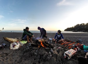
Bonfire at Muir Beach
5.0Take in a scenic sunset and enjoy the warmth of a bonfire on the beach! Muir Beach changes the number of fire pits it has seasonally. May through November, the beach offers 6 fire pits, and in the colder months (December through April), there are 3 fire pits on the beach toward the south end of t...Read more -
Muir Beach, California
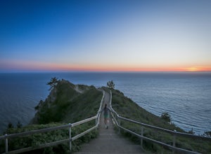
Muir Beach Overlook
4.9The Muir Beach Overlook is one of the most convenient spots to take in an amazing view of the entire coastline, and one of the best places to catch a dramatic sunset. It’s conveniently located one mile north of Muir Beach and parking is easy. It’s a 5 minute walk down the trail to the Overlook. O...Read more -
Muir Beach, California
Owl Trail
5.01.2 mi / 300 ft gainThe Owl Trail runs between Slide Ranch and the Muir Beach Overlook and is a great way to take in the breathtaking views, flora and fauna of the Northern California coast. The easiest way to access the trail is to park at the Muir Beach Overlook and to take the trail down to Slide Ranch and then...Read more -
Moss Beach, California
Fitzgerald Marine Reserve
5.00.89 mi / 46 ft gainLocated beside a residential neighborhood, Fitzgerald Marine Reserve offers a rare glimpse of life in the northern California intertidal zones. There are parking spaces and restrooms available, as well as ranger-led guided tours. Be sure to check the tide charts and go during low tide (preferab...Read more -
Moss Beach, California
Cypress Tree Tunnels at Moss Beach
4.50.79 mi / 105 ft gainThe Cypress Tree Tunnels are a quick jaunt from San Francisco (22 miles) and make for a great half-day trip. Getting here depends on traffic, but 30 minutes from the center of the city is doable. Parking is relatively easy. You can either park at the south end of the area at the Cypress Cove entr...Read more -
San Mateo County, California
Run Sawyer Camp Trail
5.012 mi / 300 ft gainThe Sawyer Camp Trail is a popular paved trail that stretches alongside the Crystal Springs Reservoir all the way to Hillcrest Blvd. The sixth mile crosses over the San Andreas Dam with nice views of San Andreas Lake.There are markers every half mile which makes timing and tracking your run easy....Read more -
Moss Beach, California
Pillar Point Bluff Loop
4.71.84 mi / 154 ft gainSitting on a 140 acre bluff top, the Pillar Point Bluffs are a simple, easy hike with breathtaking views throughout. The bluffs are 22 miles from San Francisco – a 30 minute drive depending on the traffic. There is a small 10 car or so parking lot off of Airport Blvd, but there are two additional...Read more -
Half Moon Bay, California
Paddle Half Moon Bay Jetty
The Half Moon Bay Jetty is a calm place to paddle as it is covered on all sides. There is an opening into the ocean on the far side, but is mostly calm with plenty of beach area to launch. Keep in mind, there are boats in the harbor so keep an eye out. There is also a scenic hike nearby the West ...Read more -
Mill Valley, California
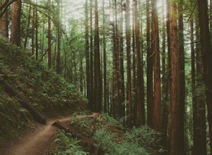
Canopy, Panoramic, Redwood Trail, Sun, Dipsea Trail Loop
4.74.31 mi / 1145 ft gainWhile there are other, less crowded redwood groves in the Bay Area, Muir Woods National Monument is easily one of the best. It is a beautifully maintained site, with wooden footpaths meandering between towering redwoods that are between 600 – 800 years old. It’s home to some true giants, with its...Read more -
Half Moon Bay, California
Catch the Sunset at Maverick's Beach
5.01 miMaverick's beach is most well-known for the Maverick surf competition and the gnarly waves which surface here in the winter months. For the rest of the year, the beach is still a site to see. With huge waves crashing ¼ mile off shore and bluffs towering 100 feet above you, it’s a picturesque plac...Read more -
Tiburon, California
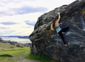
Bouldering at Ring Mountain
0.5 mi / 400 ft gainItching to climb outdoors near San Francisco? With only a quick drive from the city, Ring Mountain is a beautiful nature preserve overlooking the city of San Francisco offering two main rock formations, Turtle Rock (Pictured) and Split Rock. Split Rock is the slabby rock south of the parking ar...Read more -
Foster City, California
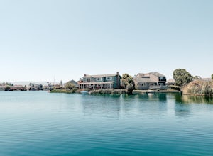
Paddle the Foster City Lagoon
The Foster City Lagoon is one of the most calm waters to paddle on. This is a great spot for beginners to learn how to paddleboard for the first time. The lagoon gets very still and makes it the perfect spot for reflection photos. On sunny days, there are many kayakers, SUP, small boats, and ev...Read more -
Belmont, California
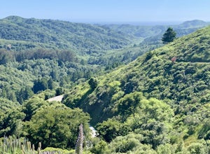
Hike San Mateo's Sugarloaf Mountain
5.01.5 mi / 500 ft gainSugarloaf is tucked away in Laurelwood Park which is located in a residential neighborhood right off of Hwy 92 in San Mateo, making this a great hiking & trail running option for Peninsula residents.I always park on Glendora Dr. and follow the paved path down towards the playground. At the bo...Read more -
Mill Valley, California
Dipsea Trail
4.613.03 mi / 3701 ft gainThe Dipsea Race is the 2nd oldest foot race in the US. The race is named after the Dipsea Inn at the end of the trail at Stinson Beach. The good news is that you can enjoy this scenic trail and its sweeping ocean views at your leisure. The bad news is that the race is only one-way. If you choose,...Read more -
Corte Madera, California
Ring Mountain Loop
4.02.65 mi / 597 ft gainRing Mountain Open Space is an easy but uphill trail that take you to the top where you can explore more trails. Take the 101 exit for Paradise Dr in Corte Madera, follow the road, and park on the side of the road once you pass Westward Dr. Even though there are many places to start the trail fo...Read more -
Stinson Beach, California
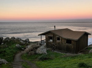
Steep Ravine Cabins
5.0Although these cabins are bare bones, lacking both water and electricity, they couldn't put you in a better spot for views of the Pacific Ocean. From your cabin, you can enjoy amazing sunsets, possibly whale watching, and access to trails like the cabin's namesake, Steep Ravine Trail. The cabins...Read more

