Corte Madera, California
Looking for the best hiking in Corte Madera? We've got you covered with the top trails, trips, hiking, backpacking, camping and more around Corte Madera. The detailed guides, photos, and reviews are all submitted by the Outbound community.
Top Hiking Spots in and near Corte Madera
-
Half Moon Bay, California
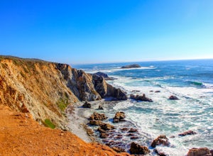
Catch the Sunset at Maverick's Beach
5.01 miMaverick's beach is most well-known for the Maverick surf competition and the gnarly waves which surface here in the winter months. For the rest of the year, the beach is still a site to see. With huge waves crashing ¼ mile off shore and bluffs towering 100 feet above you, it’s a picturesque plac...Read more -
Inverness, California
Tomales Point Trail
4.79.47 mi / 1165 ft gainThis hike will take you through the Tule Elk Preserve in Point Reyes Nation Seashore, and offers fantastic views of Bodega and Tomales Bay, as well as the Pacific Ocean. Start at the Tomales Point Trailhead near the Historic Pierce Point Ranch. Follow the trail for roughly three miles. This trai...Read more -
Santa Rosa, California
Hike Crane Creek Regional Park
4.03.5 miWith multiple loops of varying length, this park is great for anyone looking for a casual hike around a beautiful area in the foothills of Rohnert Park. Crane Creek has nice secluded picnic areas next to the creek in the cover of willow, alder, buckeye and bay trees. There's also an 18-hole disc ...Read more -
Inverness, California
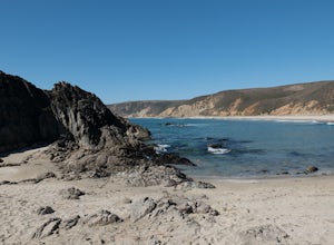
McClures Beach
1.44 mi / 243 ft gainThis beach is really easy to get to. Just follow Pierce Point Road until you see the sign to the beach. It's an easy hike down from the parking lot. There is very little shade, so make sure to bring some sunscreen. Be extremely cautious with getting into the water. There is likely underwater cu...Read more -
Napa, California
Alston Park Loop Trail
2.76 mi / 184 ft gainAlston Park Loop Trail, located in Napa, California, is a 2.76-mile loop trail that offers a moderate level of difficulty for hikers. The trail is primarily used for hiking, walking, and running and is accessible year-round. The trail is well-maintained and clearly marked, making it suitable for ...Read more -
Glen Ellen, California
Sonoma Ridge Trail
9.2 mi / 1955 ft gainSonoma Ridge Trail is a beautiful 9.2-mile out-and-back hike located near Glen Ellen, California. This hike is moderately difficult, with about 1955 feet in elevation change. 95% of the trail is covered in forest shade. Important Notes:Bikes and Horses are permitted on the trails. Dogs are NOT p...Read more -
Glen Ellen, California
Wolf House in Jack London SP
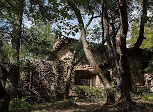
There is a museum in "The House of Happy Walls" which Mrs. London built in redwood grove find park information, exhibits and a small sales area there. A nearby trail leads to Jack London’s grave and to the remains of "Wolf House," London’s dream house which was destroyed by fire in 1913. The par...Read more -
Belmont, California
Hike San Mateo's Sugarloaf Mountain
5.01.5 mi / 500 ft gainSugarloaf is tucked away in Laurelwood Park which is located in a residential neighborhood right off of Hwy 92 in San Mateo, making this a great hiking & trail running option for Peninsula residents.I always park on Glendora Dr. and follow the paved path down towards the playground. At the bo...Read more -
Glen Ellen, California
Corridor Ridge Loop Trail
4.02.48 mi / 289 ft gainCorridor Ridge Loop Trail is a loop trail where you may see wildflowers located near Glen Ellen, California.Read more -
Clayton, California
Hike Mt. Diablo
4.413 mi / 3323 ft gainMt. Diablo has some of the most expansive views in California, despite it's relatively low peak elevation. It played a large role in the surveying the Bay Area during its early discovery. Getting There: To get to the staging area, take Interstate 80 to I-680 to Highway 4. Exit at Railroad Bouleva...Read more -
Half Moon Bay, California
Hike Along the Half Moon Bay Coastal Trail
4.65 mi / 104 ft gainStart at the visitor center along Kelly Avenue. Take note that the day parking fee is $10 in 2016 for each vehicle. You will then be able to enjoy both the Coastside Trail and Francis Beach (plus other beaches) with access to the amenities such as coin-operated showers and a semi-private beach.Th...Read more -
Walnut Creek, California
Camp at Juniper Campground in Mount Diablo SP
Mount Diablo's summit in Mount Diablo State Park rises to 3,848ft, with Juniper Campground in Mount Diablo SP is at approximately 3,000ft in elevation. Juniper Campground overlooks the valley below and some of the San Francisco Bay. Reservations for Juniper Campground can be made at Reserveamer...Read more -
Walnut Creek, California
Juniper to the Summit Loop Trail and Meridian Ridge
6.56 mi / 2037 ft gainJuniper to the Summit Loop Trail and Meridian Ridge is a loop trail that is strenuous located near Diablo, California.Read more -
Clayton, California
Hike the Waterfalls of Mount Diablo Loop Trail
5.06 mi / 1627 ft gainWinter and spring rains create scenic waterfalls in this hike at Mount Diablo, the East Bay's signature peak. Be careful hiking immediately post-rain, watch for slippery sections of mud. The trail is moderately difficult and is used by hikers, walking groups, trail runners, and for nature trips. ...Read more -
Danville, California
Summit Mount Diablo via Rock City Trail
5.07.8 mi / 2299 ft gainAlthough steep in sections, this trail is a wonderful workout and hikers are more than rewarded for their efforts. The Rock City Trail is a direct route to the summit of Mount Diablo, and the park is an ecological treasure dear to the hearts of Bay Area residents. The best views are on clear days...Read more -
Danville, California
Hike in Mount Diablo's Madrone Canyon
2.8 mi / 550 ft gainThis hike starts at the Rock City area of Mount Diablo State Park. Begin at the Madrone Canyon Trail, hiking southeast towards the Devils Slide trail. Along this section of the hike, the trail dips into a wooded canyon and follows the path of a small creek. To best experience the beauty of the cr...Read more


