
Mount Diablo Summit Loop
Clayton, California
Details
Distance
13.12 miles
Elevation Gain
3579 ft
Route Type
Out-and-Back
Description
Added by John Smith
If you make this hike you'll have bragging rights for reaching the top of one of the Bay Area's tallest mountains at 3,849 feet. This makes for a great training spot for Half Dome or Whitney. Heads up there is a small fee to enter the park.
Mt. Diablo has some of the most expansive views in California, despite it's relatively low peak elevation. It played a large role in the surveying the Bay Area during its early discovery.
Getting There:
To get to the staging area, take Interstate 80 to I-680 to Highway 4. Exit at Railroad Boulevard in Pittsburg. Drive 4 miles over the foothills. Railroad turns into Kirker Pass Road. Turn left onto Clayton Road. Go 1 mile to Mitchell Canyon Road and turn right. Mitchell Canyon ends at the trailhead.
Once you've parked and made it to the trailhead, get your backpack all set with water, snacks, optimism - it's going to be a bit of a trek. The leg to the summit is 6.8 miles and full of elevation change.
From the trailhead, head 4 miles on the Mitchell Canyon fire road. After 4 miles, you'll reach a fork leading to either Meridian Ridge or Deer Flat Rd. Head to the right on Deer Flat Rd for approximately 1.5 miles until you reach the Juniper Campground. Head through the campground parking lot and keep an eye out for the sign to the summit. Take the single-track trail to the lower summit. At the lower summit you may think to yourself, "why didn't I just drive the car up here?" The short answer is that it would be too easy! Take a couple minutes here to hydrate and grab a snack. Once you're ready to head back, go right on the Summit Trail, then hang a left on the North Peak Trail for about 3 miles. Turn left on Prospector's Gap, then right on the Meridian Ridge fire road. Turn right at the single-track Back Creek Trail for 2 miles to the Bruce Lee Trail. Head left from there and you will be back at the trailhead and your car shortly thereafter.
The Reward:
Now that you've accomplished this amazing feat, head to ØL Beercafe & Bottle Shop and treat yourself to a pint or two (they also sell bottles to take home). Not feeling a beer, you can get your sugar fix at A Sweet Affair
Download Outbound mobile app
Find adventures and camping on the go, share photos, use GPX tracks, and download maps for offline use.
Get the appFeatures
Mount Diablo Summit Loop Reviews

A great full day hike (13 miles). Be prepared with food and water. The terrain is rocky, make sure to have good broken in footwear. Definitely not for the faint of heart, it’s pretty grueling.
5.0

This is a long hike but the the views from the summits are breathtaking. I recommend doing the hike in the spring to fall before its 100 degrees outside.
5.0

No dogs allowed, and the people at the visitors center are rude.
1.0

I've biked, hiked, and run Diablo and it's still one of the best for all 3
5.0

A challenging and rewarding day hike for both winter and summer. Start as early as possible - it'll warm up pretty quick and be difficult to hike in the extreme afternoon temps.
5.0
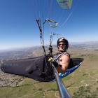
So Epic! I fly my paraglider from Diablo frequently! Such a great launch for cross country routes to the east over the central valley, and to the south along 680!
5.0
Leave No Trace
Always practice Leave No Trace ethics on your adventures and follow local regulations. Please explore responsibly!
Nearby

Hike the Waterfalls of Mount Diablo Loop Trail

Southern Lime Ridge Loop

Juniper to the Summit Loop Trail and Meridian Ridge

Camp at Juniper Campground in Mount Diablo SP

Castle Rock Trail

Run the Mt. Diablo Foothill Loop
Discover
Community
Mobile Apps

© 2026 The Outbound Collective - Terms of Use - Privacy Policy