Coronado, California
Looking for the best hiking in Coronado? We've got you covered with the top trails, trips, hiking, backpacking, camping and more around Coronado. The detailed guides, photos, and reviews are all submitted by the Outbound community.
Top Hiking Spots in and near Coronado
-
Ramona, California
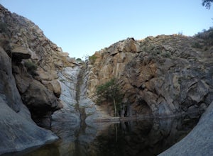
Cedar Creek Falls
4.85.52 mi / 1024 ft gainThe trail to Cedar Falls starts out at a hill in a residential area and ends in an unexpected spot where there is a beautiful waterfall complete with a swimming hole. Surrounded by 75-foot-high cliffs, a magnificent waterfall splashes into a pool known as the Devil’s Punch Bowl. Hikers have been ...Read more -
Escondido, California
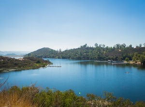
Camp at Dixon Lake
2.1 mi / 295 ft gainDixon Lake is Escondido's best kept secret! A man-made reservoir located right next to Daley Ranch, Dixon Lake offers overnight camping, boat rentals, fishing, and hiking, along with picnic areas, a kids park, and more. The campground is open year-round and is located next to the lake with a lof...Read more -
Carlsbad, California
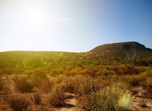
Hike and Fish at Lake Calavera
4.06.24 miLake Calavera Preserve is located in Carlsbad, CA and is home to one of North America's smallest volcanoes. It is the end peak of each trail and is what's known as a "volcanic plug" (cool hardened lava). The northern face of Mount Calavera is that of columnar joints- columns of molded lava. Geolo...Read more -
Santa Ysabel, California
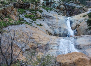
Three Sisters Falls
4.93.42 mi / 906 ft gainThree Sisters Falls is by far the best hike, for the most reward, that I've gone on in the close vicinity of San Diego. Only a short hour and a half drive from downtown San Diego, the hike offers all the draws of a National Park: remote wilderness, strenuous hiking, scenic mountain views, and ama...Read more -
San Diego County, California
Multi-pitch Climbing at Corte Madera
5.0This is one of San Diego's finest multi-pitch climbing crags. South-facing and standing 500 feet tall, Corte Madera has a history of both traditional and sport routes. The traditional routes will offer adventure with some en-route bushwhacking. The newer sport routes climb the clean faces of this...Read more -
Campo, California
Hike Corte Madera Mountain
7.75 mi / 2375 ft gainFrom Buckman Springs Road, turn onto Corral Canyon OHV/Morena Stokes Valley Rd and drive almost 5 miles to a green gate with a red heart on it, this is the trailhead. Just past the turn is the parking area that fits 5-6 vehicles. Walk across the road past the locked gate and head up the oak cover...Read more -
Oceanside, California
Bike or Skate the Strand
4.01 mi / 0 ft gainOceanside's iconic Strand is a 1 mile long ocean-front road that is perfect for cycling, walking, and running. At various points it is one way or pedestrian only, and is a must-do for any visitors to Oceanside.From the north The Strand begins at Breakwater Way and heads south underneath The Ocean...Read more -
Ramona, California
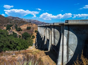
Explore the Sutherland Dam
2.01 miOnce your on Sutherland Dam Rd, follow it until your right next to the dam. Park on the side of the road where you see a small turn-out. Walk down to the side of the dam and drop down onto the concrete flooring of the dam. Walk on-top where allowed, and check out the views of the lake and the mo...Read more -
Julian, California
Hike Cuyamaca Peak
4.55.5 mi / 1700 ft gainThis peak is one of the tallest in the county. Reaching the summit of the peak takes you to an elevation of 6500'. Although this peak isn't as challenging as others nearby, it's located in the center of San Diego, which offers up amazing views, which is the main reason to take this hike. The best...Read more -
Julian, California
Hike Stonewall Peak
4.73.82 mi / 820 ft gainThis hike is one of the most popular in the Cuyamaca Rancho State Park. When you reach Stonewall Peak's summit, enjoy the view of the surrounding park and nearby Lake Cuyamaca. The hike up the east side is a popular and relatively easy trail. Although you'll be gaining 800 feet, the hike is relat...Read more -
San Diego County, California
Hiking the Laguna Hills via the PCT
5.020 mi / 2000 ft gainThis trail is well-maintained, but gets a little rocky on the PCT, and the Chariot Fire burn-zone between Penny Pines and Hayes peak will have a few downed trees and some overgrown grasses. On the other hand, the trail network of the BLT is confusing to follow as the entire network is named "Big ...Read more -
Campo, California
Kitchen Creek Falls Trail
4.04.83 mi / 722 ft gainKitchen Creek Falls Trail is an out-and-back trail that takes you by a waterfall located near Pine Valley, California.Read more -
Campo, California
Photograph the Mexican Border on the PCT Southern Terminus
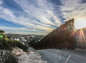
4.5From San Diego head East on Hwy 8 for roughly 60 miles to Buckman Springs Road (Exit 51). Take a right on Buckman Springs road an drive South for 10 miles. Turn right on CA-94 W (Campo Rd) and drive for 1.5 miles. After crossing the railroad tracks turn left on Forrest Gate Road. Take this road f...Read more -
Santa Ysabel, California
Hiking in Santa Ysabel
3.0Starting at the trailhead on Hwy 79, enter through the gate and make sure to close it behind you - the preserve is open range area for herds of cows, make sure not to disturb them when hiking. From the gate you'll see the sign with a detailed map of trails that are available for hiking. The trail...Read more -
Julian, California
Volcan Mountain Trail
4.82 mi / 1270 ft gainVolcan Mountain Trail located near Julian, California is a moderate day hike. This well-maintained trail offers beautiful views, but keep in mind there isn't too much sun protection, so be sure to pack plenty of water and coverage on sunnier days. Dogs are permitted on the trail on a leash.Read more -
San Diego County, California
Hike Garnet Peak Trail
3.02.6 mi / 500 ft gainWhile there are a few trail options, the designated Garnet Peak Trail begins off of Sunrise Highway at Mile Marker 27.8. There is a small pull-off on the east side of the road with a sign denoting the trail. An Adventure Pass is required for parking in this area of Cleveland National Forest.The f...Read more

