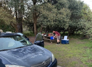
Castro Valley, California
Castro Valley, California is a top pick for outdoor fun. With its scenic and serene views, it's a must-visit for those seeking a unique experience. There are plenty of top attractions in and near the area, including Lake Chabot Regional Park, Anthony Chabot Regional Park, and Skyline Wilderness Park. Visitors can enjoy a variety of activities, such as hiking, biking, fishing, and camping. There are also plenty of trails to explore, offering breathtaking views of the Bay Area. For those who love nature, there are plenty of wildlife areas to explore, including the Hayward Regional Shoreline and the Don Castro Regional Recreation Area. Whether you're looking for an adventure or a peaceful day out, Castro Valley has something for everyone.
Top Spots in and near Castro Valley
-
Santa Cruz, California
Hike the Rincon Fire Trail
5.01 mi / 300 ft gainThe Rincon Fire Trail Starts at a small dirt parking lot next to CA-9 and traverses down the mountain to the San Lorenzo River Connecting with the Pipeline Trail. The trail can be a simple one of a mile out and back or up to 5 miles depending on your preference. The elevation will change by about...Read more -
Petaluma, California
Hike Helen Putnam Regional Park
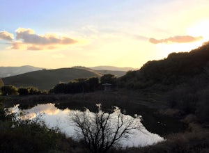
4.06 mi / 550 ft gainA 216-acre park, Helen Putnam offers 9 trails that are relatively short but can be combined however you wish. Go 2 miles or 10 miles. Loop in and out, up or around. I take a different route every time I hike here.For a good 6-mile hike, begin at the southwest corner, where the parking lot and res...Read more -
Soquel, California
Land of Medicine Buddha Loop
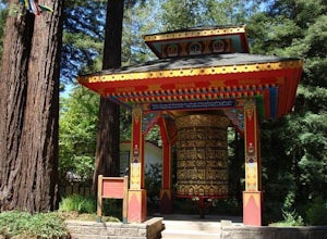
4.55.74 mi / 915 ft gainNear the retreat, there is a short trail called "Eight Verses Pilgrimage Trail" providing people with the opportunity to meditate on thought transformation in a peaceful and picturesque outdoor setting. From there, a beautiful 6 mile loop will take you up to the top of the ridge and then back aro...Read more -
Point Reyes Station, California
Sky Trail Loop
5.09.55 mi / 1818 ft gainSky Trail in Point Reyes National Seashore is a dramatic, mostly single-track trail that runs along the main spine of the Inverness Ridge and across highest mountains in Point Reyes, looming above the Olema Valley and Highway 1 which mark the San Andreas Fault rift zone and the dividing line betw...Read more -
Point Reyes Station, California
Sky Campground via Sky Trail
2.66 mi / 495 ft gainEntering Point Reyes National Seashore from Bear Valley Road the Sky Trailhead is a 4.9 mile drive. Camping in Sky Camp requires a Camping Permit. Once at the Sky Trailhead parking lot. The Sky Trailhead will be on the left side pulling in. The hike is not very strenuous and not all that lo...Read more -
Davenport, California
Beach Picnic at Shark Fin Cove
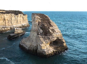
4.3Shark Fin Cove is a large rock formation in an inlet off Highway 1 in Northern California. It is located 1 mile south of Davenport and 10 miles north of Santa Cruz. There is a sizable parking lot located on the side of Highway 1 to park in. Walk down the path left of the parking lot and cross the...Read more -
Point Reyes Station, California
Coast Campground via Laguna Trailhead
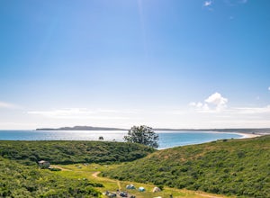
4.34.02 mi / 633 ft gainThis campground is the closest you can get to staying overnight on Pt. Reyes coastline if you're backpacking in. Once you get there, enjoy the view! The easiest way to get to the camp is from the slightly uphill hike along the Laguna Trail and the Firelane Trail. The trailhead for the Laguna Tra...Read more -
Point Reyes Station, California
Hike the Laguna Trail & Coast Trail Loop
5.05.2 mi / 300 ft gainLeave your car on a side of the road. When navigating there, put "HI Hostel Point Reyes" in your navigation - you park literally on the other side of the road, opposite to the hostel. Go to the west and soon you'll find the start of Coast Trail with a tsunami warning sign. During first 1.8 mile y...Read more -
Santa Cruz, California
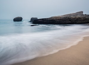
Explore Panther Beach
4.5Panther Beach's white sand, clear water, and interesting rock formations make it one of the most stunning beaches along this stretch of CA1. But this is a hidden gem for a reason - there are no signs along CA1 for Panther Beach. You need to keep you eyes peeled for cars parked along the side of t...Read more -
Santa Cruz, California
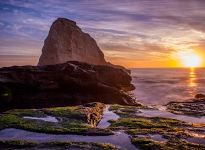
Photographing the Sunset at Panther Beach
5.0Probably my favorite beach in the Santa Cruz area. Panther Beach lies just south of Davenport along the beautiful Hwy 1. Park at a large dirt pull out on the left hand side if your heading north from Santa Cruz. The trail down to the beach is steep and not that well maintained so watch your step....Read more -
Santa Cruz, California
Photograph the UC Santa Cruz Arboretum
5.0No matter the time you'll decide to visit the UC Santa Cruz Arboretum, you'll have thousands of interesting plants and birds to see and watch. The Arboretum is located on the west side of UCSC campus, between the main campus entrance and the west entrance. Parking is 5$ for adults and 2$ for chil...Read more -
Aptos, California
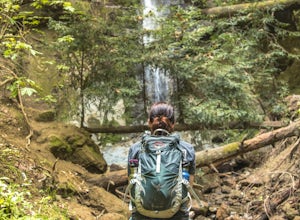
Hike to Nisene Marks' Maple Falls
4.68.5 mi / 900 ft gainAs you enter the park, you'll need to pay $8 for parking via a self-pay envelope, so it's recommended that you bring exact change. At the park booth, be sure to grab a map. The hike can be a little tricky with no cell service and limited trail signage. Once you've grabbed your map, keep driving p...Read more -
Inverness, California
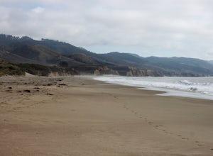
Walk along Limantour Beach
4.8The entire drive to Pt. Reyes is picturesque, but once you make it to Limantour, you and your dog can both get out and enjoy it! This area, between Drake's Bay and an estuary, allows you to spend time relaxing or head out for a run (keep the dog on leash). If you're lucky you might either get a c...Read more -
Capitola, California
Camp at New Brighton Campground
/ 0 ft gainThis Capitola camping spot is the place to be if you're looking to do a variety of activities in a variety of landscapes. You can swim, fish, or explore the nearby forest of Monterey Pine and coastal Oak. In the evening, walk into Capitola for live music and great fish tacos. The S.S. Palo Alto,...Read more


