Brisbane, California
The Brisbane Quarry Loop Trail is among the top outdoor adventures in Brisbane, California. This 5.3-mile trail is moderately challenging, featuring a beautiful river and captivating rock formations. It offers scenic views of the San Bruno Mountain State and County Park, which is a must-visit spot. The trail is primarily used for hiking, walking, and running. The Brisbane Marina, located nearby, is another popular spot for sailing and fishing. For bird watchers, Sierra Point is a prime location to spot various species. The best Trails and Outdoor Activities in Brisbane, California, offer a unique blend of scenic beauty and physical challenge, making them ideal for a day of outdoor fun.
Top Spots in and near Brisbane
-
Pescadero, California
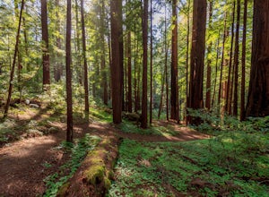
Año Nuevo and Goat Trail Loop
4.03.76 mi / 761 ft gainThis steep and winding trail takes you to the top of a ridge where you can see the Pacific coastline and the redwoods piercing through the forest canopy. To do this trail connect the Ano Nuevo Trail, Olmo Fire Road, Goat Trail and the Six Bridges Trail. If you don't have all day to do the Canyon ...Read more -
Nicasio, California
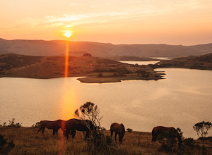
Hike and Fish at Nicasio Reservoir
5.03 mi / 300 ft gainNicasio is a quaint town just inland of the more popular coastal town of Point Reyes. It's most known for it's wine country, rolling hills, and the home of Skywalker Ranch, George Lucas's getaway home. Most visitors of this area either pass right on through for Point Reyes or use it's scenic road...Read more -
Livermore, California
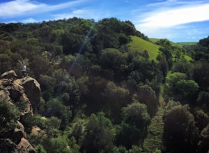
Condor, Volvan, Stone Corral, Coyote Loop
4.54.38 mi / 620 ft gainThis regional preserve is perfect for day hikes. There are also designated campsites and even a backpack campsite. Horses and dogs are welcome in the preserve. There are many different clearly marked trails that one can choose from. A good 4.5 mile loop is to start at the Park Residence entrance...Read more -
Pescadero, California
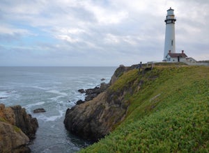
Explore the Pidgeon Point Lighthouse
5.0Pidgeon Point Lighthouse is conveniently located just 50 miles south of San Francisco. Constructed in 1872 and standing at 115 feet, it is among the tallest lighthouse in America.Part of the state park system, it is surprisingly secluded. Numerous parking space were available in the lot with hand...Read more -
Pescadero, California
Exploring Big Sur to Pigeon Point
We started off in Big Sur and took as many pull-off viewpoints as possible between Big Sur and the final destination, Pigeon Point Lighthouse. The weather was foggy in some spots but would open up to reveal the vast Pacific Ocean and sun in others. The weather was mild for us but we're familiar w...Read more -
Antioch, California
Hike the Old Homestead Loop
5.06.5 miThis is a fun day hike that takes you through the beautiful hills of the Black Diamond Mines Regional Preserve and a bit of the Contra Loma Recreational Area as well. You can hike here year round, but I suggest going in the spring time when the hills are covered in soft, green grass and the wild ...Read more -
Point Reyes Station, California
Sky Trail Loop
5.09.55 mi / 1818 ft gainSky Trail in Point Reyes National Seashore is a dramatic, mostly single-track trail that runs along the main spine of the Inverness Ridge and across highest mountains in Point Reyes, looming above the Olema Valley and Highway 1 which mark the San Andreas Fault rift zone and the dividing line betw...Read more -
Point Reyes Station, California
Sky Campground via Sky Trail
2.66 mi / 495 ft gainEntering Point Reyes National Seashore from Bear Valley Road the Sky Trailhead is a 4.9 mile drive. Camping in Sky Camp requires a Camping Permit. Once at the Sky Trailhead parking lot. The Sky Trailhead will be on the left side pulling in. The hike is not very strenuous and not all that lo...Read more -
Saratoga, California
Skyline-to-the-Sea Trail
4.530.8 miWant to experience one of the bay area's most memorable backpacking trips? We've got the details to get you out on the trail. To start the trek, drop your car at the Castle Rock State Park Parking Lot, which is located ~2.5 miles south of the junctions of Highways 35 and 9 off of Highway 35. Not...Read more -
Saratoga, California
Backpack Castle Rock State Park
4.7Castle Rock Trail Camp has a different policy than other backcountry camps in the area (i.e. campsites along Skyline to the Sea). This campground is open all year and is available on a first come, first served basis. If you can, grab a spot a Frog Flat Camp. To get to the camp, park your car at t...Read more -
Los Gatos, California
Hike the Saratoga Gap Trail
4.64.7 miThe Saratoga Gap Trail is relatively lightly trafficked trail that is good year round, although waterfalls peak in late winter and spring. Overall, this 4.7 mile partial loop hike is moderate, with about 1000 feet in elevation change. Trailhead elevation is about 3090 feet. The featured hike desc...Read more -
Point Reyes Station, California
Coast Campground via Laguna Trailhead
4.34.02 mi / 633 ft gainThis campground is the closest you can get to staying overnight on Pt. Reyes coastline if you're backpacking in. Once you get there, enjoy the view! The easiest way to get to the camp is from the slightly uphill hike along the Laguna Trail and the Firelane Trail. The trailhead for the Laguna Tra...Read more -
Point Reyes Station, California
Hike the Laguna Trail & Coast Trail Loop
5.05.2 mi / 300 ft gainLeave your car on a side of the road. When navigating there, put "HI Hostel Point Reyes" in your navigation - you park literally on the other side of the road, opposite to the hostel. Go to the west and soon you'll find the start of Coast Trail with a tsunami warning sign. During first 1.8 mile y...Read more -
Livermore, California
Hike the East Shore Trail Loop
3.7 mi / 1040 ft gainThis hike is best done during the spring, fall, or winter when moderate temperatures make the hike more comfortable. Be warned that this hike has a large elevation change despite being less than 4 miles. Starting at the Arroyo Road Staging Area, take the East Shore Trail east, heading towards a s...Read more -
Inverness, California
Limantour Beach
4.85.33 mi / 66 ft gainThe entire drive to Pt. Reyes is picturesque, but once you make it to Limantour, you and your dog can both get out and enjoy it! This area, between Drake's Bay and an estuary, allows you to spend time relaxing or head out for a run (keep the dog on leash). If you're lucky you might either get a c...Read more -
Sanborn County Park, California
Hike Sanborn County Park via the San Andreas Trail
4.04.2 mi / 1282 ft gainThis is a moderately rated 4.2 mile trail that winds through the redwoods west of Saratoga. It features a dirt trail with tall trees and a creek. The hike is very tranquil and there is lot s of greenery. There are big rocks in the creek that can you can sit on. People often meditate here as i...Read more

