Big Pine, California
Big Pine, California, is a top destination for outdoor adventures. One must-visit attraction is the North Fork Big Pine Creek Trail. This 16.2-mile trail is moderately difficult, offering scenic views of the Sierra Nevada mountains. As you hike, you'll pass by several crystal-clear alpine lakes, including Second Lake and Third Lake, known for their turquoise hues. The trail also features striking rock formations and the largest glacier in the Sierra Nevada, the Palisade Glacier. For a shorter hike, the Ancient Bristlecone Pine Forest trail is a 4.4-mile loop near Big Pine. This trail is best known for its ancient bristlecone pine trees, some of which are over 4,000 years old. Both trails offer unique, breathtaking views and are among the best trails and outdoor activities in Big Pine.
Top Spots in and near Big Pine
-
Mammoth Lakes, California
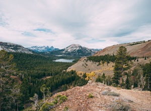
Heart Lake
5.02.11 mi / 500 ft gainYou will see a couple of trailheads starting by parking at the Coldwater Creek Campground parking lot. This one is specifically marked Heart Lake. There will be a couple of forks in the trail, but if you stay right and on the more obvious path, you will be up to Heart Lake in no time. (Going left...Read more -
Mammoth Lakes, California
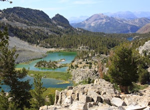
Duck Lake via Duck Pass Trail
4.79.29 mi / 1880 ft gainThe Duck Pass trail in the John Muir Wilderness combines breathtaking views, wildflowers and plenty of icy mountain lakes for swimming into a trail that is moderate in both difficulty and distance. With multiple lakes along the way to pitch your tent and plenty of day hike options from a base cam...Read more -
Mammoth Lakes, California
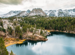
Arrowhead Lake
5.02.25 mi / 538 ft gainIf you make your way to the Goldwater Campground there is plenty of parking. The trailhead you take leads to many lakes but the Duck Pass trailhead is the on you want to take. This is a easy trail to follow and walk with very little obstacles. You follow it along for around a mile and you won't ...Read more -
Mammoth Lakes, California
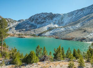
Pika Lake via Duck Pass Trail
9.41 mi / 1880 ft gainAs many of the other hikes start in this area, you start at the Goldwater Creek Campground where there is plenty of parking and restrooms. You will take the Duck Pass Trailhead for this hike. • I wanted to point out that this is not the easiest hike to do as a day hike. Many people do overnighte...Read more -
Mammoth Lakes, California
Skelton Lake Trail
5.03.2 mi / 804 ft gainThe hike to Skelton Lake in Mammoth Lakes, CA starts off at the Duck Lake Pass trailhead just past Lake Mary. The hike starts off with quite a few switchbacks as you climb through the John Muir Wilderness. About one mile up the trail, you'll see an option to veer off to Arrowhead Lake. Continue o...Read more -
Crowley Lake, California
Emerald Lake
4.01.76 mi / 417 ft gainEmerald lake is a relatively short 1.7 mile out-and-back hike. There is ample parking at the parking lot and trailhead. There is also overflow parking at the upper lot for Duck Lake and Skelton Lake. The trail has a decent amount of uphill, but you should arrive shortly (<30 mins) at your de...Read more -
Hume, California
Big Stump Loop Trail
5.01.71 mi / 305 ft gainBig Stump Loop Trail is a loop trail where you may see wildflowers located near Dunlap, California.Read more -
Sequoia National Park, California
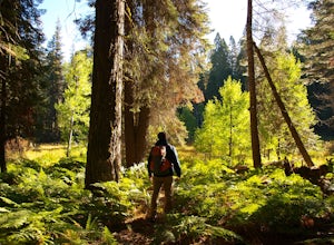
Hike through the Giant Forest in Sequoia NP
5.02 mi / 154 ft gainTake a drive to Sequoia National Park and take in the beautiful views of the second oldest national park. If you go in the winter or early spring time, be sure to check the weather beforehand and be prepared for the cold.If you are an avid traveler to national parks, I'd recommend that 2 weeks b...Read more -
Sequoia National Park, California
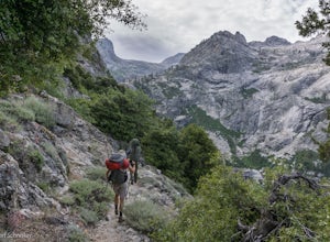
Backpack the High Sierra Trail
5.071 miThe High Sierra Trail begins at Crescent Meadow in Sequoia National Park, on the West side of the Sierra Nevada range, and ends at Whitney Portal on the East, traversing the highest and most beautiful part of the Sierras. From deep river canyons to high alpine peaks, lakes, and meadows, this hike...Read more -
Sequoia National Park, California
Hike Crescent Meadow
4.51.6 miCrescent Meadow is a collection of loops in the Giant Forest in Sequoia National Park. The trailhead is located just past the tunnel log east of General's Highway 198. The main loop is 1.6mi total. However you can take any of the loops to the General Sherman tree 3mi, Tharp's Log trail 0.5mi, or ...Read more -
Sequoia National Park, California
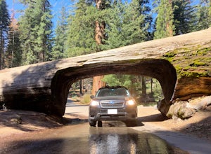
Drive through Tunnel Log
Tunnel log is a massive fallen sequoia across the middle of the road, which is a great photo opportunity for visitors of the national park. The mammoth tree fell over in 1937, but a year later, a car tunnel was carved in the middle of its trunk so vehicles could still pass through. Although the...Read more -
Mammoth Lakes, California
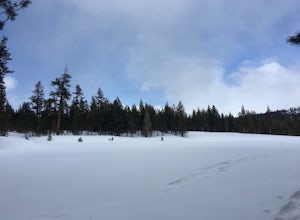
Snowshoe Shady Rest Park
2 mi / 100 ft gainShady Rest Park is located on Sawmill Road just minutes from the Mammoth Lakes town center. Start off by crossing through the parking lot headed north towards the large open field covered in snow. The open field is a great place to walk around and become comfortable with wearing and walking in sn...Read more -
Inyo County, California
Backpack Mount Langley
5.021 mi / 4000 ft gainMt. Langley sits four hours north of Los Angeles and is one of the easier 14ers to bag in California. Mt. Whitney absorbs most of the foot traffic, so enjoy the relative quiet and seclusion.The trailhead starts at Horseshoe Meadows/Cottonwood Lakes Trailhead Campgrounds and meanders for 7.5 miles...Read more -
Mammoth Lakes, California
Photograph Lake Mary, Mammoth Lakes
4.0Lake Mary is the largest of the 11 lakes in the Mammoth Mountain area. Explore the lake’s perimeter and find your own perfectly peaceful place to watch one of Mammoth’s signature stunning sunsets. Parking is easy to come by either on the side of the road or at the marina parking lot up the road.B...Read more -
Mammoth Lakes, California
Lake George Trail
5.01.34 mi / 89 ft gainThe Lake George Loop is perfect for exploring the shoreline and fishing near the top of the Mammoth Lakes wilderness. The lake can get quite cold due to the elevation and surrounding mountains not allowing the sun to hit it for an extended time, but if you go during mid-day you should have a refr...Read more -
Mammoth Lakes, California
Crystal Lake via Mammoth Crest Trail
4.82.5 mi / 1257 ft gainIn Lake George, park along Lake George Road and walk towards Crystal Crag Trailhead sign to begin the hike. If you couldn't find it, you can head to the boat rentals by the lake and you will see a sign saying trailhead is behind you. The trail is well maintained and it is really easy to follow. ...Read more

