Banning, California
Banning, California, is home to some of the best trails and outdoor activities. The top pick is the Black Mountain Trail, a scenic, must-visit hiking route. It's a 7.6-mile loop, known for its challenging inclines and unique rock formations. You'll also enjoy the breathtaking views of Fuller Mill Creek, a lively river that accompanies the trail. Another notable attraction is the Mount San Jacinto State Park near Banning, offering a variety of outdoor adventures. From hiking, camping, to wildlife viewing, it's a perfect spot for outdoor activities. The park is also home to the famous Palm Springs Aerial Tramway, which provides stunning panoramic views of the surrounding landscape. So, if you're in Banning, don't miss these outdoor attractions.
Top Spots in and near Banning
-
Lytle Creek, California
Old CC Spur Trail via Big Tree Cucamonga Rd
5.11 mi / 1138 ft gainOld CC Spur Trail via Big Tree Cucamonga Rd is an out-and-back trail that takes you by a waterfall located near Fontana, California.Read more -
Lake Elsinore, California
Hike Bear Canyon Trail to Sitton Peak
6.4 mi / 2200 ft gainA MUST hike for any orange country resident! The hike starts of off Ortega HWY 74 at the Bear Canyon Trail head on the same side of the road as the Ortega oaks candy store. Its recommended you park in the lot across the street from the trail head (tip:there is a working water spicket in the parki...Read more -
Lake Elsinore, California
Sitton Peak
9.36 mi / 2011 ft gainIt's amazing what you can find in your own backyard if you really do you research. In Orange County there are so many awesome hiking options that are often overlooked. The Bear Canyon to Sitton Peak Trail in the San Mateo Wilderness is one of those. Sitton tops out at 3,273 feet and it's a 5 mil...Read more -
Desert Hot Springs, California
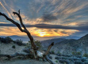
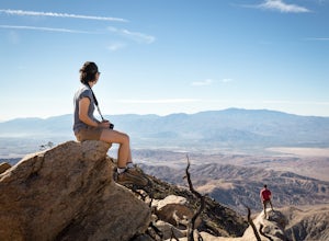
Catch a Sunset at Keys View in Joshua Tree NP
5.0This is a great place to watch the sunset, perched on the crest of the Little San Bernardino Mountains, provides panoramic views of the Coachella Valley and is well worth the 20-minute drive from Park Boulevard down Keys View Road. The views reach as far south as Salton Sea and on some clear days...Read more -
Desert Hot Springs, California
Inspiration Peak in Joshua Tree
1.81 mi / 425 ft gainMost automobile-bound visitors to Joshua Tree make their way to Keys View, and why wouldn't they? It has some of the best views in the park and with it, some of the biggest, loudest crowds. Most don't realize that a short hike away is even *better* views and, if you're lucky, solitude, on top of ...Read more -
Landers, California
Explore Giant Rock
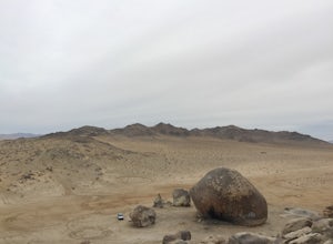
This is an adventure that my wife and me have been wanting to do for a while now. We finally decided to make the 30 minute journey out to Landers from Yucca Valley. There are quite a few points of interest along the way, but that is a story for another adventure.Giant Rock is 5.2 miles northwest ...Read more -
Palomar Mountain, California
Hike to Palomar Observatory from the Palomar Observatory Campground
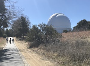
5.04.4 mi / 718 ft gainSituated in the Palomar Mountains of Cleveland National Forest, Palomar Observatory Campground offers many amenities for enjoyable camping and exploring the area. A portion of the campsites loop has been cleared of trees with level cement pads to allow campers to set up their own telescopes. Dr...Read more -
Twentynine Palms, California
Willow Hole Trail in Joshua Tree National Park
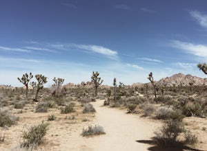
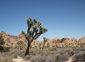
6.8 mi / 341 ft gainThe Willow Hole hike begins at Boy Scout trailhead and winds past and through the Wonderland of Rocks to a marshy stand of willows. The trail is flat, but with little shade so be sure to bring lots of water! As you leave the parking lot you'll enter an expansive stand of Joshua Trees that grows...Read more -
Palomar Mountain, California
Hike Thunder Spring and Chimney Flat Loop
3.04 mi / 900 ft gainPalomar Mountain is the hidden gem of San Diego. Well, not so hidden per se- but most don't know that the little climb up the mountain can transport you from the prevalent brush-filled terrain of SD to a lush, diverse forest.The great thing about Palomar is that every day you visit could be compl...Read more -
Palomar Mountain, California
Hike to French Valley
5.03.8 mi / 450 ft gainWhen it comes to Palomar Mountain State Park, most people stick to Doane Lake and Upper Doane Valley. Yet on the far right of the parking lot at Doane Pond, there is actually a trailhead that will guide you to a completely different section of the park. The Lower Doane Valley trail is, in my opti...Read more -
Corona, California
Hike to Santiago Peak via Holy Jim
5.015 mi / 4500 ft gainWhen you think of Orange County, you think of beaches, boardwalks, but what you may not know is that there are some great hikes in our very own backyard! My favorite is a fairly strenuous day hiking adventure that only the strong survive. Not to dissuade any interested parties, since this is a ...Read more -
Corona, California
Hike to Holy Jim Falls
3.02.9 mi / 570 ft gainTo start, directions on how to get to the trail there are two different ways, the most common , which I will explain, being through Rancho Santa Margarita you will head east on Santa Margarita Parkway, turn left at the dead end (into a parking lot for a shopping center) on Plano Trabuco Road, thi...Read more -
Twentynine Palms, California
Climb The Spire in Joshua Tree National Park
0.75 miPark at the Hidden Valley Nature Trailhead. Instead of going into Hidden Valley, follow the obvious climber's trails to the Southwest for about 3/4 mile keeping the rocks of Hidden Valley on your right. The trail wraps around the outside edge of Hidden Valley, turning Northwest. After about 20 mi...Read more -
Riverside County, California
Hidden Valley Nature Trail
4.41.03 mi / 164 ft gainTurn off of Park Blvd near Intersection Rock (there will be signs for the turn) and follow the paved road for about a minute. There is a large parking lot with many picnic tables. The trail begins with a slight uphill of around 100 ft and continues through a opening between two large rocks. Af...Read more -
Twentynine Palms, California
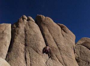
Rock Climb Locomotion in Joshua Tree National Park
5.0Locomotion is a great spot to set up for the day and enjoy the world class climbing that Joshua Tree has to offer. Camp at the nearby and coveted Hidden Valley Campground and you'll be within walking distance to Locomotion and a dozen other quality climbing spots. Joshua Tree really is a camping/...Read more -
Riverside County, California
Cap Rock Nature Trail
3.00.75 mi / 161 ft gainThere are two Joshua Trees guarding the trail, which makes for a perfect photo op. There are some monzogranite rock formations (of which the park is famous for). Watch for bunnies and lizards! The trail is handicap accessible, so parents with young children in strollers or those in wheelchairs ca...Read more

