Banning, California
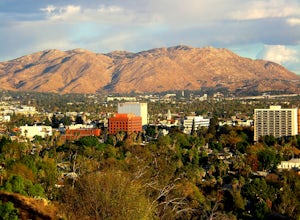
Banning, California, is home to some of the best trails and outdoor activities. The top pick is the Black Mountain Trail, a scenic, must-visit hiking route. It's a 7.6-mile loop, known for its challenging inclines and unique rock formations. You'll also enjoy the breathtaking views of Fuller Mill Creek, a lively river that accompanies the trail. Another notable attraction is the Mount San Jacinto State Park near Banning, offering a variety of outdoor adventures. From hiking, camping, to wildlife viewing, it's a perfect spot for outdoor activities. The park is also home to the famous Palm Springs Aerial Tramway, which provides stunning panoramic views of the surrounding landscape. So, if you're in Banning, don't miss these outdoor attractions.
Top Spots in and near Banning
-
Big Bear, California
Cougar Crest Trail
5.05.57 mi / 892 ft gainOn the north side of Big Bear Lake, just off the 38, you will find a turn off for the Cougar Crest Trail. The parking lot is well marked, and signs for the trailhead are easy to spot. Parking is not an issue if you come in later in the afternoon, but the hike can get crowded during peak hours. Fo...Read more -
Fawnskin, California
Grays Peak Trail
1.06.95 mi / 1293 ft gainThis is a fairly easy mountain peak to climb. The trailhead is easily accessible right off of Hwy 38 by the town of Fawnskin. There is a large National Forest sign noting the parking area to Grays Peak Trail. Note that parking in this lot requires either a day pass or a California Adventure pa...Read more -
Riverside, California
Hike Two Trees Trail
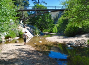
2.5 mi / 977 ft gainParking is free at the trailhead, but there is only room for approximately five cars. The trailhead is on the edge of a neighborhood, so you can park there if needed. From the parking lot, head west, and immediately veer right and across the bridge. If you go left at the first fork, you can stay ...Read more -
Mountain Center, California
Lion Peak Trail
9.39 mi / 1722 ft gainLion Peak Trail is an out-and-back trail that is moderately difficult located near Mountain Center, California.Read more -
Pioneertown, California
Indian Trail Loop at Pipe's Canyon
6.16 mi / 892 ft gainIndian Trail Loop at Pipe's Canyon is a loop trail where you may see beautiful wildflowers located near Pioneertown, California.Read more -
Canyon Lake, California
Kabian Memorial Park Loop
5.03.48 mi / 335 ft gainKabian Memorial Park Loop is a loop trail that takes you by a lake located near Quail Valley, California.Read more -
Big Bear, California
Explore Van Dusen Cabin
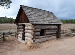
4.0This is a great day trip to spend in the mountains. from Highway 18 at the Big Bear Dam you turn left onto highway 38 around the north shore of Big Bear. Continue till you see the sign Van Dusen Rd and turn left. The paved road takes you through residential neighborhoods where the dirt road begin...Read more -
Big Bear, California
Holcomb Valley Campground
This campground is awesome! With great views, plenty of space and clean bathrooms it'll have you in for a treat! Whether it be a multiple day trip or just one night this campground is awesome. Read below for information if you are looking for a trip in the mountains! Cost: This campground is a ...Read more -
Pioneertown, California
Pioneertown to Big Bear via Burns Canyon Road and 2N02
18.8 mi / 3287 ft gainThe Pioneertown to Big Bear trail via Burns Canyon Road and 2N02 is a unique hiking route in Pioneertown, California. This trail is known for its diverse terrain and stunning views. The trail starts in the historic Pioneertown and winds its way up to Big Bear, a popular mountain resort. The tra...Read more -
Big Bear, California
Rock Climb Holcomb Valley
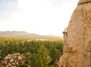
5.0Most of the drive to Holcomb Valley is done on regular paved roads until about the last hour when you get above Big Bear Lake and you start your journey on dirt roads. The road is extremely bumpy and has lots of pot holes but there are generally quite a few cars up there that don't have 4 wheel d...Read more -
Pioneertown, California
Visit Historic Pioneertown
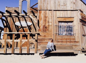
Here in California we have a lot of desert to sift through. When trying to figure out how to navigate the mass, you have to know the places worth fighting the brutal heat or chilling cold. Pioneertown will lure you in regardless. You will see why as you make your way up the 4-mile winding road of...Read more -
San Bernardino County, California
Off-Road Jacoby Canyon
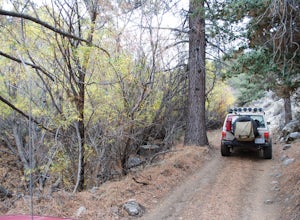
2.9 miThis is now my favorite trail in the San Bernardino National Forest. Ranging from desert scenes at the bottom and pine trees at the top, you experience such high levels of outdoors feel you can't resist. This trail has so many awesome spots for camping and off-roading that it has a great mix for ...Read more -
San Bernardino County, California
Aztec Falls
3.31.23 mi / 16 ft gainFrom Lake Arrowhead, take the 173 to Hook Creek Road until you dead end onto Squint Ranch Road. Take a right at the first fork in the road, and park in the lot for Splinters Cabin. The dirt road can be a bit rocky and might not be the best for small cars. Once you're there, be sure to display you...Read more -
Yucca Valley, California
Backpack the California Riding and Hiking Trail in Joshua Tree
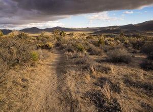
36.97 mi / 2792 ft gainThe starting point for this hike is at the Black Rock campground, 5 miles from the town of Yucca Valley. You'll need to self register for a free backcountry permit before starting. The first section of the trail follows a wash then the trail narrows and, after only a mile or two, you'll begin cl...Read more -
Riverside, California
Hike Mt. Rubidoux
4.32.7 mi / 500 ft gainFeaturing over 161 acres and over 3.5 miles of combined paved and dirt trails, Mount Rubidoux Park in Riverside, CA is a beautiful natural environment and adventure location. Although some say this is just a "hill", this Inland Empire gem offers a quick escape from the pace of city life. Just m...Read more -
Yucca Valley, California
Eureka Peak
5.00.47 mi / 82 ft gainAccessing Covington Flats in Joshua Tree National Park requires a high ground-clearance overland vehicle. Bring spare water and emergency tools incase of a breakdown. From Route 62 in Yucca Valley, CA take La Contenta Dr. South toward Joshua Tree. This is a backcountry entrance that does not hav...Read more

