California
Looking for the best backpacking in California? We've got you covered with the top trails, trips, hiking, backpacking, camping and more around California. The detailed guides, photos, and reviews are all submitted by the Outbound community.
Top Backpacking Spots in and near California
-
Big Pine, California
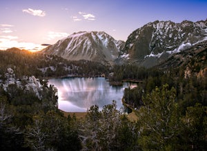
Fourth Lake via Big Pine Creek North Fork Trail
4.012.6 mi / 3205 ft gainFrom Big Pine, you'll turn onto Crocker St. to head towards the mountains. Once you are about 11 miles down the road you will see a sign and a turnoff on the right for trailhead parking. That is where you are going to want to park if you are staying overnight but you can continue to where the roa...Read more -
Mariposa County, California
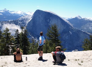
Backpack to North Dome in Yosemite
5.08.8 miTo stay overnight in Yosemite without a reserved campsite requires a "Wilderness Permit" to camp, but you can camp anywhere. However, any fires need to be in pre-made fire pits (so rangers can know where to check for fires) Day 1 - Hike in from the Porcupine Trailhead off of Tioga Road in to vie...Read more -
Pearblossom, California
Mt. Waterman
5.05.87 mi / 1499 ft gainMt. Waterman is accessed along Highway 2 in the Angeles National Forest. Heading east from La Canada look for mileage marker 58.0 (34 miles from La Canada) just past the closed ski resort. Park at one of the large paved turnouts on your left. Display an Adventure Pass ($5 at Ranger Station or Big...Read more -
McCloud, California
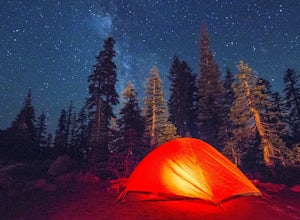
Panther Meadows Campground
5.0The Panther Meadows Campground is located in the timberline on Mt. Shasta. The free campsite has 10 sites with a fire ring and a table. The elevation of the campground is 7,500 ft, making it the highest campground on Mt. Shasta. Summer nights can get pretty cold, so make sure to bring proper atti...Read more -
Three Rivers, California
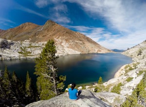
Backpack to Franklin Lakes & Franklin Pass
11.4 mi / 2500 ft gainFranklin Lakes is part of the Sequoia National Park and can be reached from the trailhead starting near the Mineral King Ranger Station. Bear containers are required and can be rented at the Ranger Station. The hike to Franklin Lakes campground will take 6 hours or less (depending on your speed/h...Read more -
Big Sur, California
Goat Camp via Twitchwell Flat Use Trail
5.09.2 mi / 3852 ft gainTo find this trailhead, head down Highway 1 towards Limekiln State Park Campground. Between Lucia and Limekiln, there should be a shoulder off the side of the road to park overnight. Cross the street to the trailhead of Twitchwell Flat Use Trail. Bear in mind that there is abundant poison oak alo...Read more -
Sequoia National Park, California
Hike to Emerald Lake, Sequoia National Park
4.510.4 mi / 2200 ft gainBegin this hike at the Alta Peak Trailhead in the Sequoia National Park. The trail initially takes you east-southeast through a loosely forested area that is stark and arid. Around 1.5 miles in you'll cross a small creek, but this creek may dry up in the late spring/summer. Shortly after the cree...Read more -
Kyburz, California
Backpack Desolation's Primitive Western Edge through Rockbound Pass
4.426.28 mi / 5151 ft gainThis 26 mile loop meanders through some of the most primitive trails in Desolation Wilderness. Starting from Wrights Lake, the route proceeds over Rockbound Pass, loops around several lakes, and returns to Wrights Lake. Not many hikers venture past the steep and rocky Rockbound Pass to enter this...Read more -
Echo Lake, California
Lake Aloha
4.012.34 mi / 1552 ft gainYou'll start the hike at the Echo Lakes trailhead, just off of Highway 50 in Lake Tahoe. The trail meanders past Lower and Upper Echo Lakes, slowly gaining altitude as you pass a smattering of summer cabins. The climb is enough to make you feel it, but before you know it, it's over. Once cresti...Read more -
Tahoma, California
Backpack to Crag Lake
4.011.1 mi / 1220 ft gainDay 1:This trip is a great early season trip while you are waiting for the snow to melt in the high country or it could be a good first backpacking trip because of its proximity to the trailhead and the fact that it's a relatively easy hike. Also, you get to camp by a beautiful lake with a drama...Read more -
Mammoth Lakes, California
Agnew Meadows to Tuolumne Meadows
5.030.27 mi / 4757 ft gainUnlike most through hikes that require two cars or hitchhiking, you can accomplish this with only one car by using a YART. Another benefit is that by entering in Mammoth, it is usually much easier to get permits as opposed to starting in Yosemite where permits can be harder to get. Then once yo...Read more -
Madera County, California
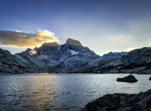
Thousand Island Lake via Agnew Meadows
5.019.6 mi / 3642 ft gainStart from Agnew Meadows about 7 miles away. You can take the High Trail out as part of the River Trail with a long detour passing by several other scenic lakes, including Shadow Lake, Garnet Lake, and Ruby Lake. You will arrive at Thousand Island Lake a few hours after lunch, just in time to set...Read more -
Three Rivers, California
Backpack in Mineral King
5.030 miThe trailhead is right near the Mineral King Ranger Station (on Mineral King Rd) in Sequoia National Park. Depending on where you're coming from I would recommend driving in and camping at Cold Springs Campground (which is also in close proximity to the ranger station) the night before you begin ...Read more -
Castaic, California
Hiking the Piru Creek Gorge Trail
Take the I-5 exit North of Castaic, CA at Templin Hwy. Turn onto Golden State Hwy heading the only direction it goes from the exit, North. When it dead-ends in a few miles at the National Forest Gate, you are at Frenchman's Flat.You can camp here, or hang with the day hikers. Heading North along ...Read more -
Trinity Center, California
Stuart Fork Trail to Emerald and Sapphire Lakes
5.027.06 mi / 4213 ft gainThe trail begins just past the Trinity Alps Resort, a private collection of cabins near Weaverville, CA. Hikers wanting an early start can spend the night at the Bridge Camp Campground, located next to the trailhead. The path starts out wide and level, following an old road to the wilderness bou...Read more -
Forks of Salmon, California
Hike to the Caribou Lakes, Shasta-Trinity Alps
4.016 mi / 3000 ft gainHike through the most majestic and unforgettable mountain ranges, alpine terrains, glacier lakes outside of the Sierra Nevada in Northern California. Yes, it's a long drive there and a lengthy hike, but if you have any doubts about whether this is worth the effort, just go! I struggled with the s...Read more

