Angelus Oaks, California
Angelus Oaks, California is a top destination for outdoor adventures. The best trails and outdoor activities are abundant, with hiking being a must-visit. The San Bernardino Peak Trail is a challenging 16.5-mile hike, offering scenic views of boulder formations, dense forests, and the San Gorgonio River. The trail is well-marked, with a moderate to difficult rating, making it ideal for seasoned hikers. For a more relaxed outdoor activity, Jenks Lake is a popular spot for fishing and picnicking. Nearby, the Big Bear Alpine Zoo offers a unique attraction, housing over 85 species of animals native to the area. Whether it's hiking, fishing, or wildlife viewing, Angelus Oaks has something for everyone.
Top Spots in and near Angelus Oaks
-
La Verne, California
Bridge to Nowhere via East Fork Trail
4.49.65 mi / 1798 ft gainThe trail on this 10-mile hike is predominately slow and steady, but can be a little rocky, so be prepared to scramble. When you’re fording the river, the water level can range from knee to chest high, especially in the wet months. A good pair of waterproof hiking boots is helpful, but water shoe...Read more -
La Verne, California
Cattle Canyon Trail
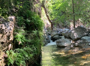
6.7 mi / 1066 ft gainWithin the San Gabriel Mountains from Highway 39 and along East Fork Road is Cattle Canyon. To go through Cattle Canyon, you can access the trail head just south of the Bridge to Nowhere trail head along East Fork Road right after it intersects with Glendora Mountain Road. There is a small parkin...Read more -
La Verne, California
Marshall Canyon Trail
4.05.99 mi / 722 ft gainFor this adventure you can choose to start in a multiple of places; for the easiest parking use Oak Mesa Park located next to Oak Mesa Elementary School. From the parking lot cross the soccer field towards the bridge on the north east end of the school. Once across the bridge follow Los Robles ea...Read more -
Twentynine Palms, California
Willow Hole Trail in Joshua Tree National Park
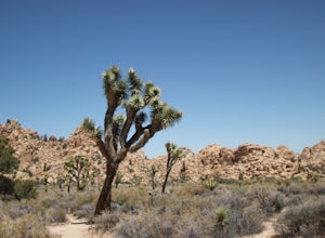
6.8 mi / 341 ft gainThe Willow Hole hike begins at Boy Scout trailhead and winds past and through the Wonderland of Rocks to a marshy stand of willows. The trail is flat, but with little shade so be sure to bring lots of water! As you leave the parking lot you'll enter an expansive stand of Joshua Trees that grows...Read more -
Azusa, California
Bighorn Mine Trail
5.03.69 mi / 607 ft gainIf you decide to head over to Wrightwood for some skiing during the winter, make sure to get a hike in while you’re at it. There are several trail systems along the Angeles Crest Highway (Hwy 2), and one of them is scenic Big Horn Mine Trail. The end point of the hike is the historic and abandone...Read more -
Azusa, California
Summit Mt. Baden-Powell
5.07.86 mi / 2808 ft gainThis well maintained and well traveled trail is a popular route with day hikers, backpackers, and Pacific Crest Trail through hikers. Since the trail is on the face of the mountain, snow may linger late into the season. The Pacific Crest Trail is clearly marked on the western corner of the Vinc...Read more -
Twentynine Palms, California
Canyoneer Joshua Tree's Rattlesnake Slot Canyon
The trailhead is located at the end of Indian Cove road. From Indian Cove Campground, take the road to the east about a mile to a picnic area where there is parking at the mouth of the canyon.From the picnic area hike up the Canyon in a south to south-east direction. After a few hundred yards a d...Read more -
Aguanga, California
Vail Lake Loop
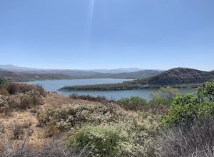
4.07.25 mi / 922 ft gainVail Lake Loop is a loop trail that takes you by a lake located near Temecula, California.Read more -
Twentynine Palms, California
Tour Keys Desert Queen Ranch in Joshua Tree National Park
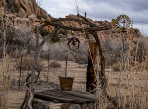
Joshua Tree National Park flawlessly combines otherworldly landscapes, incredible recreational opportunities, and a colorful, wild-west history. Before it was a national park, Joshua Tree was home to cattle rustlers, gunslingers, miners, and rugged homesteaders. One of the most quirky characte...Read more -
Temecula, California
Dripping Springs Trail
4.013.68 mi / 3287 ft gainThe trail immediately begins to climb out of the campground on a well-graded incline. The next mile contains some climbing leading to a set of switchbacks. A long strenuous climb ensues until the 3200' elevation is reached. The trail then makes an easy southward traverse to the basin before resum...Read more -
Silverado, California
Harding Falls Trail
5.05.96 mi / 1378 ft gainThe lot provides free parking, with plenty of spaces available throughout the day. The first few miles feature a descent into the canyon on a defined trail out in the open. The way back up is a decent incline in the sun! Be prepared, because even though 6+ miles may not seem too hard, this h...Read more -
Twentynine Palms, California
Boy Scout's Trail in Joshua Tree
4.516.12 mi / 1539 ft gainThe Boy Scout trail connects the main part of the National Park to the outer rim campground, Indian Cove Campground. All backcountry overnight trips must be registered at a registration board (free, self-registration). Start this trip at the registration board located in either Indian Cove Campgr...Read more -
Twentynine Palms, California
Rock Climb Locomotion in Joshua Tree National Park
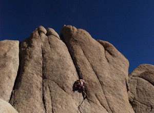
5.0Locomotion is a great spot to set up for the day and enjoy the world class climbing that Joshua Tree has to offer. Camp at the nearby and coveted Hidden Valley Campground and you'll be within walking distance to Locomotion and a dozen other quality climbing spots. Joshua Tree really is a camping/...Read more -
Twentynine Palms, California
Climb The Spire in Joshua Tree National Park
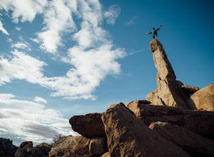
0.75 miPark at the Hidden Valley Nature Trailhead. Instead of going into Hidden Valley, follow the obvious climber's trails to the Southwest for about 3/4 mile keeping the rocks of Hidden Valley on your right. The trail wraps around the outside edge of Hidden Valley, turning Northwest. After about 20 mi...Read more -
Riverside County, California
Hidden Valley Nature Trail
4.41.03 mi / 164 ft gainTurn off of Park Blvd near Intersection Rock (there will be signs for the turn) and follow the paved road for about a minute. There is a large parking lot with many picnic tables. The trail begins with a slight uphill of around 100 ft and continues through a opening between two large rocks. Af...Read more -
Twentynine Palms, California
Climb at Intersection Rock in Joshua Tree
Intersection Rock is located in the Hidden Valley Campground with lots of parking!Overhang bypass route5.72 PitchesStandard Trad RackIntersection Rock has many classic routes- I found right ski track and overhang bypass to be 2 of my favorite routes in j tree.Start left of the flake in a crack, t...Read more


