Alpine Meadows, California
The best Trails and Outdoor Activities in Alpine Meadows, California, are a must-visit for those seeking scenic outdoor adventures. A top choice is the Five Lakes Trail, a moderate 5-mile round trip hike that offers stunning views of granite peaks and five beautiful alpine lakes. This trail is ideal for hiking, backpacking, and bird watching. The Pacific Crest Trail, a long-distance trail extending over 2,650 miles, also passes through Alpine Meadows, offering a more challenging hike with panoramic views of the Sierra Nevada. Another nearby attraction is the Truckee River, perfect for whitewater rafting and fishing. For rock climbing enthusiasts, the Donner Summit is just a short drive away. These outdoor activities make Alpine Meadows a top destination for those seeking adventure and natural beauty.
Top Spots in and near Alpine Meadows
-
Kyburz, California
Backpack to Smith Lake, Desolation Wilderness
5.05.6 mi / 1750 ft gainTo get to the Twin Lakes Trailhead from the Bay Area/Sacramento, head east on HWY 50 past Kyburz for 4 miles until you see the left-hand turnoff for Wrights Road. If coming westbound on HWY 50, this will be a right-hand turn 5 miles past Strawberry. Follow this paved road for 8 miles (watch for p...Read more -
Kyburz, California
Hike the Grouse, Hemlock, and Smith Lake Trail
5.0Starting from the Wright's Lake parking area, walk past the service gate to find the loop trail. Follow the loop trail to the signed trail for Twin, Grouse, Island, and Hemlock Lakes heading toward the right. You will begin an approximate 150 foot ascend before coming to a saddle. Another 150 foo...Read more -
Kyburz, California
Backpack Desolation's Primitive Western Edge through Rockbound Pass
4.426.28 mi / 5151 ft gainThis 26 mile loop meanders through some of the most primitive trails in Desolation Wilderness. Starting from Wrights Lake, the route proceeds over Rockbound Pass, loops around several lakes, and returns to Wrights Lake. Not many hikers venture past the steep and rocky Rockbound Pass to enter this...Read more -
South Lake Tahoe, California
Ski or Snowboard Heavenly
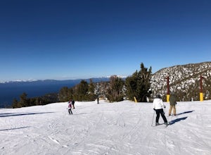
5.0One of the more beautiful resorts in Lake Tahoe to go snowboarding and skiing. Heavenly is situated in South Lake Tahoe on the border of California and Nevada. This ski resort has an amazing view of the lake while going down, as well as one of the largest total areas to ski in Lake Tahoe. This ...Read more -
Kyburz, California
Gertrude Lake Trail
8.28 mi / 1362 ft gainGertrude Lake Trail is an out-and-back trail that takes you by a lake located near Kyburz, California.Read more -
South Lake Tahoe, California
Cliff Jumping Paradise
4.5If you choose to go cliff jumping, be safe and know your limits ahead of time. Don't feel like the big jump is your only option, there are lower jumps, especially across from the beach (only about 15ft. high). Angora Lake in Lake Tahoe is a easy 1mi hike up, but well worth it at the top. It's a b...Read more -
Reno, Nevada
Church's Pond via the Jones-Whites Creek Trail
4.06.49 mi / 2185 ft gainFor the first 0.6 miles the trail follows a peaceful creek, before upping the steepness as it ascends the mountain sides via multiple switchbacks. At 2.5 miles in, you reach a peak that allows you to see from Reno to Washoe City; a perfectly good place for sane people to enjoy and turn back. Howe...Read more -
Reno, Nevada
Jones Creek Loop
1.5 mi / 335 ft gainNestled in a forested area on the eastern slope of the Sierra Nevada, Galena Creek Regional Park is seven miles up the Mt. Rose Highway from the intersection with I-580. Galena Creek flows through the park creating separate north and south portions of the park, and the Jones Creek Loop is a great...Read more -
Reno, Nevada
Jones Whites Creek Loop
5.09.65 mi / 2405 ft gainStarting at about 6500 ft of elevation Jones Creek Trail is a 9.2 mi loop trail starting in Galena Creek Park. The park itself is very accessible off of Mt. Rose Highway, parking is free, and there is plenty of it during a typical weekend. When entering the park simply follow the signs that say "...Read more -
Reno, Nevada
A Lazy (Fun) Float Down the River
4.5Start your day by heading to Tahoe City where the East and North Shores of Lake Tahoe meet. Be sure to grab supplies along the way including drinks, picnic lunch, sunscreen, coolers, floating devices (if you aren’t interested in renting) and maybe even some super soakers if you are planning to ...Read more -
Nevada City, California
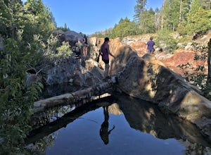
Emerald Pools
4.00.68 mi / 49 ft gainEmerald Pools is an out-and-back trail that takes you by a river located near Emigrant Gap, California.Read more -
El Dorado County, California
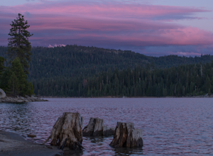
Camp at Ice House Reservoir
4.01 mi / 1 ft gainDesolation Wilderness is just west of Lake Tahoe, a part of Eldorado National Forest. It's a very popular backpacking destination as the PCT and Tahoe Rim Trail both run through the area. There are what seems to be endless amounts of mountain lakes, creeks, and rivers that run through this area w...Read more -
New Washoe City, Nevada
Deadman's Overlook Trail
4.01.28 mi / 318 ft gainDeadman's Overlook Trail is a loop trail where you may see beautiful wildflowers located near Washoe Valley, Nevada.Read more -
Nevada City, California
Bowman Road and Meadow Lake Road to Henness Pass
3.035.45 mi / 4895 ft gainBowman Road and Meadow Lake Road to Henness Pass is a point-to-point trail that takes you by a lake located near Alta, California.Read more -
Echo Lake, California
Hike Flagpole Peak from the bottom of Echo Summit
3.5 mi / 1900 ft gainFor this hike there are two places you can start from. One is at the Echo Lakes parking lot and the other is at the bottom of Echo Summit (where we started at). Parking at the gun tower at the bottom of Echo Summit you'll be looking right at the face of Flagpole. After parking just off the side o...Read more -
Kyburz, California
Hike Pyramid Peak
5.0Although it stands only slightly higher than its neighbors, Pyramid Peak nonetheless dominates the Crystal Range atop which it sits. Great views from the summit make this a must-do.The Route: The route is fairly straightforward to Lake Sylvia (see map). Simply follow the well-defined Lyons Cr...Read more


